PTC Crane below is built by Mammoet (old Van Seumeren) and Huisman Itrec
How do you lift millions of pounds hundreds of feet into air? Very carefully, of course. But moving such massive payloads is no joking matter, where safety must come first. Therefore, you probably won't hear any complaints that the world's largest mobile crane rotates at only 1 /8 rpm.
The huge machine that tackles these difficult jobs is the PTC III, from Mammoet Group, Rotterdam, Netherlands. Like the mammoth (Mammoet is Dutch for mammoth), the cranes that Mammoet develops are known for their huge size, strength, and ability to thrive in hostile conditions. Recently, Mammoet commissioned the largest mobile crane in the world, the PTC III. It stands 200 m tall and can lift 1600 t at speeds to 80 m/min. It was developed to handle heavy conveyor systems used in the oil industry for maintenance work.
But size, weight, and strength may not be the most impressive aspect of this machine. PTC stands for Platform Twin-ring Containerized, where twin-ring refers to the crane's construction, and containerized meaning that it can be disassembled and transported by standard means. The crane is supported on a steel ring, with 54 wheels on four bogies to allow its tower — driven by gears through hydraulic motors — to rotate through 360°. When disassembled, the entire crane fits within 88 standard marine shipment containers that can be transported readily by ship, rail, or truck.
Ideal application for hydraulics
The idea of a hydraulic drive for the rotary drive came up very quickly, explained Jan van Seumeren Jr., technical director at Mammoet. "Naturally, the winches and drive wheels could have been driven electrically. But we would have needed very large motors and generators for on-site supply." Large electric motors could have prevented the PTC III front meeting space and/or weight requirements for shipping. Furthermore, heavy, bulky motors could have made assembly and disassembly more difficult.
The PTC III relies on a 20-ft tall, diesel-driven power supply that drives electric generators and 17 hydraulic pumps. The pumps drive 29 hydraulic motors that each drive a planetary gear drive. The hydraulic motors provide the mechanical power to drive the wheels through the gear drives, and each gear drive multiplies torque from the motor and allows it to rotate at a more efficient speed than if the motor drove the wheel directly.
Collectively, the wheels transmit the torque to rotate the tower up to 1°/sec. Van Seumeren says the gear drives are lubricated with hydraulic fluid, and the the entire hydraulic system holds roughly 8000 l of fluid. Pumps, motors, and gear drives were all provided by Bosch Rexroth BV, Boxtel, Netherlands.
Bosch Rexroth's involvement was not only as a supplier, but as a development partner that became involved in the project at an early stage, says van Seumeren. "We selected as many components as possible from the Rexroth standard range." He points out that service was also an important consideration. "Bosch Rexroth has a worldwide service organization and already has a service support center or its own subsidiary practically everywhere we go."
The PTC III is the fifth twin-ring crane Mammoet has designed and built in cooperation with Huisman-Itrec, Scheidam, Netherlands. It weighs 2100 t, so it can lift more than 3 /4 its own weight.
Design considerations
Perhaps the most challenging design requirement of the PTC III design was that all crane parts had to be transportable within 88 standard 20- or 40-ft shipping containers with a maximum weight per container of 30.4 t. Standard containers and weights mean permits and escort vehicles are not required for truck transport.
For marine transport, each container can be handled in terminals at standard rates, and rail transport is also routine. These all add up to substantial savings in transport charges, time, and effort. In fact, transport costs of the PTC III are about half that of cranes with a comparable lifting capacity.
Much of this savings can be attributed to hydraulics because it transmits high power from relatively small, lightweight components. In addition, most parts have a double function, one during operation of the crane and one during transportation of the crane. For example, ballast blocks at the end of mast sections can be assembled to form containers.
Another requirement was to minimize assembly time. Normally, cable must be unreeled in preparation for shipping a crane, but with the PTC III, unreeling is unnecessary. This not only saves time prior to transport, but when the crane is reassembled at a new job site as well.
Structure
The upper structure of the crane's slew ring consists of two longitudinal beams, connected by quick connection pins to one transverse beam at the front. Multiple components — such as the power pack, lower ballast beam, upper ballast beam, several winches, backmast erection frame, boom stops, and operator cabin — are mounted on a longitudinal beam. All components feature modular design with quick-connection pins to enable rapid assembly and disassembly. As many components as possible are made identical so they are interchangeable.
For example, front and rear bogies are identical. Each axle is hydraulically driven to enable smooth slewing motion and free rolling. Most winches — hoist winches, topping winch, back-mast erection winch, and an auxiliary hoist winch — share a similar design to simplify assembly and disassembly procedures. Each winch has a 52-mm wire and a maximum line pull of 60 t.
Track drives for propulsion
However, one more requirement still hasn't been mentioned — the PTC III is also self propelled. Cranes often need to be moved to different locations within a job site. You might expect a crane of this size to require at least partial disassembly before being moved. But the PTC III's rigid ring construction also serves as a stable transport chassis. When the crane needs to be moved, four track drives can be deployed via massive cylinders, to lift the base off the ground. Hydraulic motors then actuate each track drive to move and steer the PTC III to a new location at the job site. Considering its size, it is easy to maneuver and can be operated in relatively tight areas.
A multitude of materials
The PTC III is a marvel of engineering encompassing more than its hydraulic system. For example, its construction required: 1000 t of steel for the structure 2100 m of electrical cable 5300 m of 50.4-mm steel cable and 2650-m of 30-mm steel cable 1500 t of steel for counterweight 1280 m of hydraulic hose 6000 l of hydraulic oil 6000 l of paint.
The great pyramid from the side Egyptian pyramid and statues Perfectly placed two ton Giza pyramid blocks The Cheops pyramid The Great pyramid from above Entrance to the Great Pyramid Perfectly cut granite stone Perfectly strait slope of the Great pyramid What the great pyramid used to look like The Sphinx and the Giza pyramids Perfectly fit together pyramid blocks Air chambers pointed to Orions belt 12K yrs ago Perfection of ascending passage in Great pyramid
Sphinx and the Giza pyramids Passage in the Great pyramid Perfectly flat pyramid rock
Osirian temple with the flower of life burnt into the rock you can chip down and it's still there. Temple of Osiris is 50 feet betow the temple of Abydos and it takes 9,000-12,000 years to accumulate.
Rhamsees II statue laying down holding a spherical flower of life inhis hand with 64 tetrahydrad grid.perfectly polished laying down ramsees museum they would have to cut it in bieses 1,000 tons solid pink granite 5 x more than what we can lift today only a few feet.Memphis' museum about 24 km south of Cairo. 13 meters tall. so they built the mueseum around it. Others the pillars obilisks are in excess of 1,000 tonscome from the quary 100's of miles up the nile on the other side over a mountain range.
Khufu Pyramid Statistics
A total of over 2,300,000 (or only 590,712)* blocks of limestone and granite were used in its
construction with the average block weighing 2.5 tons and none weighing less than 2 tons.
The large blocks used in the ceiling of the King's Chamber weigh as much as 9 tons.
Construction date (Estimated): 2589 B.C..
Construction time (Estimated): 20 years.
Total weight (Estimated): 6.5 million tons.
The estimated total weight of the structure is 6.5 million tons!
sphynx carved and the head recarcded from lyons head ot pharoes head by one of the pharoes, the erosion patterns say it has to be carved when there was a lot of rain hitting it. the last time this area had a loto of rain was 10,000 years ago which matches the osirian temple at abydos. the blocks at the base of the sphyncs. blocks removed from front of sphynx is hard at 1,000 lbs blocks 200 ton blocks you can see the layers match where they were removed and can tell which came from where in the enclosure.
we can move 200 ton rock but only from truck bed to boat, and we can't stack them to make a temple. 10,000 years ago someone was moving them with ease.
Great pyramid 2,300,000 stones 13.84 square acres 481 feet high. 1/4 of an inch off the base
Over a million hyroglypch walls in Egypt in temples and tombs everywhere tell us everththing how they made love eat got ot washroom and not one mentions building the pryamids. they aren't tombs no evidence never a body bfound tthere in a pyramid only in the kings valley.
txt talk about enoupmpurs monuments being built all ofer the world and all of them say the sun gods did it and taught us hnow to built write and everythingnl and no hyroglyphs insude of the pyramid
for the pyramids to be built in 20 years at seven days a week 10 hours a day 365 days a year for 20 years have to place a stone every two minutes. But as farmers couls only do it during the flood of the nile three months in the year so for in three months the year you'd have to place stones every two seconds to make it in 20 years. some up to 40 tons rocks in king s chamber a 100 ton slap of pink granite rock.
The base of the pyramid covers 13 acres, 568,500 square feet and
the length of each side was originally 754 feet, but is now 745 feet.
The original height was 481 feet tall, but is now only 449 feet.
The majority of the outer casing, which was polished limestone,
was removed about 600 years ago to help build cities and mosques
which created a rough, worn, and step-like appearance.
The Great Pyramid of Giza, in 2005. Built c. 2560 BC, it is the oldest and largest of the three pyramids in the Giza Necropolis.
The Great Pyramid of Giza (also called the Pyramid of Khufu and the Pyramid of Cheops) is the oldest and largest of the three pyramids in the Giza Necropolis bordering what is now El Giza, Egypt, and in a historical irony is the oldest of the Seven Wonders of the Ancient World and the only one that survives substantially intact. It is believed the pyramid was built as a tomb for fourth dynastyEgyptian Pharaoh Khufu (Cheops in Greek) and constructed over a 20 year period concluding around 2551 BC. The Great Pyramid was the tallest man-made structure in the world for over 3,800 years. Originally the Great Pyramid was covered by casing stones that formed a smooth outer surface, and what is seen today is the underlying core structure. Some of the casing stones that once covered the structure can still be seen around the base. There have been varying scientific and alternative theories regarding the Great Pyramid's construction techniques. Most accepted construction hypotheses are based on the idea that it was built by moving huge stones from a quarry and dragging and lifting them into place.
There are three known chambers inside the Great Pyramid. The lowest chamber is cut into the bedrock upon which the pyramid was built and was unfinished. The so-called[1] Queen's Chamber and King's Chamber are higher up within the pyramid structure. The Great Pyramid of Giza is the main part of a complex setting of buildings that included two mortuary temples in honor of Khufu (one close to the pyramid and one near the Nile), three smaller pyramids for Khufu's wives, an even smaller "satellite" pyramid, a raised causeway connecting the two temples, and small mastaba tombs surrounding the pyramid for nobles.
Building of the Great pyramid of Giza
It is believed the pyramid was built as a tomb for Fourth dynastyEgyptian pharaoh Khufu and constructed over a 14[2] to 20 year period. Khufu's vizier, Hemon, or Hemiunu, is believed by some to be the architect of the Great Pyramid.[3] It is thought that, at construction, the Great Pyramid was originally 280 Egyptian cubits tall, 146.478 metres (480.57 ft) but with erosion and absence of its pyramidion, its current height is 138.75 metres (455.22 ft). Each base side was 440 royal cubits, 230.37 metres (755.81 ft) in length. A royal cubit measures 0.524 meters.[4] The total mass of the pyramid is estimated at 5.9 million tonnes. The volume, including an internal hillock, is believed to be roughly 2,500,000 cubic meters.[5] Based on these estimates, building this in 20 years would involve installing approximately 800 tonnes of stone every day. The first precision measurements of the pyramid were done by EgyptologistSir Flinders Petrie in 1880–82 and published as The Pyramids and Temples of Gizeh.[6] Almost all reports are based on his measurements. Many of the casing stones and interior chamber blocks of the Great Pyramid were fit together with extremely high precision. Based on measurements taken on the north eastern casing stones, the mean opening of the joints are only 0.5 millimeters wide (1/50th of an inch).[7]
The pyramid remained the tallest man-made structure in the world for over 3,800 years,[8] unsurpassed until the 160-meter-tall spire of Lincoln Cathedral was completed c. 1300. The accuracy of the pyramid's workmanship is such that the four sides of the base have a mean error of only 58 millimeters in length [9] The base is horizontal and flat to within 21 mm[10]. The sides of the square base are closely aligned to the four cardinal compass points (within 4 minutes of arc)[11] based on true north, not magnetic north[12], and the finished base was squared to a mean corner error of only 12 seconds of arc[13]. The completed design dimensions, as suggested by Petrie's survey and later studies, are estimated to have originally been 280 cubits in height by 440 cubits in length at each of the four sides of its base. These proportions equate to π/2 to an accuracy of better than 0.05% (corresponding to the approximation of π as 22/7). Some Egyptologists consider this to have been the result of deliberate design proportion[14]. Verner wrote, "We can conclude that although the ancient Egyptians could not precisely define the value of π, in practice they used it".[15] Petrie, author of Pyramids and Temples of Gizeh, who was the first accurate surveyor of Giza and the excavator and surveyor of the Pyramid of Meidum, concluded: "but these relations of areas and of circular ratio are so systematic that we should grant that they were in the builders design".[16] Earlier in the chapter he wrote more specifically, that: “We conclude therefore that the approximation of 7 to 22 as the ratio of diameter to circumference was recognised”.[17] These proportions equated to the four outer faces sloping by 51.843° or 51° 50′ 34″, which would have been understood and expressed by the Ancient Egyptians as a seked slope of 5½ palms[18].
Materials
The Great Pyramid consists of more than 2.3 million limestone blocks (unless it was built on a substantial core of natural rock, which is possible). The Egyptians obtained the majority of the limestone blocks from a nearby quarry. The Tura limestone used for the casing was quarried across the river. The largest granite stones in the pyramid, found in the "King's" chamber, weigh 25 to 80 tonnes and were transported more than 500 miles away from Aswan. Traditionally, ancient Egyptians cut stone blocks by hammering wedges into the stone which were then soaked with water. The wedges expanded, causing the rock to crack. Once they were cut, they were carried by boat either up or down the Nile River to the pyramid.[19]
Casing stones
At completion, the Great Pyramid was surfaced by white 'casing stones' – slant-faced, but flat-topped, blocks of highly polished white limestone. These were carefully cut to what is approximately a face slope with a seked of 5 1/2 palms to give the required overall dimensions. Visibly, all that remains is the underlying stepped core structure seen today. In AD 1300, a massive earthquake loosened many of the outer casing stones, which were then carted away by Bahri Sultan An-Nasir Nasir-ad-Din al-Hasan in 1356 in order to build mosques and fortresses in nearby Cairo. The stones can still be seen as parts of these structures to this day. Later explorers reported massive piles of rubble at the base of the pyramids left over from the continuing collapse of the casing stones, which were subsequently cleared away during continuing excavations of the site. Nevertheless, a few of the casing stones from the lowest course can be seen to this day in situ around the base of the Great Pyramid, and display the same workmanship and precision as has been reported for centuries. Petrie also found a different orientation in the core and in the casing measuring 193 centimeters ± 25 centimeters. He suggested a redetermination of north was made after the construction of the core, but a mistake was made, and the casing was built with a different orientation. Petrie related the precision of the casing stones as to being "equal to opticians' work of the present day, but on a scale of acres." and "to place such stones in exact contact would be careful work; but to do so with cement in the joints seems almost impossible."
Construction theories
Many alternative, often contradictory, theories have been proposed regarding the Pyramid's construction techniques. Not all even agree that the blocks were quarried; Davidovits claims that they were cast in situ using a "limestone concrete", a theory which is rejected by other Egyptologists. The rest accept that it was built by moving huge stones from a quarry, being only unable to agree whether they were dragged, lifted or even rolled into place. The Greeks believed that slave labour was used but modern Egyptologists accept that it was built by many tens of thousands of skilled workers. They camped near the pyramids and worked for a salary or as a form of paying taxes until the construction was completed.[citation needed] Their cemeteries were discovered in 1990 by archaeologists Zahi Hawass and Mark Lehner. Verner posited that the labor was organized into a hierarchy, consisting of two gangs of 100,000 men, divided into five zaa or phyle of 20,000 men each, which may have been further divided according to the skills of the workers.
One of the mysteries of the pyramid's construction is how they planned its construction. John Romer suggests that they used the same method that had been used for earlier and later constructions, laying out parts of the plan on the ground at a 1 to 1 scale. He writes that "such a working diagram would also serve to generate the architecture of the pyramid with a precision unmatched by any other means." He devotes a chapter of his book to the physical evidence that there was such a plan.[24] In fact, the Cole survey of 1925 discovered as part of some planning an actual Original Builder's Mark, engraved into the pavement perpendicular to the N face, suggesting definitely different slopes planned into the Pyramid E and W faces.
Interior
Diagram of the interior structures of the Great Pyramid. The inner line indicates the pyramid's present profile, the outer line indicates the original profile.
The original entrance to the Great Pyramid is 55' vertically about ground level and 24' east of the centre line of the pyramid. This was probably a measure to defeat any attempt to break into the pyramid. The efficacy of this ruse is proven by the presence of a Robbers Tunnel dug into the stonework on the centre line of the pyramid. This is the work of Caliph al-Mamun, whose men would have dug all the way through the pyramid without encountering anything had it not been for the unfortunate accident described below.
From this original entrance there is a Descending Passage 3'11" in height and 3'5" in width which goes down at an angle of 26° 31'23" through the masonry of the pyramid and then into the bedrock beneath it. After 345' the passage becomes level and continues for a further 29' to the lower Chamber, which appears not to have been finished. There is a continuation of the horizontal passage in the south wall of the lower chamber; there is also a pit dug in the floor of the chamber, which may represent a start at making the chamber deeper, or may have some ritual significance as a conduit to the pirmaeval waters under the earth.
Some Egyptologists suggest the Lower Chamber was intended to be the original burial chamber, but that King Khufu later changed his mind and wanted it to be higher up in the pyramid.[25]EgyptologistBob Brier believes it was an insurance policy in case Khufu died early. When he was still alive and healthy after about 5 years of construction, the second (Queen's) chamber was begun. Sometime around the fifteenth year this chamber was also abandoned unfinished and the last or King's Chamber was built high up in the center of the pyramid.
33' from the entrance there is a square hole in the roof of the Descending Passage. This is the beginning of the Ascending Passage and was originally concealed with a slab of stone. The banging and thumping of al-Mamun's men dislodged this slab, which fell to the floor of the Descending Passage and slithered to the bottom of the sloping portion. The noise it made alerted the robbers that they needed to turn left.
The Ascending Passage is 129' long, as wide and high as the Descending Passage and slopes up at almost precisely the same angle. At the lower end the Ascending Passage is closed by three huge blocks of granite, each about 5' long. These appear to have been stored in the Grand Gallery - they are approximately an inch wider and higher than the entrance to the Ascending Passage - and released after the pharaoh's burial to slide down the Ascending Passage and permanently seal it. Once released, it would have been impossible to control the speed of descent of these granite blocks, so it is almost certain that they were released from above by workmen who would then have been shut in the pyramid.
At the start of the Grand Gallery on the right hand side there is a hole cut in the wall (and now blocked by chicken wire). This is the start of a vertical shaft which follows an irregular path through the masonry of the pyramid to join the Descending Passage. Almost certainly this was the escape route of these workmen and its roughness may indicate that it was constructed surreptitiously.
Also at the start of the Grand Gallery there is a Horizontal Passage leading to the so-called Queen's Chamber. The passage is 3'8" high for most of its length, but near the chamber there is a step in the floor, after which the passage is 5'8" high. In the left-hand wall of this Horizontal Passage there are two metal pipes sloping down at an angle. These were inserted by Japanese archaeologists who had previously used cosmic rays passing through the pyramid to expose x-ray film placed in the Lower Chamber, effectifely x-raying the pyramid. They discovered two anomalies suggestive of hidden chambers, but when they drilled down to these anomalies they found chambers one course high and completely filled with desert sand. It is thought that blocks of stone which failed to arrive in time for some reason were substituted for with the sand.
The Queen's Chamber is exactly half-way between the north and south faces of the pyramid and measures 18'10" north to south, 17'2" east to west and has a pointed roof with an apex 20'5" above the floor. At the eastern end of the chamber there is a niche 15'4" high, probably intended to house a statue of Khufu, though there is no sign of such a statue having been installed. The original depth of the niche was 3'5" but it has been deepened by treasure hunters.
In the north and south walls of the Queen's Chamber there are shafts. Unlike those in the King's Chamber, which immediately slope upwards, these are horizontal for over 6' before sloping upwards. The horizontal distance was cut in 1872 by a British engineer, Waynman Dixon, who believed on the analogy of the King's Chamber that such shafts must exist. He was proved right, but the fact that the shafts do not connect with the outer faces of the pyramid, nor with the Queen's Chamber leaves their purpose unknown. At the end of one of his shafts Dixon discovered a ball of black dioriate - almost certainly a "hammer" used to smooth the stonework - and a bronze implement of unknown purpose. Both objects are currently in the British Museum.
The shafts in the Queen's Chamber were explored in 1992 by the German engineer Rudolf Gantenbrink using a crawler robot of his own design which he called "Upuaut 2". He discovered that one of the shafts was blocked by limestone "doors" with two eroded copper handles. Unfortunately he issued a press release and in so doing fell foul of Zahi Hawass, who banned him from further work in Egypt. Some years later the National Geographic Society created a similar robot which drilled a small hole in the southern door, only to find another larger door behind it.[27] The northern passage, which was harder to navigate due to twists and turns, was also found to be blocked by a door.[28]
The Grand Gallery continues the slope of the Ascending Passage, but is 28' high and 153' long. At the base it is 6'9" wide, but after 7'6" the blocks of stone in the walls are corbelled inwards by 3" on each side. There are seven of these steps, so at the top the Grand Gallery is only 3'5" wide. It is roofed by slaps of stone laid at a slightly steeper angle than the floor of the gallery, so that each stone fits into a slot cut in the top of the gallery like the teeth of a ratchet. The purpose was to have each block supported by the wall of the Gallery rather than resting on the block beneath it, which would have resulted in an unacceptable cumulative pressure at the lower end of the Gallery.
At the upper end of the Gallery on the right-hand side there is a hole near the roof which opens onto a short tunnel by means of which access can be gained to the lowest of the Relieving Chambers. The other Reliving Chambers were discovered in 1837/8 by Colonel Howard Vyse and J. S. Perring, who dug tunnels upwards using blasting powder.
The floor of the Grand Gallery consists of a shelf or step on either side, 1'8" wide, leaving a lower ramp 3'5" wide between them. In the shelves there are 54 slots, 27 on each side, matched by both vertical and horizontal slots in the walls of the Gallery (forming a cross shape rising out of the slot in the shelf). The purpose of these slots is not known, but the central gutter in the floor of the Gallery, which is the same width as the Ascending Passage, has led to speculation that the blocking stones were stored in the Grand Gallery and the slots held wooden beams to restrain them from sliding down the passage. This, in turn, has led to the proposal that originally many more than 3 blocking stones were intended, to completely fill the Ascending Passage.
At the top of the Grand Gallery there is a step giving onto a horizontal passage approximately 3'4" long, in which can be detected four slots, three of which were almost certainly intended to hold granite portcullises. Fragments of granite found by Petrie in the Descending Passage may have come from these now vanished doors.
The King's Chamber is 34'4" from east to west and 17'2" north to south. It has a flat roof 19'1" above the floor. 3' above the floor there is an "air shaft" in the north and south walls (one is now filled by an extractor fan to try to circulate air in the pyramid). The purpose of these shafts is not known: they appear to be aligned on stars, but on the other hand one of them follows a dog-leg course through the masonry, which would seem to spoil any benefit from celestial alignment. They do not appear to contribute to air circulation, so the most likely explanation is a ritual one.
The King's Chamber is entirely faced with granite, the blocks of stone being fitted with such precision that it is impossible to insert a piece of paper between them. Above the roof, which is formed of nine slabs of stone weighing in total about 400 tons, are five compartments known as Relieving Chambers. The first four, like the King's Chamber, have flat roofs formed by the floor of the chamber above, but the final chamber has a pointed roof. Vyse suspected the presence of upper chambers when he found that he could push a long reed through a crack in the ceiling of the first chamber. From lower to upper, the chambers are known as "Davidson Chamber", "Wellington Chamber", "Lady Arbuthnot Chamber" and "Cambell's Chamber". It is believed that the compartments were intended to safeguard the King's Chamber from the possibility of a roof collapsing under the weight of stone above the Chamber. As the chambers were not intended to be seen, they were not finished in any way and a few of the stones still retain mason's marks painted on them. One of the stones in Cambell's Chamber bears a mark, apparently the name of a work gang, which incorporates the only reference in the pyramid to Pharaoh Khufu.
The only object in the King's Chamber is a rectangular granite sarcophagus, one corner of which is broken. The sarcophagus is slightly larger than the Ascending Passage, which indicates that it must have been placed in the Chamber before the roof was put in place. Unlike the fine masonry of the walls fo the Chamber, the sarcophagus is quite roughly finished, with saw marks visible in several places. This is in contrast with the finely finished and decorated sarophagi found in other pyramids of the same period. Petrie suggested that such a sarcophagus was intended but was lost in the river on the way north from Aswan and a hurriedly made replacement was used instead. This ingenious theory does not explain why the sarcophagus could not have been finished in situ.
Entrance
Today tourists enter the Great Pyramid via the Robbers' Tunnel dug by workmen employed by Caliph al-Ma'mun around AD 820. The tunnel is cut straight through the masonry of the pyramid for approximately 90', then turns sharply left to encounter the blocking stones in the Ascending Passage. Unable to remove these stones, the workmen tunnelled up beside them through the softer limestone of the Pyramid until they reached the Ascending Passage. It is possible to enter the Descending Passage from this point, but access is usually forbidden.
In recent years entrance to the pyramid has been restricted to groups of 100 morning and afternoon. As tickets are highly prized, those wishing to enter must queue outside the right ticket office for an hour or more before it opens. Under Zahi Hawass photography inside the pyramid is now strictly forbidden.
King's Chamber and the Golden Mean
At the end of the lengthy series of entrance ways leading into the interior is the structure's main chamber, the King's Chamber. This granite room was originally 10 × 20 × 11.4 cubits, or about 5.235 m × 10.47 m × 5.974 m,[30][31] comprising a double 10 × 10 cubit square floor, and a height equal to half the double square's diagonal. Some believed that the height was consistent with the geometric methods for determining the Golden Ratio φ (phi) as the height is approximately phi times the width minus ½, while phi can be derived from other dimensions of the pyramid,[32] but evidence from Petrie’s surveys and later conclusions drawn by others shows that it was in fact the circular proportions that were deliberately incorporated into the internal and external designs of the Great Pyramid by its architects and builders, for symbolic reasons.[33] The so called golden ratio phi simply exists in the proportions of the architecture as an inadvertent by-product of the inclusion of the circular proportions. The reason for the inadvertent inclusion is that phi, the golden ratio, has a naturally occurring mathematical relation to the circular ratio pi that is unrelated to the architecture or geometry, and which was unknown to the pyramid's builders. Petrie confirmed that the King’s Chamber was a triumph of Egyptian geometry, the ratio of its length to the circuit of the side wall being the same as the ratio of 1 to pi, and that the exterior of the pyramid had been built to the same proportions.
Pyramid complex
The Great Pyramid is surrounded by the usual complex of buildings. The Pyramid Temple, which stood on the east side of the pyramid and measured 171' north to south and 132' east to west, has almost entirely disappeared apart from the black basalt paving. There are only a few remnants of the causeway which linked the pyramid with the valley and the presumed Valley Temple which, if it exists, is buried beneath the village of Kafr es-Samman.
On the south side are the subsidiary pyramids, popularly known as Queens' Pyramids. Three remain standing to nearly full height but the fourth was so ruined that its existence was not suspected until the recent discovery of the first course of stones and the remains of the capstone. Herodotus claims that Khufu was a tyrant who prostituted his daughter in order to raise the money for building the Great Pyramid. She, however, requested a stone from each of her customers and used them to build her smaller pyramid. There is no evidence to support this tale (though it may reflect an arranged marriage advantageous for Khufu) and it is not certain that the Queens' Pyramids housed members of the court. Some have suggested that they corresponded to the later canopic jars for burial of the royal viscera - heart, lungs, liver and entrails.
Hidden beneath the paving around the pyramid was the tomb of Queen Hetepheres, sister-wife of Sneferu and mother of Khufu. Discovered by accident by the Reisner expedition, the burial was intact, though the carefully sealed coffin proved to be empty. Reisner suggests that Hetepheres was originally buried near her husband's pyramid but the tomb was robbed and the mummy destroyed. Khufu transferred the burial to his own pyramid complex, but the priests responsible for the burial did not dare tell him that his mother's body was missing.
There are three boat-shaped pits around the pyramid, of a size and shape to have held complete boats, though so shallow that any superstructure must have been removed or disassembled. It is not clear how these pits were sealed, as the span is rather too large for stone slabs, which may be why they were found empty apart from ropes and a few fragments of gilded wood found in one pit by Reisner. However in May, 1954, the Egyptian archaeologist Kamal el-Mallakh discovered a fourth pit, in shape a long, narrow rectangle, still covered by slabs of stone weighing up to 15 tons. Inside were 1224 pieces of wood, the longest 75' in length, the shortest 4". These were entrusted to a native boat builder, Haj Ahmed Yusuf, who slowly and methodically worked out how the pieces fit together. The entire process, including conservation and straightening of the warped wood, took fourteen years.
The result is a spectacular cedar-wood boat 143' long, its timbers held together by ropes. It is not clear how the boat was made water-tight. Early theories that soaking in water caused the wood to swell and thus become water-tight did not prove effective with the modern reconstruction "Horizon of Min" based on boats found in the Wadi Gawasis excavation and the reconstructers had recourse to traditional fibre caulking reinforced by beeswax. There is no sign of such measures on the Khufu boat, which may simply mean that the boat was never actually floated. The name "Djedefre", Khufu's son and successor, is found on some of the slabs of stone that sealed the pit, indicating that the boat was put there by Khufu's son.
The reconstructed boat is housed in a special boat-shaped, air-conditioned museum beside the pyramid. During construction of this museum, which stands above the boat pit, a second sealed boat pit was discovered. It was deliberately left unopened in the hope that future excavation techniques will allow more information to be recovered, however a hole was drilled in the sealing stones and air extracted from the pit in the hope of obtaining information about the ancient atmosphere. However as the air was found to be identical to modern air it was concluded that the pit is not hermetically sealed.
The Gizeh pyramid complex, which includes the pyramids of Khufu, Khafre and Menkaure, is surrounded by a cyclopaean stone wall, outside which Mark Lehner has discovered the town where the workers on the pyramids were housed. Among the discoveries are communal sleeping quarters, bakeries, breweries and kitchens (with evidence showing that bread and fish were staples of the diet), a hospital and a cemetery (where some of the skeletons were found with signs of trauma associated with accidents on a building site)
Thieves, tourists and excavators
Although succeeding pyramids were smaller, pyramid building continued until the end of the Middle Kingdom. However, as authors Briar and Hobbs claim, "all the pyramids were robbed" by the New Kingdom, when the construction of royal tombs in a desert valley, now known as the Valley of the Kings, began.[36][37] Joyce Tyldesley states that the Great Pyramid itself "is known to have been opened and emptied by the Middle Kingdom", before the Arab caliph Abdullah al-Mamun entered the pyramid around AD 820.[38]
Pyramid corner Base and entrance to the Great pyramid Perfect Giza pyramid Base of the Great Pyramid Structure of the Great pyramid Great pyramid from above The Giza pyramids Giza pyramids on top of the plato Pyramid from the corner The entrance to the Great pyramid Perfectly strait slope of the Great pyramid Giza pyramids from above Big Daddy Mamoet crane. Worlds largest crane lift weight capacity: 1200 hundred Metric tons. 200 Meters high. Great pyramid 139 meters and the tallest crane 200 meters
Giza pyramids Perfect base of Great pyramid
2 Lebanon
Temple Baalbeck Heliopolis Baalbeck Heliopolis Baalbeck Heliopolis with man Baalbeck Heliopolis Big Daddy Mamoet crane. Worlds largest crane Baalbeck Heliopolis
Giant Baalbeck stone Baalbek Megalith 1200 tons 68'x14'x14' Baalbek Megalith 1200 tons 68'x14'x14' Map of Sumeria Possible ancient temple and tower destroyed by nuclear blast with artifact inside
Stones lengthy 20 meters and one thousand tonnes heavy: who managed in the past to raise these megaliths? Perhaps a race of giants coming from space?
Stonehenge, Ollantaytambo, Palenque, Easter Island: we of Sator ws often talked about ancient megalithic structures in the world. Places like the mysterious cyclopean stones of the pyramids of Giza in Egypt, the gigantic walls in France, Japan, Peru, Mexico and so on. Facilities also all architecturally similar, though far from their thousands of km… Most likely these enormous monuments were erected by one race that lived on Earth in ancient ages, even before the ancient peoples that we know were living there. But what this race could be so technologically advanced and capable of building colossal monuments structured blocks of stone from the weight of hundreds of tons? We are now in mind the possibility of the Giants where all the ancient cultures of the world speak, but also in the Bible and known as Nefilim. These were described as a gigantic creatures falls from the sky and coupled with the women of Palestine, giving rise to a hybrid race
(Above) The colossal temple of Venus in Baalbek, even the greatest of all: the Romany built on an existing megalithic site of colossal proportions..
Among the drugs most colossal temples of the world's Heliopolis at Baalbek in Lebanon. What immediately strikes of this great and ancient complex is the size. Looking at the main temple of Jupiter one realizes that falls outside the scope human, especially in the basement of where you can see the bigger boulders, each of which measure more than 21 m in length for almost 5 of width and with a weight of about 1000 tonnes. According to the archeology official site attributed to the Canaanites dates to the Bronze Age, around 2900-2300 BCE and it is dedicated to the triad Adad-Ishtar-Shamash. Even the famous Russian researcher Zecharia Sitchin speaks, in his opinion the site was built by an alien race, the Anunnaki from planet Nibiru in 10,500 BCE During the domination of the Greek Ptolemies the city was renamed Heliopolis, dedicated to the sun god Helios and the Greek Egyptian Ra. Later, during the Roman domino, the triad of God was transformed into that of Jupiter-Venus-Mercury, then during Neronian Age were built the temple of Jupiter in 60 CE, while at the same time the altar was built tower next to the building. In later times, under various emperors, Trajan, Antonio Pio and Caracalla, were built the Temple of Bacchus and the Temple of Venus. Finally there was the Arabic Philip born in Damascus that built the hexagonal courtyard . But it is clear that the foundations of the huge site is far more ancient and are neither Greek nor Roman origin, since the use of blocks that are the megalithic temples, custom certainly not typical of these two great cultures. Certainly seeing the size of the blocks first thing that comes to mind are once again the similarities with other most famous monuments of the world as the rocks of the pyramid of Cheops, cyclopean walls of Cuzco in Peru, the menhir of Stonehenge or many other megalithic monuments found as we have already mentioned in various places in the world.
(Left top) The temple of Jupiter shows only a few columns, but the dimensions are colossal, exceeding 40 meters. But what impresses is the base (right): the stones that make it are tens of meters long and as thick. How could move with the technology of antiquity boulders weighing more than a thousand tons? (On the left below) monolith is stuck in the ground a few steps from temples weighs 1,150 tons, is one of the heavier stones never sculpted. Only human beings of gigantic proportions could think of buildings of similar size.
For years archaeologists make assumptions on how were built these cyclopean monuments. Our theory is that this is exactly beings literally giants, the same as in a antidiluvian age lived on the Earth. It was most likely a single world culture that built the monument below the Roman temples of Baalbek, the pyramids of Giza, the strongholds of Peru and Moai on Easter Island, and so on. These Nefilim, or as they called them the sumeric Anunnaki, according to the theory of Zecharia Sitchin who translated the sumeric tablets, arrived from the planet Nibiru to extract gold from the quarries land, created by a genetic experiment human beings in order to use them as slaves to work in the mines. The old triad of Gods comprised Adad (or Sin), ancient kings Enlil divine son of sumeric God wind and rain, Ishtar goddess of love and Shamash, solar deity depicted on a winged disc, perhaps the commander of these remote astronauts. Presumably these ancient archaeological monuments were used as bases for launching and landing of their ships. Whether it is true or not, perhaps the only explanation is that they were really gigantic size to have built these giants, then, when everything was then swept away by Flood, civilizations settled in these places already there and found the monuments left by their predecessors. Even today there are many assumptions such as was built the great pyramid of Cheope; certainly not the Egyptians or slaves farmers with tools copper, neither belonged to Pharaoh Cheops, if he ever existed. And certainly those who went later, that is the same Egyptians, they found, right there, the three pyramids and the Sphinx and remodelled strokes of the huge statue. But probably these giants here who built the pyramids were called Shemsu-Hor, namely, divine beings followers of the god Horus who reigned in Egypt of the Pharaohs before humans. The same thing happened in Peru, where we can see clearly Machu Picchu as the Cyclopean boulders are fitted between them perfectly without cement, while in a later construction of the Incas arrived later were placed on top of them. These are made of brick much smaller and with a thatched roof, typical buildings of peoples farmers who have nothing to do with the technology of previous now destroyed from the immense cataclysm.
(Above left) Megalithic architecture of the Temple of Valley of the Sphinx at Giza in Egypt. (The center) The same temple shows boulders as polished like in Peru. Note the size of the blocks. (Right) The Great Pyramid was built with limestone blocks weighing ranging from 50 to 200 tonnes, with boulders megalithic Room in the King reaching the 500. (Below left) Another impossible object : the obelisk of Luxor, high 40 m, heavy 1100 tonnes remained in his quarry. (The center) The Sphinx of Giza ahead with the megalithic Temple of Valley. (Right) Our Antonella sent to Sacsayhuaman, Peru, in front of several carved faces monolith top 5 meters and heavy 400 tonnes
In addition to stories about Nefilim or Anunnaki other cultures and traditions of ancient narrate Giants, among them include the Edda, an epic poem of the Viking tradition. In the text is written that at the beginning there were only two kingdoms: north Niflheim desert and frozen, while south Muspellheim, a heated kingdom inhabited by demons headed by a giant named Sutr the Black. From the two kingdoms, from the liquefied ice by the heat gave to life a giant called Ymir. The same character is associated with Yama in Indian mythology. They described such giants as a being endowed with enormous physical strength and great knowledge. Greek mythology speaks of giant beings born from the union of heaven and earth, such as Cyclops or even the Titans. These stories, however, do not seem to be only mythology, but many are so far the archaeological evidence found almost everywhere in the world of giant beings.
In 1936, during the italian fascist era, it said in the "Notiziario" (newspaper of the fascist regime) find in the State of Chihuahua in Mexico skeletons of giant high by 3 to 3.60 m in height. The archaeologists said at the time that it was certainly an unknown race and lived in antidiluvian age; remains of people who died as a result of cataclysm in which sunk their continent. It is clear that they referred to the legendary continent of Atlantis. Among other discoveries are the skeletons of men high 3.60 m inside a cave in Mexico along with objects of various kinds. But the most disturbing among the findings was certainly one of Hernan Cortes, that during the conquest of Mexico seized of human bones of enormous dimensions, including a femur of 180 cm. The natives said that they belonged to an extinct race, it is exposed today at Mt. Blanco Fossil Museum in the United States.
Another amazing femur high as a man, was found nell'800 in Mesopotamia, today's Iraq, in 1577 to Weillisau in Switzerland was found a human skeleton top 5.80 m, today exposed in a rebuiling of the local museum. Then again in 1870 the Indians found a burial Omaha, eight giants whose skulls measured 60 cm. The Omaha knew their origin through the traditions and they called them Mu-A-Luska, saying that they were from the Pacific probably were just originating in the lost continent of Mu that was in that ocean. In 1925 a Glozel in France were found bones of giants dating a1 7000 BCE, accompanied by handicrafts also giants. In 1924 in Texas were even found cave paintings that showed a tyrannosaurus, while in the same state were even human footsteps of giants with those of dinosaurs; these were considered reliable by scientists. In 1943 in the Aleutian Islands soldiers found some bones of giants really huge, about 7 m. Even in Italy can be observed human bones stored in huge nuragic necropolis in Sardinia and yet many others are still around the world. According to a scientist named Horbiger, in the past the Earth would have had more moons influencing the Earth's magnetic field and grow a disproportionate living beings. Then after one of these moons came into collision with our planet causing a huge cataclysm that dramatically changed and sunk lands and continents, and with them these beings. Perhaps some of them still live today, maybe fled, testified as some Amazzonic Indians at the beginning of the twentieth century, the legendary underground Kingdom of Agharti.
(Sopra) Gigantic femur exposed at Mount Blanco Fossil Museum in the United States.
These indigenous people said to be entered in these caves and coming into contact with their high population of three to five meters, as we have already discussed in this article. As both ended really do not know yet, but one thing is certain: the existence of these Giants is a reality and perhaps today, thanks to these findings there is a bit clearer history and origin of our megalithic monuments.
Traces of Giants. From here on the left clockwise: the skeleton of a man found high 3.6 m in Mammouth Cave in Kentucky, a man was found in his garden a femur of 1.5 m; ancient Patagonians (here depicted in a print d 'age) were more than 3 m high; human skull in comparison with that of a gigantopitecus; picture of a man of a Peruvian Andean race originally found by Pizarro; nineteenth century's photos of the discovery of a Giant skeleton.
The Baalbek Megalith in Lebanon
Hajar-el-Hibla ("stone of the pregnant woman"). Located in the Beqaa Valley, 85 kilometers from Beirut, this phenomenal stone is estimated to weigh nearly 1200 tons. The dimensions of the stone are approximately 68'x14'x14'
If you are fascinated by the massive stone structures of Stonehenge and the Egyptian pyramids, the temple ruins of Baalbeck will put you at your wits’ end. A part of these ruins next to the Litani River in the Bekaa Valley of Lebanon belong to the Roman period but major portions of the ruins are believed to hail from a much older pre-historic civilization. These ruins are hailed as one of the most intriguing wonders of the world. The temples attributed to the Roman deities like Mercury, Jupiter and Venus count among the best-preserved Roman treasures. However, expert eyes can detect indigenous influences in the temple ruins as well that shows that these temples were meant for local deities like Hadad and Atargatis.
But what holds the center of mystery about these stone structures are the massive megalithic platform upon which the Roman temples sit. You could identify three such stone blocks that could weigh something close to 350 tons (772,000 lbs). It is a mystery how these blocks were extracted, shaped and carried over miles and lifted to the height of 22 feet to rest atop smaller blocks. Dating of these gigantic blocks has revealed them to be far older than the Roman age. Historical records of Balbeck show it to be only 2,000 years old when Alexander the Great had conquered Baalbeck and turned it into the pilgrim city of Heliopolis.
Moreover, the stone blocks put up by the Romans (never exceeding 70 tones) were far lighter in comparison to the massive stones. If you explore the quarry site 3 miles away from the temples, you can still find an unmoved stone block called ‘the stone of the pregnant woman’ there, which is estimated to be of 1500 tons. It is stunning how these stone blocks, dating back to prehistoric times could be cut into such accurate shapes and fitted together without a single hair-gap precision! These are undoubtedly the largest stone blocks of the earth and should set you wondering what kind of engineering went behind the fit and alignment of these massive structures.
There are 24 such blocks altogether in the temple complex, the smallest of them close to 300 tones and measuring 68 x 14 x 14 feet. A fascinating ‘trilithon’ consisting of a row of three megaliths lies at the western end of the Bal-Jupiter temple, each of which is no less than 750 tones. This raised platform called ‘tel’ was probably deemed a sacred site by both the Romans and the Canaanites though many suggest this could be the remnant of some medieval fortress as well. What will appear grossly incongruous to your eyes is the lack of architectural mastery in the setting of the Roman temple blocks. These appear rather haphazard in comparison to the neatly set monoliths belonging to the unknown culture.
That these stones are different from the Roman building becomes obvious when you find the perimeter of the Jupiter temple not covering the entire width of the underlying monolith. The temple basically stands upon three such blocks, leaving an unused tier of megaliths to jut out at the sides of the temple foundation. If you study the back wall of the temple, you can see for yourself its ill-fitting stone configuration that was probably the result of Arabs, Turks and Crusaders installing Roman temple ruins as a fort, with gaps in between as provisions for canon firing.
What is even more startling is that these huge blocks are not the foundation layer. The original edifice seems to be made up of smaller blocks upon which these giants are laid. That way, the structure seems to be strangely inverted in style, with excavations revealing 3 tiers of stones beneath, increasingly smaller in size. This brings into play an interesting evolution of stonework – with a backward development pattern.
What is even more startling is that these huge blocks are not the foundation layer. The original edifice seems to be made up of smaller blocks upon which these giants are laid. That way, the structure seems to be strangely inverted in style, with excavations revealing 3 tiers of stones beneath, increasingly smaller in size. This brings into play an interesting evolution of stonework – with a backward development pattern.
SIGNS OF THE GODS CHAPTER THREE
A Tour of the Evidence
According to the accepted history of mankind, we should not find examples of twentieth century technology being used thousands of years ago. And yet examples of this technology can be seen at sites all around the world, defying conventional scientific explanation. The fact that physical evidence of such technology does exist is highly disturbing and lends support to the idea that an advanced race of flesh-and-blood Gods could have created us “in their own image”
This chapter covers a selection of sites which represent historical anomalies, based on my personal travels over the past few years. Many readers will already be familiar with places such as Tiwanaku and Nazca, whilst other readers will be totally unfamiliar. I will therefore attempt to strike a balance by keeping things reasonably briefly covering the essentials but also offering some fresh insights.
As those who have visited these places will appreciate, there is no substitute for being there. Indeed. I cannot count the times that I have been surprised to find things to be quite different from how I had imagined them to be. I am also including in this chapter some rather less familiar locations. Chavin de Huantar, for instance, is interesting for its original, highly advanced underground aqueduct systems, and I will be drawing a fascinating parallel between these and the waterworks of Tiwanaku.
Another little known site is that of Baalbek in Lebanon. As a result of war and terrorism, Baalbek has been a “no go” area for more than twenty years. However, in May 1995, I finally managed to visit the Temple of Jupiter at Baalbek, and I am delighted to be able to share my first-hand impressions of the amazing 800-ton stones which have been miraculously transported and positioned in one of its foundation walls.
The difficulties of performing these manoeuvres, even with twentieth century technology, are most enlightening! Some of the sites not covered in this chapter are dealt with elsewhere. The pyramids of Giza, for instance, warrant a whole chapter in their own right (chapter 4), whilst the ancient astronomical observatory of Stonehenge is covered in chapter 5. A full discussion of the astronomical aspects of Tiwanaku and Machu Picchu is also held over until chapter 5.
In the pages which follow, I will be aiming to demonstrate a common pattern of anomalous technology in the prehistory of mankind. In particular, I will be examining the weaknesses of the current scientific explanations for these anomalies, where such theories exist at all. In some locations, such as Nazca, we find a wide divergence of scientific opinion, which amounts to little more than a confession of ignorance. In most of the other locations, however, there is a complete void of scientific opinion, and a tendency to blatantly ignore crucial evidence. Puma Punku is a classic example of this approach, its precision-cut stones generally being excluded from the archaeologists’ reports on the associated site of Tiwanaku.
One of the most frustrating areas of ancient technology is that of construction methodology. Almost every engineer has a theory on how his ancient precursors might have carved and erected hugs precision-cut stones, but few such engineers have been brave enough to roll their sleeves up and put their theories to the test. On the few occasions where the experts had dared to venture forth into the field, the results have been dismal.
For example, one of the most prominent Egyptologists, Mark Lehner, recently led a team which attempted to erect an Egyptian obelisk using ancient tools and materials. The team had great difficulty explaining how the obelisk was transported up the Nile, since loading it onto a boat seemed to be physically impossible. The same team then had a dreadful struggle to erect an obelisk which was only one tenth the size and weight of the genuine article.
Mark Lehner belongs to a group of experts who believe that the ancient stonemasons worked granite (one of the hardest types of natural stone) by constantly pounding it with other, smaller stones. These experts typically demonstrate how the pounding technique can, after a few hours of effort, produce small indentations in the granite. They then claim this as proof that the pounding method does actually work.
Unfortunately, not one of these experts has ever carried such a job through to completion, in order to show us how the stonemasons achieved perfect edges, especially the “inner edges’ of holes which are excavated into the face of the stone. In this chapter, we will see several amazing examples of such stonework, which could not possibly have been produced by the simple stone or copper tools which the ancient people supposedly used. It is not my intention to speculate on exactly what kind of advanced technology was used to cut these stones, nor to answer the question of how they were moved over -impossible” distances and gradients. We map never know.
The question which I personally find more pertinent, and equally fascinating, is “why did they do it?”. It is at this point that conventional scientists and historians attempt to distract us from their lack of understanding by vaguely referring to primitive religious beliefs. Some of the most curious anomalies in the world are thus conveniently labelled as temples, altars and ritual baths, when in fact their original purpose and function are totally obscure.
Unless we can understand the significance of an object, the question of “why was it made’!” will get us nowhere. For instance, asking why someone built a Stonehenge temple is a very different question from asking why someone built a Stonehenge Astronomical observatory. It is therefore essential for us to cast off the religious interpretations and examine ancient objects with an open mind.
Nevertheless, the significance of some objects is sufficiently clear to frame the relevant questions. Among the questions which I will be asking are: why were 800-ton stones used in a wall at Baalbek when smaller stones would have been quite adequate: why were sophisticated waterworks so important to the original designers of Tiwanaku and Chavin? And why were the figures at Nazca designed only for viewing from the air?
Inevitably, I cannot avoid dropping a few immediate hints towards my answers to the above questions. However, readers must appreciate that a complete solution requires a fundamentally different frame of reference, which will be gradually introduced in the chapters which follow. In due course, and at the appropriate time, I will revisit nearly all of the sites in this chapter, to confirm their chronologies and to offer my explanations of their functions or meaning. In the meantime, I invite you to share my preliminary thoughts on our mysterious past.
The imposing ruins of Baalbek in Lebanon are situated in the fertile Bekaa valley at the foot of the Anti-Lebanon mountains. 53 miles north-east of Beirut. Baalbek was once one of the world’s most sacred sites, and its temples one of the wonders of the ancient world. In modern times, however, Baalbek lies forgotten - wiped off the map by more than twenty years of warfare and terrorism. The site has become so neglected that some archaeology books omit any mention of it.
What a contrast from two thousand years ago, when Roman emperors would journey 1,500 miles to this remote location, to make offerings to their Gods and receive oracles on the destiny of their empire. Indeed, it was here that the Romans built their grandest ever temples, crowned by the magnificent temple to their chief God, Jupiter.
Only six pillars from that temple have survived the series of earthquakes which have laid the site to ruins, but these pillars, shown in Plate 1, still form a spectacular sight today, rising to a commanding height of 66 feet. The size of this temple literally dwarfs the Parthenon of Athens. However. as magnificent as the Temple of Jupiter certainly is, it stands on a pre-Roman terrace of colossal stones which is even more impressive.
At the bottom of Plate 1 can be seen a row of nine blocks in the south-east wall of the terrace, each measuring approximately 33 by 14 by 10 feet, and thus weighing more than 300 tons apiece. At the same level in the adjoining south-western wall, we find six further 300-ton stones, above which are situated three enormous megalithic blocks, referred to as “the Trilithon or the “Marvel of the Three Stones”.
Plate 2 shows the three granite blocks of the Trilithon (the light coloured course), forming the sixth visible layer of the wall. Each of these stones measures an amazing 64 feet in length (on average). with a height of 14 feet 6 inches and a thickness of 12 feet.?
They are estimated to weigh a staggering 800 tons each.
Michel Alouf, the former curator of the ruins, notes that:
“... in spite of their immense site, they [the Trilithon stones] are so accurately placed in position and so carefully joined. that it is almost impossible to insert a needle between them. No description will give an exact idea of the bewildering and stupefying effect of these tremendous blocks on the spectator.”
The angle of the photograph in Plate 2 (hampered by the perimeter fence) hardly does justice to the immense size of the Trilithon. Fortunately, however, its dimensions can be judged by a slightly larger block, known as the “Stone of the South”, which lies in a nearby hillside quarry, ten minutes walk to the south-west.
Plate 3 demonstrates the huge scale of this stone slab, which measures 69 feet long by 16 feet wide by 13 feet 10 inches high. This block is estimated to weigh around 1,000 tons, the equivalent of three Boeing 747 aircraft. How were the 500-ton stones of the Trilithon moved from the quarry to the acropolis? The distance is not huge, no more than a third of a mile. Nor is the elevation very different between the two points.
And yet, when one considers the size and weight of these stones and the fact that the route from the quarry to the acropolis is not entirely flat, transportation via any conventional means presents a seemingly impossible dilemma. Furthermore, an even greater mystery surrounds the manner in which the Trilithon stones were then fitted more than 20 feet high into the wall, without mortar and with perfect precision.
Some experts would have us believe that the Romans constructed this vast stone terrace at Baalbek as a foundation for their temples. However, it is a fact that no Roman emperor ever claimed to have accomplished this fantastic achievement, and as one authority has noted, there is a huge contrast in scale between the Roman temples and the size of the terrace on which they stand.
In addition, we have no evidence of any Roman technology that could have moved stones weighing 800 tons. In fact, there is no evidence of any known civilization having the technology to erect the colossal stones which we see in the terrace at Baalbek! Who could have built these huge stone foundations and why? It is a mystery that has inspired the imaginations of men for thousands of years. The Arabs believed that Baalbek belonged to the legendary Nimrod, who once ruled this area of Lebanon.
According to an Arabic manuscript found at Baalbek, Nimrod sent giants to rebuild Baalbek after the Flood, whilst another tale relates that Nimrod rebelled against his God and built the Tower of Babel at Baalbek. Other legends associate Baalbek with the Biblical figure of Cain, the son of Adam, claiming that he built it as a refuge after his GodYahweh had cursed him.
According to Estfan Doweihi, the Maronite Patriarch of Lebanon:
Tradition states that the fortress of Baalbek... is the most ancient building in the world. Cain, the son of Adam, built it in the year 133 of the creation, during a fit of raving madness. He gave it the name of his son Enoch and peopled it with giants who were punished for their iniquities by the flood. The local Muslims also believed that it was beyond the capability of humans to move the enormous stones of Baalbek. Instead of giants, however, they credited the work to demons or djinn. The English traveller, David Urquhart, in a similar vein, suggested that the builders used mastodons huge extinct elephant-like mammals - as mobile cranes to help them move the stones!
It is sometimes claimed that modern cranes cannot lift stones as heavy as Baalbek’s 800-ton monoliths. This is actually incorrect. I posed the problem of the Baalbek stones to Baldwins Industrial Services, one of the leading British crane hire companies. I asked them how they might attempt to move the 1,000-ton Stone of the South and place it at the same height as the Trilithon.
Bob MacCrain, the Technical Director of Baldwins, confirmed that there were several mobile cranes currently available that could lift and place the 1,000-ton stone on a support structure 20 feet high. Baldwins themselves operate a 1,200 ton capacity Gottwald AK912 strut jib crane, whilst other companies operate cranes capable of lifting 2,000 tons. Unfortunately, these cranes do not have the capability to move whilst carrying such heavy loads. How then might we transport the Stone of the South to the acropolis?
Baldwins suggested two possibilities. The first would use a 1,000-ton capacity crane fitted with crawler tracks. The disadvantage of this method would be the need for massive ground preparation works in order to provide a solid, level roadway for the crane to move. The alternative to a crane would be a series of modular hydraulic trailers, combined to create a massive load carrying platform.
These trailers raise and lower their loads using hydraulic cylinders built into their suspension. The initial lift at the quarry would be achieved by the use of a cut-out section beneath the stone, which the trailer would drive into. The final positioning in the wall, at a height of 20 feet, would be achieved by using an earth ramp. There is, of course, one slight problem with Baldwins’ solution. None of this twentieth century technology was supposedly available when Baalbek was built! What happens if we fall back on non-technological methods?
The usual suggestion is that megalithic stones were moved using a system of wooden rollers. However, modern experiments have shown such rollers being crushed by much lighter weights than 800 tons. Even if such a system was possible, it has been estimated that it would take the combined efforts of 40,000 men to move the Stone of the South. It remains completely unproven that an 800-ton stone could have been moved using such primitive methods.
Another major weakness of the conventional explanation is why the builders should have struggled with such a large weight, when it would have been far easier to split the giant monolith into several smaller blocks. According to my engineer friends, it would actually have been very risky to use large blocks in the Trilithon. This is because any vertical defects running length-wise through the stone would have led to a severe structural weakness. In contrast, a similar fault in a smaller block would not have affected the overall construction.
It therefore makes no sense at all to imagine tens of thousands of men attempting to move and lift three 800-ton stones. How can we resolve this apparent dilemma and what can we deduce concerning the motivations of the Baalbek designers? On the one hand, it seems as if they were supremely confident their material had no defects. They might thus have favoured large stones for a specific structural reason, namely to provide a more stable platform which could withstand enormous vertical forces. An intriguing idea. On the other hand, it is possible that the builders were simply in a hurry, and it was therefore expeditious to cut and move one large stone rather than two small ones. This does of course presuppose a high level of construction technology being available.
Although the first of the above alternatives is the more enticing, in my opinion it is the latter alternative which provides the more likely explanation. My impression of the Baalbek platform, shared by others, is that it is incomplete. The Trilithon layer for instance, rises above any of the other megalithic stones and does not form part of a level terrace.
It thus appears to form part of an unfinished defensive wall. This theory is reinforced by the Stone of the South, which is still attached at one point to the rocky floor of the quarry. The physical evidence indicates a sudden abandonment of the construction project. However, if the Trilithon layer represents a later addition, erected using high technology at an unknown time, then the layers below it must take us even further back into prehistory.
These lower layers in the south-western wall, have been carefully constructed of smaller stones, topped by a layer of 300-ton stones which have been shaped with an outward taper (Plate 2). If we now move to the same level in the adjoining south-eastern wall (Plate 1), we see a layer of megaliths, which although of similar size, are ill-matched: some are tapered, others are not, and the cut of the tapering does not match, even on adjacent blocks. The unavoidable conclusion is that this upper layer of the original platform has been reconstructed having once sustained serious damage.
Let us now return to the sacred importance of Baalbek. Michel Alouf comments that “nowhere is it clearly stated to what cause the religious importance of this town ought to be attributed”. However, the Romans did leave us a clue with their temples to the Gods Jupiter Mercury and Venus. Why did the Romans, and indeed earlier civilizations of the Near East, worship this triad of Gods?
A major clue comes from the Greeks who called Baalbek “Heliopolis” - the city of Hellos. According to ancient legend, Hellos was a Sun God who could traverse the skies in his “chariot”, and Baalbek was the alleged resting place of that chariot.
Could this legend explain the need for such massive foundations in the original platform at Baalbek?
On the other side of the globe, the ruins of Tiwanaku in Bolivia have been described as the “Baalbek of the New World”.’” The site of Tiwanaku lies in a broad plain in the Rio Tiwanaku valley, one of several that cut back from the southern edge of Lake Titicaca into the huge plateau of the Bolivian altiplano.
Its colossal stone blocks may not equal those of Baalbek in size, but they lie at an altitude of 13.000 feet. Here, the air is so thin that tourists struggle to catch their breath, and the high level of ultraviolet solar radiation poses a constant danger to human eyes and skin.
Thousands of years ago, the lichen-encrusted ruins of Tiwanaku were home to the highest urban settlement of the ancient world. Around AD 200, for reasons which are not entirely clear, Tiwanaku emerged as a sacred ceremonial centre. By AD 5001 it was the capital of an expanding empire - the first empire of the ancient Americas.
This empire, however, was not achieved by military conquest, but via economic power derived largely from huge agricultural surpluses. It was the collapse of the agricultural system, brought about by climatic change, that precipitated the end of the Tiwanakan era after 500 years of supremacy. The fact that Tiwanaku achieved agricultural surpluses at all is quite astonishing. Today, few farmers are brave enough to eke out an existence on the Bolivian altiplano, since hostile agricultural conditions bring total crop disaster every five years on average.
However, in ancient times this barren, windswept landscape had been transformed into a veritable oasis via a highly advanced agricultural technology. Archaeologists have found the remains of so-called “raised fields” which protected crops from frost damage and allowed miraculous yields to be achieved.
Experimental tests have shown this ancient technology to be far superior to modern methods using fertilizers. At its peak, the sacred city of Tiwanaku covered 2 square miles. Its ceremonial core was surrounded by a moat, and the earth and clay which had been excavated from the moat had been used to construct a huge mound, known as the Akapana.
The Tiwanakans also built a number of semi-subterranean temples alongside a much larger temple known as the Kalasasaya. Nearby, an equally huge temple, known as Puma Punku, was built to a quite different design. (Figure 6) shows the layout of all these principal structures.
Let us now take a closer look at these supposedly Tiwanakan temples, beginning with the most imposing structure, the Akapana. This artificial mound measures around 600 by 600 feet at its base, with a height of 50 feet. Although sometimes described as a truncated pyramid, it is in fact an irregular shape, with seven terraces and a large central depression. Inside the Akapana, archaeologists have found an amazing network of zigzagging stone water conduits.
Writing in 1993, anthropologist Alan Kolata, who had spent many years excavating at Tiwanaku stated:
“Our recent excavations at Akapana revealed an unexpected, sophisticated and monumental system of inter-linked surface and subterranean drains.”
It is assumed that this “drainage” system was designed to collect rainwater in the Akapana’s central sunken court and feed it down to underground tunnels via the various terraces. The first component of this system was a major trunk line that led around the sides of the Akapana. Alan Kolata described this stone conduit as “finely crafted” and “precisely fitted”, with the capacity to handle an “enormous flow”.
This trunk line fed the water to the next lower terrace, where it flowed for around 10 feet in an exterior stone drain, before once again entering the Akapana. The alternating internal/external route continued until the water eventually exited ten feet underground via “beautifully constructed tunnels” - (Figure 7). From here, the water drained into the Rio Tiwanaku and ultimately into Lake Titicaca.?
Similarly sophisticated waterworks systems have been found at the nearby site of Puma Punku and at Lukurmata (near Lake Titicaca), even though these “temples” were otherwise quite different in design. Once again the water flowed into canals which led to Lake Titicaca. Were these elaborate waterwork systems simply designed for drainage?
Alan Kolata acknowledged that the Akapana system was not a structural necessity:
“A much simpler and smaller set of canals would have accomplished the basic function of draining accumulated rain water from the summit. In fact, the system as installed by the architects of Akapana, although superbly functional, is completely over-engineered, a piece of technical stone-cutting and joinery that can only be called pure virtuosity?”
Did the Tiwanakans really build these waterworks systems, as the archaeologists would have us believe, or did they inherit them from a much earlier, more advanced but unrecorded culture? The evidence suggests the latter. One clue, which has mystified the archaeologists, is that the water systems of the Akapana had ceased to function at some time before AD 600, when the Tiwanakan empire was at its peak.
This was proved by the discovery of undisturbed human and animal remains, buried at key points in the structure, where they would have been affected if the waters had still been flowing. Another clue exists in the dating of human occupation at Tiwanaku to 1580 BC and 2134 BC using radiocarbon and obsidian dating respectively.
Both dates tend to suggest that the Akapana was important prior to the Tiwanakan emergence in AD 200. The anomalies continue if we move to the nearby site of Puma Punku, almost a mile to the south-west of the main ruins. Here we find the largest stones of Tiwanaku, some weighing over one hundred tons, representing the shattered remains of a partially excavated structure which is still not properly understood.
Plate 4 shows the scale of one of these huge red sandstone blocks, measuring approximately 26 by 16 by 2 feet and estimated to weigh 120 tons. Although badly eroded, the perfect lines of this and surrounding blocks can still be seen. They have amazed countless travellers such as the Spanish chronicler Pedro Cieza de Leon who observed that:
“... some of these stones are very worn and wasted, and there are others so large that one wonders how human hands could have brought them to where they now stand... When one considers the work, I cannot understand or fathom what kind of instruments or tools were used to work them, for it is evident that before these huge stones were dressed and brought to perfection, they must have been much larger to have been left as we see them... I would say that I consider this the oldest antiquity in all of Peru”
Other stones at Puma Punku contain inexplicable grooves and niches, whilst some such as of metal clamps which were used of these clamps have actually been whereabouts are now uncertain. metal that is not associated with cultures at this time. One of the Punku is shown in Plate 5.
This a precision-cut groove wide. Inside the groove, all of the seen equal distant drilled holes. grooves and holes have been made Figure 8 bear the indentations to fix the stones together. Some found, although their They were made of bronze - a any of the South American most impressive stones at Puma block, several feet high, contains approximately 6 millimeters way from top to bottom, can be. The question is, how could tiny using crude stone hammers or soft copper hand tools? On the contrary, to cut and drill stone with this accuracy would require twentieth century technology.
Returning to the main site of Tiwanaku, we find one of the most famous sculptures of the ancient world situated inside the Kalasasaya temple. The “Gateway of the Sun” is much smaller than one imagines, standing approximately 9 feet high. It is nevertheless, a most impressive monument, being carved from a single piece of gray andesite weighing around 15 tons. This stone is, like granite, one of the hardest and most difficult stones to work.
On one side, the Gateway features a carving of the deity Viracocha and his winged attendants, but I would like to focus on the reverse side. Plate s shows the Gateway’s series of enigmatic niches, which include recesses for two hinges in the lower parts. These niches have been cut into the stone with great precision, forming perfect inside edges that could not possibly have been chiselled out using crude and primitive tools.
My final example of the precision workmanship at Tiwanaku lies to the east of the Kalasasaya in a semi-subterranean temple known as the Kantatayita. Plate 9 shows some of the precision-cut stones at this location, once again with perfectly cut inside edges.
In the background of Plate 9, there lies a most unusual piece of curved architecture, once again made of the very hard gray andesite stone. its front is elaborately carved and surrounded by nail holes, but its rear is stunning. It is difficult to find the superlatives to describe the perfect symmetry shown in Plates 6 and 7.
Perfect edges are combined with a curved design which flares downwards and inwards simultaneously. Try carving that one with stone tools! I have mentioned here only a few of the many incredible stones that lie strewn across the site of Tiwanaku, and it is worth emphasizing that many more still lie buried in the ground under layers of sediment from thousands of years of human occupation and periodic flooding from Lake Titicaca.
How old might the site of Tiwanaku actually be? Unfortunately, no written records have survived (assuming they ever existed) to help us date the earliest phases. However, based on the astronomical alignments of the Kalasasaya, it has been suggested that that temple, and hence the site as a whole, was built at either 4050 BC or 10050 BC although there have been no scientific appraisals of the age of the Kalasasaya’s stone pillars, the weathering of these stones has led many to agree with the earlier of the two dates.
My own impression was that the 12-feet high standing pillars of the Kalasasaya looked older than those of Stonehenge (dated to 2700-2300 BC) but not by an additional 7,500 years. On the other hand, the huge blocks at Puma Punku may well be a lot older than the Kalasasaya pillars, since they have spent much of their life covered in mud and protected from the elements.
The little history that we do have of Tiwanaku has been filtered through numerous later cultures, including the Incas and the Spanish conquistador’s who subjugated them in the sixteenth century. Cieza de Leon, mentioned earlier, was intrigued by Tiwanaku, and recorded the myths that were handed down by the local inhabitants:
“It is believed that before the Incas reigned, long before, certain of these buildings existed... I asked the natives if these buildings had been built in the time of the Incas, and they laughed at the question, repeating what I have said, that they were built before they reigned, but that they could not state or affirm who built them. However, they had heard from their forefathers that all that are there appeared overnight.”
Similar legends claimed that Tiwanakuwas built in a single night, after the Flood, by a mysterious race of giants - an explanation reminiscent of Baalbek. Other myths described Lake Titicaca as the sacred spot where the God Viracocha created the world. Another legend, echoing the Bible, claimed Titicaca to be the home of a patriarchal couple who had survived a great Flood and propagated the Andean peoples. All of these tales are commonly cited to explain the religious mystique which allowed Tiwanaku to expand in later times.
In contrast to the legends, scientists are unable to explain why Tiwanaku suddenly emerged as a sacred centre. They are unable to explain how huge stones were transported over tens of miles from the nearest quarries. They cannot explain the significance of the canals which surround the site, nor the sophisticated waterworks systems inside the Akapana and elsewhere. And they cannot explain the existence of stones which have been cut and drilled using modern technology!
Chavin de Huantar
The ruins of Chavin de Huantar are located at an altitude of 10,500 feet in the Peruvian Andes, sandwiched between two ranges of rugged mountains, one cutting it off from the coast, the other separating it from the Amazonian jungle. It is difficult to find a more remote and better hidden location than Chavin de Huantar. And yet, 2,500 years ago, Chavin emerged as one of the most sacred cities in South America, exerting a profound influence on the distant coastal regions of Peru between 500-200 BC.
The main export from Chavin was religion, centered on the cult of a fanged jaguar. As a result of this strange cult, the remote city of Chavin developed into a most unlikely hub of regional trade, which carried the distinctive Chavin art-style throughoutancient Peru. At its peak, Chavin de Huantar covered 105 acres and its population numbered around 3,000 - small by today’s standards, but an unusually large size for Peru at that time.
The main ceremonial area at Chavin de Huantar covered 12 acres. Although referred to by the locals as “El Castillo” (the Castle), the Chavin were never an aggressive people. The ruined mounds of Chavin de Huantar have also been fancifully described as pyramids, which they were not. On the contrary, archaeological reconstruction’s of the site show a series of flat-topped temples, surrounding three sides of a square, sunken plaza. These unique “temples” rank among the oddest buildings of the ancient world.
The principal temple, also known as the “Old Temple”, is designed in a U-shape, facing due east towards the sunrise. It contains a labyrinth of narrow subterranean passages, many of which inexplicably lead to dead-ends. One narrow passageway, however, allows access to an unusual vault in the form of a cross. At this juncture of passages, in the sacred heart of the temple, stands a stone in the shape of a knife or lance projecting from the ceiling into the floor. This carved stone, shown in Figure 9a, is known as El Lanzon - “the Lance”.
The El Lanzon monolith, carved from one piece of granite 15 feet high, is assumed to be the main deity of the Chavin religion. Figure 9b shows an exploded view of the carving, clearly showing the fangs and claws of this God. Although its fangs seem to be linked to the Chavin jaguar cult, the carving as a whole resembles a mixture of human and bull features, with serpents flowing from the head.
The God has his right arm raised and left arm lowered, as if to convey some kind of message. Some commentators have noted the lack of a life line in the raised hand, suggesting that the God signifies death. Others see the image as benign and refer to it as “the smiling God of Chavin”. Whilst the precise meaning of El Lanzon is uncertain, it is clear that the carved statue was of great importance.
The fact that its narrow, tapered upper section fits accurately through a tailor-made hole in the roof indicates that the temple must have been designed around the statue. It therefore seems as if this sacred relic was deliberately hidden away in the depths of the temple, in such a way that it could not be removed. Why did the priests go to such lengths to hide and protect their divine idol?
A clue may exist in the irregular shape of the granite (especially at the front) which suggests that the stone was damaged before the carving was made. If that was the case, the stone may have already been sacred. It is possible that the Chavin priests carved El Lanzon and hid it to protect it from further damage.
The outside walls of the Old Temple were once adorned with more than two hundred frightening stone heads, some animal but mostly human. Only one of these gruesome heads remains in its original position (Plate 10). The fangs and large nose are typical of the Chavin heads, as is the strange knob-shaped protrusion on the top. The meaning of these features is a mystery. It seems particularly strange that such unwelcoming stone faces would have greeted the pilgrims who made the gruelling journey to Chavin.
Why did Chavin de Huantar suddenly emerge as a religious centre? Why did pilgrims trek through almost a hundred miles of extremely difficult mountain terrain to reach it?
Clearly there was something very special about this place something that is not readily apparent from the sprawling ruins of the temples which have been dated to around 500 BC. Does Chavin have a secret, earlier past?
Archaeologists have indeed found evidence of earlier occupation at Chavin de Huantar, radiocarbon dated to 1400 BC, suggesting that the importance of the site preceded the building of the temples by at least 800 years. What was going on at this remote mountainous location? The answer perhaps lies in the earliest phase of construction - a subterranean network of finely constructed stone channels, which drew water from a nearby river and carried it underneath the site via an amazing hydraulic system.
In her book Chavin de Huantar - A Short Eternity, archaeologist Nancy Abanto de Hoogendoorn described:
“... the large and complicated system of hydraulic channels in and around the temple. One of these takes in water directly from the Wacheqsa river.., the water leaving the temple by another subterranean channel to the river Mosna.”
(Figure 10) shows the flow of water from the Wacheqsa intake, a short distance to the west, underneath the site to the Mosna river immediately to the east. Several hydraulic channels brought the waters together in a subterranean gallery and fed it underneath a square sunken plaza.
On one side of the plaza stood a large rectangular building known as the Northern Platform. Hoogendoorn has described the interior of the Platform as “a large passage, completely made of sculpted stones and a quite profound hydraulic system”. It is thought that the heavily damaged Southern Platform on the opposite side of the plaza had a similar function to its northern counterpart.
The two platforms can be seen in Plate 11, either side of the sunken plaza. Finally, all of the flowing waters converged underground at a point just beyond the plaza, where they were then drained by a single channel to the Mosna river.
Why would anyone begin the construction of a settlement with such an advanced underground hydraulic system? The obvious answer is drinking water and sewerage, but if this was the case, then it was over-engineered on a massive scale, and would be quite without precedent in the ancient world. Another theory suggests that the builders designed the hydraulic system to counter the risk of flooding, supposedly by regulating the flow of the Wacheqsa river. It is difficult to see how this idea would have worked in practice, and if the risk of flooding was known in advance, why would anyone set down their roots in such a vulnerable position? There are plenty of other, safer locations in the vicinity.
On the contrary, it has been suggested that one of the few advantages of the Chavin location is its very proximity to these two water sources. This logical line of thought leads us to wonder whether the builders of Chavin deliberately chose this site specifically to make use of the flowing waters. It is difficult to believe that they were regulating the flow of waters between the two rivers for no apparent reason, so what might they have been doing?
It is a fact that water is absolutely essential for most industrial processes. Few clues remain at the site to establish exactly what these processes might have been, but one authority has recently suggested the panning of gold as a possibility. An old Incan legend indeed speaks of gold, silver and precious stones hidden somewhere beneath the temples. Unfortunately, the first proper excavations of Chavin de Huantar, begun in 1919 by Julio Tello, were never completed, because in January 1945 an enormous flood buried the site under ten feet of mud and stones. Since then, archaeological efforts have concentrated on restoring the site to its previous condition.
Crucially, excavations stopped at the level of the sunken plaza which is located at the heart of the Chavin waterworks. This plaza is dated to a later phase of Chavin, around 400-300 BC, and one wonders what earlier constructions might lie beneath it. Could Chavin have once been an industrial centre and could the key to its sacred importance lie in its secret past?
It may be no coincidence that the over-engineering of the Chavin waterworks is mirrored by a similar level of unnecessary complexity in the Akapana waterworks at Tiwanaku...
Baalbeck slab Baalbek wall with man in lower left Baalbeck Columns Temple at Baalbek Heliopolis in Baalbek Baalbeck Heliopolis Column
Column at Baalbek Swastika at Baalbeck Baalbek Megalith 1200 tons 68'x14'x14' Pillars at Baalbek Temple at Baalbek Baalbeck Heliopolis Baalbeck, Lebanon map Ollantaytambo Lebanon Baalbeck Heliopolis Baalbeck Heliopolis Baalbeck Heliopolis Baalbeck Heliopolis
The Great Sphinx is one of the world's largest and oldest statues, but basic facts about it, such as who was the model for the face, when it was built, and by whom, are still debated. These questions have resulted in the popular idea of the "Riddle of the Sphinx,"[3] although this phrase should not be confused with the original Greek legend of The Riddle of the Sphinx.
Names of the Sphinx
It is not known by what name the original creators called their statue, as the Great Sphinx does not appear in any known inscription of the Old Kingdom, and there are no inscriptions anywhere describing its construction or its original purpose. The commonly used name Sphinx was given to it in Classical antiquity, about 2000 years after the accepted date of its construction, by reference to a Greek mythological beast with a lion's body, a woman's head and the wings of an eagle (although like most Egyptian sphinxes, the Great Sphinx has a man's head and no wings). The English word sphinx comes from the Ancient Greek Σφιγξ (sphinx), apparently from the verb σφιγγω (sphingo, English: I strangle), after the Greek sphinx who strangled anyone who failed to answer her riddle.
The name may alternatively be a corruption of the Ancient EgyptianSsp-anx (in MdC), a name given to royal statues of the Fourth Dynasty (2575–2467 BCE and later) in the New Kingdom (circa1570–1070 BCE) to the Great Sphinx more specifically, although phonetically the two names are far from identical.
Medieval Arab writers, including al-Maqrīzī, call the Sphinx balhib and bilhaw, which suggest a Coptic influence. The modern Egyptian Arabic name is أبو الهول (transliteration: Abū al-Hūl; English: Father of Terror).
Builder and timeframe
Despite conflicting evidence and viewpoints over the years, the traditional view held by modern Egyptologists at large remains that the Great Sphinx was built in approximately 2500 BC by the pharaoh Khafra, the supposed builder of the second pyramid at Giza.[5]
Selim Hassan, writing in 1949 on recent excavations of the Sphinx enclosure, summed up the problem:
Taking all things into consideration, it seems that we must give the credit of erecting this, the world’s most wonderful statue, to Khafre, but always with this reservation that there is not one single contemporary inscription which connects the Sphinx with Khafre, so sound as it may appear, we must treat the evidence as circumstantial, until such time as a lucky turn of the spade of the excavator will reveal to the world a definite reference to the erection of the Sphinx.
The "circumstantial" evidence mentioned by Hassan includes the Sphinx's location in the context of the funerary complex surrounding the Second Pyramid, which is traditionally connected with Khafra.[7] Apart from the Causeway, the Pyramid and the Sphinx, the complex also includes the Sphinx Temple and the Valley Temple, both of which display the same architectural style, with 200-tonne stone blocks quarried out of the Sphinx Enclosure.
A diorite statue of Khafra, which was discovered buried upside down along with other debris in the Valley Temple, is claimed as support for the Khafra theory.
The Dream Stela, erected much later by PharaohThutmose IV (1401–1391 or 1397-1388 BCE), associates the Sphinx with Khafra. When the stela was discovered, its lines of text were already damaged and incomplete, and only referred to Khaf, not Khafra. An extract was translated:
...which we bring for him: oxen ... and all the young vegetables; and we shall give praise to Wenofer ... Khaf ... the statue made for Atum-Hor-em-Akhet.[8]
The Egyptologist Thomas Young, finding the Khafhieroglyphs in a damaged cartouche used to surround a royal name, inserted the glyph ra to complete Khafra's name. However, the stela offers no indication of the relationship between the Sphinx and 'Khafra' – as its builder, restorer, worshipper or otherwise. When the Stela was re-excavated in 1925, the lines of text referring to Khaf flaked off and were destroyed.
Dissenting hypotheses
Some Egyptologists and geologists have disagreed with the mainstream theories of construction, and have proposed various alternative theories — about the builder or the dating — to explain the Sphinx's construction.
One theory by French EgyptologistVassil Dobrev states that the builder of the Sphinx may have been Khafre's successor, Djedefre, at some point in his reign of (2528-2520 BCE). It is thought to have been made in the likeness of his predecessor and father Khufu.
Early Egyptologists
Many of the early Egyptologists and excavators of the Giza pyramid complex believed the Great Sphinx and other structures in the Sphinx Enclosure predated the traditional date of construction (the reign of Khafra or Khephren, 2520–2492 BCE).
In 1857, Auguste Mariette, founder of the Egyptian Museum in Cairo, unearthed the much later Inventory Stela (estimated Dynasty XXVI, c. 678-525 BCE), which tells how Khufu came upon the Sphinx, already buried in sand. Although certain tracts on the Stela are considered good evidence,[10] this passage is widely dismissed as Late Periodhistorical revisionism.
The Sphinx stela shows, in line thirteen, the cartouche of Khephren. I believe that to indicate an excavation carried out by that prince, following which, the almost certain proof that the Sphinx was already buried in sand by the time of Khafre and his predecessors [in Dynasty IV, c.2575-2467 BCE].
This marvelous object [the Great Sphinx] was in existence in the days of Khafre, or Khephren, and it is probable that it is a very great deal older than his reign and that it dates from the end of the archaic period [c.2686 BCE
Modern revisionist scholars
Rainer Stadelmann, former director of the German Archaeological Institute in Cairo, examined the distinct iconography of the nemes (headdress) and the now-detached beard of the Sphinx and concluded that the style is more indicative of the Pharaoh Khufu (2589–2566 BCE), builder of the Great Pyramid of Giza and Khafra's father.[14] He supports this by suggesting that Khafra’s Causeway was built to conform to a pre-existing structure, which, he concludes, given its location, could only have been the Sphinx.
Colin Reader, an Englishgeologist who independently conducted a more recent survey of the Enclosure, points out that the various quarries on the site have been excavated around the Causeway. Because these quarries are known to have been used by Khufu, Reader concludes that the Causeway (and thus the temples on either end thereof) must predate Khufu, thereby casting doubt on the conventional Egyptian chronology.
In 2004, Vassil Dobrev of the Institut Français d’Archéologie Orientale in Cairo announced that he had uncovered new evidence that the Great Sphinx may have been the work of the little-known Pharaoh Djedefre (2528–2520 BCE), Khafra's half brother and a son of Khufu. Dobrev suggests that Djedefre built the Sphinx in the image of his father Khufu, identifying him with the sun god Ra in order to restore respect for their dynasty. Dobrev also notes, like Stadelmann and others, that the causeway connecting Khafre's pyramid to the temples was built around the Sphinx suggesting it was already in existence at the time.
From his investigation of the Enclosure's geology, Schoch concluded that the main type of weathering evident on the Sphinx Enclosure walls could only have been caused by prolonged and extensive rain.[18] According to Schoch, the area has experienced a mean annual rainfall of approximately one inch (2.5 cm) since the Old Kingdom (c. 2686–2134 BCE), and since Egypt’s last period of significant rainfall ended between the late fourth and early third millennia BCE,[ he dates the Sphinx's construction to the sixth or fifth millennia BCE
Colin Reader agrees that the evidence of weathering indicates prolonged water erosion. Reader found, inter alia, that the flow of rainwater causing the weathering had been stemmed by the construction of 'Khufu's quarries',[23] which lie directly "upstream" of the Sphinx Enclosure, and therefore concludes that the Sphinx must predate the reign of Khufu (2589–2566 BCE), and certainly Khafra, by several hundred years. Reader however disagrees with Schoch's palaeometerological estimates, and instead concludes that the Sphinx dates to the Early Dynastic Period (c.3150-2686 BCE).
David Coxill, a geologist working independently of both Schoch and Reader, concludes from the evidence of weathering in the Enclosure:
Most Egyptologists, dating the building of the Sphinx to Khafra's reign (2520-2492 BCE), do not accept the Water Erosion Theory. Alternative explanations for the evidence of weathering, from Aeolian processes and acid rain to exfoliation, haloclasty, thermal expansion, and even the poor quality limestone of the Sphinx, have been put forward by Egyptologists and geologists, including Mark Lehner James A. Harrell of the University of Toledo, Lal Gauri, John J. Sinai and Jayanta K. Bandyopadhyay Alex Bordeau, and Lambert Dolphin, a former senior research physicist at SRI International.
The chief proponents of the Water Erosion Theory and others have rejected these alternative explanations. Reader, for example, points to the tombs dug into the Enclosure walls during Dynasty XXVI (c. 600 BCE), and notes that the entrances of the tombs have weathered so lightly that original chisel marks are still clearly visible. He points out that if the weathering on the Enclosure walls (up to a metre deep in places) had been created by any of the proposed alternative causes of erosion, the tomb entrances would have been weathered much more severely.Similarly, Schoch points out that the alternative explanations do not account for the absence of similar weathering patterns on other rock surfaces in the complex.
Fringe hypotheses
The Sphinx attracts many theories which are generally not accepted by mainstream Egyptologists or are not supported by scientific evidence.
Orion Correlation Theory
This theory by popular authors Graham Hancock and Robert Bauval is based on the proposed exact correlation of the three pyramids at Giza with the three stars ζ Ori, ε Ori and δ Ori, the stars forming Orion's Belt, in the relative positions occupied by these stars in 10 500 BCE. The authors argue that the geographic relationship of the Sphinx, the Giza pyramids and the Nile directly corresponds with Leo, Orion and the Milky Way, respectively. Sometimes cited as an example of pseudoarchaeology, the theory is at variance with mainstream scholarship; Bauval and Hancock in turn say that archaeologists are engaged in a conspiracy to ignore or suppress evidence contradicting the established scholarly consensus.
Recent research on climate change
Recent studied by Rudolph Kuper and Stefan Kröpeli, German climatologists, and geologist Judith Bunbury suggest that the change from a green Sahara to a much drier climate occurred later than had been thought, and thus the Sphinx was built during a period of heavy rainfall. Mark Lehner now suggests that this may have resulted in the limestone of the Sphinx crumbling and flaking, which he refers to as the "scouring" of the Sphinx. “If I’m right, this episode could represent a kind of ‘tipping point’ between different climate states—from the wetter conditions of Khufu and Khafre’s era to a much drier environment in the last centuries of the Old Kingdom.”
Racial characteristics
The face of the Sphinx has been damaged over the millennia, making conclusive racial identification difficult. However, several authors have commented on its apparent "Negroid" or Ethiopian characteristics. This issue has become part of the Ancient Egyptian race controversy, with respect to the ancient population as a whole.
Restoration
After the Giza Necropolis was abandoned, the Sphinx became buried up to its shoulders in sand. The first documented attempt at an excavation dates to c. 1400 BCE, when the young Thutmose IV (1401-1391 or 1397-1388 BCE) gathered a team and, after much effort, managed to dig out the front paws, between which he placed a granite slab, known as the Dream Stela, inscribed with the following (an extract):
...the royal son, Thothmos, being arrived, while walking at midday and seating himself under the shadow of this mighty god, was overcome by slumber and slept at the very moment when Ra is at the summit [of heaven]. He found that the Majesty of this august god spoke to him with his own mouth, as a father speaks to his son, saying: Look upon me, contemplate me, O my son Thothmos; I am thy father, Harmakhis-Khopri-Ra-Tum; I bestow upon thee the sovereignty over my domain, the supremacy over the living ... Behold my actual condition that thou mayest protect all my perfect limbs. The sand of the desert whereon I am laid has covered me. Save me, causing all that is in my heart to be executed.
Mark Lehner, an Egyptologist, originally asserted that there had been a far earlier renovation during the Old Kingdom (c. 2686-2184 BCE),[38] although he has subsequently recanted this "heretical" viewpoint.
In 1817 CE, the first modern archaeological dig, supervised by the Italian Captain Giovanni Battista Caviglia, uncovered the Sphinx’s chest completely. The entire Sphinx was finally excavated in 1925.
Missing nose and beard
The one-metre-wide nose on the face is missing. The Egyptian Arab historian al-Maqrīzī, writing in the fifteenth century CE, attributes the loss to iconoclasm by Muhammad Sa'im al-Dahr, a SufiMuslim fanatic from the khanqah of Sa'id al-Su'ada. In 1378 CE, upon finding the Egyptian peasants making offerings to the Sphinx in the hope of increasing their harvest, Sa'im al-Dahr was so outraged that he destroyed the nose, and was hanged for vandalism. Al-Maqrīzī describes the Sphinx as the “talisman of the Nile” on which the locals believed the flood cycle depended. Some legends claim that the nose was broken off by a cannonball fired by Napoléon’s soldiers and that legend still lives on today. Other variants indict British troops, the Mamluks, and others. However, sketches of the Sphinx by the Dane Frederic Louis Norden, made in 1737 and published in 1755, illustrate the Sphinx already without a nose.
In addition to the lost nose, a ceremonial pharaonic beard is thought to have been attached, although this may have been added in later periods after the original construction. Egyptologist Vassil Dobrev has suggested that had the beard been an original part of the Sphinx, it would have damaged the chin of the statue upon falling. The lack of visible damage supports his theory that the beard was a later addition.
Mythology
Colin Reader has proposed that the Sphinx was probably the focus of solar worship in the Early Dynastic Egypt, before the Giza Plateau became a necropolis in the Old Kingdom (2686–2134 BCE). He ties this in with his conclusions that the Sphinx, the Sphinx temple, the Causeway and the Khafra Mortuary Temple are all part of a complex which predates the 4th Dynasty. The lion has long been a symbol associated with the sun in ancient Near Eastern civilizations. Images depicting the Egyptian king in the form of a lion smiting his enemies date as far back as the Early Dynastic.
In the New Kingdom, the Sphinx became more specifically associated with the god Hor-em-akhet (Hellenized: Harmachis) or Horus at the Horizon, which represented the pharaoh in his role as the Shesep-ankh (Living Image) of Atum. Pharaoh Amenhotep II (1427-1401 or 1397 BCE) built a temple to the north east of the Sphinx nearly 1000 years after its construction, and dedicated it to the cult of Hor-em-akhet.
Over the centuries, writers and scholars have recorded their impressions and reactions upon seeing the Sphinx. The vast majority were concerned with a general description, often including a mixture of science, romance and mystique. A typical description of the Sphinx by tourists and leisure travelers throughout the 19th and 20th century was made by John Lawson Stoddard;
It is the antiquity of the Sphinx which thrills us as we look upon it, for in itself it has no charms. The desert’s waves have risen to its breast, as if wrap the monster in a winding-sheet of gold. The face and head have been mutilated by Moslem fanatics. The mouth, the beauty of whose lips was once admired, is now expressionless. Yet grand in its loneliness, - veiled in the mystery of unnamed ages, - the relic of Egyptian antiquity stands solemn and silent in the presence of the awful desert – symbol of eternity. Here it disputes with Time the empire of the past; forever gazing on and on into a future which will still be distant when we, like all who have preceded us and looked upon its face, have lived our little lives and disappeared. John L. Stoddard's Lectures (1898) 2, 111.
When one looks at the pencil and paint renderings by European travellers (see the gallery below), one realizes that it took Europeans some time to focus accurately on the image of the Sphinx. Seven years after visiting Giza, André Thévet (Cosmographie de Levant, 1556) described the Sphinx as "the head of a colossus, cause to be made by Isis, daughter of Inachus, then so beloved of Jupiter". He pictured it as a curly-haired monster with a grassy dog collar. Athanasius Kircher (who never visited Egypt) depicted the Sphinx as a Roman statue, reflecting his ability to conceptualize (Turris Babel, 1679). Johannes Helferich's (1579) Sphinx is a pinched-face, round-breasted woman with straight hair; the only edge over Thevet is that the hair suggests the flaring lappets of the headdress. George Sandys stated that the Sphinx was a harlot; Balthasar de Monconys interpreted the headdress as a kind of hairnet, while François de La Boullaye-Le Gouz's Sphinx had a rounded hairdo with bulky collar.
Richard Pococke's Sphinx was an adoption of Cornelis de Bruijn's drawing of 1698, featuring only minor changes, but is closer to the actual appearance of the Sphinx than anything previous. Norden made the first nearly true drawing of the Sphinx (Voyage d'Egypte et de Nubie, 1755) and he was the first known to depict clearly that the nose was missing.
In 2008, the film 10,000 BC showed a supposed original Sphinx with a lion's head. Before the film, the theory was presented on earlier documentary films about the origin of the Sphinx.
The Sphynx from below The Great Sphynx
Egyptian cavern The perfect Kings chamber Kings chamber and sarcophogus The kings chamber Great pyramid air tunnel
Pyramid Chambers
Eric Von Daeniken in perfect pyramid tunnel The Queens chamber entrance Great pyramid ascending passage Perfection of the great pyramids tunnel The perfect Kings chamber entrance
The Bimini road Bimini road stones Bimini road Bimini road
Ponce stela in the sunken courtyard of the Tiwanaku's Kalasasaya temple
Tihuanacu
Coordinates: 16°33′17″S 68°40′24″W / 16.55472°S 68.67333°W / -16.55472; -68.67333Tiwanaku (Spanish: Tiahuanaco and Tiahuanacu) is an important Pre-Columbian archaeological site in western Bolivia. Tiwanaku is recognized by Andean scholars as one of the most important precursors to the Inca Empire, flourishing as the ritual and administrative capital of a major state power for approximately five hundred years. The ruins of the ancient city state are near the south-eastern shore of Lake Titicaca in the La Paz Department, Ingavi Province, Tiwanaku Municipality, about 72 km (44 miles) west of La Paz. The site was first recorded in written history by Spanish conquistador and self-acclaimed “first chronicler of the Indies” Pedro Cieza de León. Leon stumbled upon the remains of Tiwanaku in 1549 while searching for the Inca capital Collasuyu. Some have hypothesized that Tiwanaku's modern name is related to the Aymara term taypiqala, meaning "stone in the center", alluding to the belief that it lay at the center of the world.However, the name by which Tiwanaku was known to its inhabitants has been lost, as the people of Tiwanaku had no written language.
Cultural development and agriculture
The area around Tiwanaku may have been inhabited as early as 1500 BC as a small agriculturally-based village. Most research, though, is based around the Tiwanaku IV and V periods between AD 300 and AD 1000, during which Tiwanaku grew significantly in power. During the time period between 300 BC and AD 300 Tiwanaku is thought to have been a moral and cosmological center to which many people made pilgrimages. The ideas of cosmological prestige are the precursors to Tiwanaku's powerful empire.
Tiwanaku’s location between the lake and dry highlands provided key resources of fish, wild birds, plants, and herding grounds for camelidae, particularly llamas. The Titicaca Basin is the most productive environment in the area with predictable and abundant rainfall, which the Tiwanaku culture learned to harness and use in their farming. As one goes further east, the Altiplano is an area of very dry arid land. The high altitude Titicaca Basin required the development of a distinctive farming technique known as "flooded-raised field" agriculture (suka kollus). They comprised a significant percentage of the agriculture in the region, along with irrigated fields, pasture, terraced fields and qochas (artificial ponds) farming. Artificially raised planting mounds are separated by shallow canals filled with water. The canals supply moisture for growing crops, but they also absorb heat from solar radiation during the day. This heat is gradually emitted during the bitterly cold nights that often produce frost, endemic to the region, providing thermal insulation. Traces of landscape management were also found in the Llanos de Moxos region (Amazonian food plains of the Moxos). Over time, the canals also were used to farm edible fish, and the resulting canal sludge was dredged for fertilizer. The fields grew to cover nearly the entire surface of the lake[citation needed] and although they were not uniform in size or shape, all had the same primary function.
Though labor-intensive, suka kollus produce impressive yields. While traditional agriculture in the region typically yields 2.4 metric tons of potatoes per hectare, and modern agriculture (with artificial fertilizers and pesticides) yields about 14.5 metric tons per hectare, suka kollu agriculture yields an average of 21 tons per hectare.
Significantly, the experimental fields recreated in the 1980s by University of Chicago´s Alan Kolata and Oswaldo Rivera[8] suffered only a 10% decrease in production following a 1988 freeze that killed 70-90% of the rest of the region's production. This kind of protection against killing frosts in an agrarian civilization is an invaluable asset. For these reasons, the importance of suka kollus cannot be overstated.
As the population grew occupational niches were created where each member of the society knew how to do their job and relied on the elites of the empire to provide all of the commoners with all the resources that would fulfill their needs. Some occupations include agriculturists, herders, pastoralists, etc. Along with this separation of occupations, there was also a hierarchal stratification within the empire.[9] The elites of Tiwanaku lived inside four walls that were surrounded by a moat. This moat, some believe, was to create the image of a sacred island. Inside the walls there were many images of human origin that only the elites were privileged to, despite the fact that images represent the beginning of all humans not only the elite. Commoners may have only ever entered this structure for ceremonial purposes since it was home to the holiest of shrines.
Rise and fall of Tiwanaku
The city and its inhabitants left no written history, and modern local people know little about the city and its activities. An archaeologically based theory asserts that around AD 400, Tiwanaku went from being a locally dominant force to a predatory state. Tiwanaku expanded its reaches into the Yungas and brought its culture and way of life to many other cultures in Peru, Bolivia, and Chile. However, Tiwanaku was not exclusively a violent culture. In order to expand its reach, Tiwanaku used politics to create colonies, negotiate trade agreements (which made the other cultures rather dependent), and establish state cults. Many others were drawn into the Tiwanaku empire due to religious beliefs as Tiwanaku never ceased being a religious center. Force was rarely necessary for the empire to expand, but on the northern end of the Basin resistance was present. There is evidence that bases of some statues were taken from other cultures and carried all the way back to the capital city of Tiwanaku where the stones were placed in a subordinate position to the Gods of the Tiwanaku in order to display the power Tiwanaku held over many.
Among the times that Tiwanaku expressed violence were dedications made on top of a building known as the Akipana. Here people were disemboweled and torn apart shortly after death and laid out for all to see. It is speculated that this ritual was a form of dedication to the gods. Research showed that one man who was dedicated was not a native to the Titicaca Basin, leaving room to think that dedications were most likely not of people originally within the society.
The community grew to urban proportions between AD 600 and AD 800, becoming an important regional power in the southern Andes. According to early estimates, at its maximum extent, the city covered approximately 6.5 square kilometers, and had between 15,000 - 30,000 inhabitants.However, satellite imaging was used recently to map the extent of fossilized suka kollus across the three primary valleys of Tiwanaku, arriving at population-carrying capacity estimates of anywhere between 285,000 and 1,482,000 people.
The empire continued to grow, absorbing cultures rather than eradicating them. William H. Isbell states that "Tiahuanaco underwent a dramatic transformation between AD 600 and 700 that established new monumental standards for civic architecture and greatly increased the resident population." Archaeologists note a dramatic adoption of Tiwanaku ceramics in the cultures who became part of the Tiwanaku empire. Tiwanaku gained its power through the trade it implemented between all of the cities within its empire. The elites gained their status by control of the surplus of food obtained from all regions and redistributed among all the people. Control of llama herds became very significant to Tiwanaku, as they were essential for carrying goods back and forth between the center and the periphery. The animals may also have symbolized the distance between the commoners and the elites.
The elites' power continued to grow along with the surplus of resources until about AD 950. At this time a dramatic shift in climate occurred.A significant drop in precipitation occurred in the Titicaca Basin, with some archaeologists venturing to suggest a great drought. As the rain became less and less many of the cities furthest away from Lake Titicaca began to produce fewer crops to give to the elites. As the surplus of food dropped, the elites power began to fall. Due to the resiliency of the raised fields, the capital city became the last place of production, but in the end even the intelligent design of the fields was no match for the weather. Tiwanaku disappeared around AD 1000 because food production, the empire's source of power and authority, dried up. The land was not inhabited again for many years. In isolated places, some remnants of the Tiwanaku people, like the Uros, may have survived until today.
Beyond the northern frontier of the Tiwanaku state a new power started to emerge in the beginning of the 13th century, the Inca Empire.
In 1445Pachacuti Inca Yupanqui (the ninth Inca) began conquest of the Titicaca regions. He incorporated and developed what was left from the Tiwanaku patterns of culture, and the Inca officials were superimposed upon the existing local officials. Quechua was made the official language and sun worship the official religion. So, the last traces of the Tiwanaku civilization were integrated or deleted.
Architecture and art
Tiwanaku monumental architecture is characterized by large stones of exceptional workmanship. In contrast to the masonry style of the later Inca, Tiwanaku stone architecture usually employs rectangular ashlar blocks laid in regular courses, and monumental structures were frequently fitted with elaborate drainage systems. The drainage systems of the Akapana and Pumapunku include conduits composed of red sandstone blocks held together by ternary (copper/arsenic/nickel) bronze architectural cramps. The I-shaped architectural cramps of the Akapana were created by cold hammering of ingots. In contrast, the cramps of the Akapana were created by pouring molten metal into I-shaped sockets. The blocks have flat faces that do not need to be fitted upon placement because the grooves make it possible for the blocks to be shifted by ropes into place. The main architectural appeal of the site comes from the carved images and designs on some of these blocks, carved doorways, and giant stone monoliths.
The quarries, from which the stone blocks used in the construction of structures at Tiwanaku came, lie at significant distances from this site. The red sandstone used in this site's structures have been determined by petrographic analysis to come from a quarry 10 kilometers away -- a remarkable distance considering that the largest of these stones weighs 131 metric tons. The green andesite stones that were used to create the most elaborate carvings and monoliths originate from the Copacabana peninsula, located across Lake Titicaca. One theory is that these giant andesite stones, which weigh over 40 tons were transported some 90 kilometers across Lake Titicaca on reed boats, then laboriously dragged another 10 kilometers to the city.
The buildings that have been excavated include the Akapana, Akapana East, and Pumapunku stepped platforms, the Kalasasaya and Putuni enclosures and the Semi-Subterranean Temple. These are the structures that are visible to the modern visitor.
The Akapana is an approximately cross-shaped pyramidal structure that is 257 m long, 197 m wide at its maximum, and 16.5 m high. At its center, there is what appears to have been a sunken court that has been almost entirely destroyed by a deep looters excavation that extends from the center of this structure to its eastern side. Material from the looters excavation was dumped off the eastern side of the Akapana. A staircase with sculptures is present on its western side. Possible residential complexes might have occupied both the northeast and southeast corners of this structure. Originally, the Akapana was thought to have been made from a modified hill, but recent studies have shown that it is a manmade earthen mound that is faced with a mixture of large and small stone blocks. The dirt comprising Akapana appears to have been excavated the from the "moat" that surrounds the site. The largest stone block within the Akapana, which consists of andesite, is estimated to weigh 65.70 metric tons. The structure was possibly for the shaman-puma relationship or transformation. Tenon puma and human heads stud the upper terraces.
The Akapana East was built on the eastern side of early Tiwanaku and later became a boundary for the ceremonial center and the urban area. It was made of a thick prepared floor of sand and clay and supported a group of buildings. Yellow and red clay were used in different areas for what seems like aesthetic purposes. One major observation was that it was swept clean of all domestic refuse, signaling great importance to the culture.
The Pumapunku is another man-made platform built on an east-west axis like the Akapana. The Pumapunka is a rectangular terraced earthen mound that is faced with megalithic blocks. It is 167.36 m wide along its north-south axis and 116.7 m long along its east-west axis and is 5 m tall. Identical 20-meter wide projections extend 27.6 meters north and south from the northeast and southeast corners of the Pumapunku. Walled and unwalled courts and an esplanade are associated with this structure. A prominent feature of the Pumapunka is a stone terrace that is 6.75 by 38.72 meters in dimension and paved of large stone blocks. It is called the “Plataforma Lítica.” The Plataforma Lítica contains the largest stone block found in the Tiwanaku Site. Ponce Sanginesestimated weight of this block to be 131 metric tons. He estimated the weight of the second largest stone block that is found within the Pumapunka to be 85 metric tons. One of the sunken temples includes projecting heads of volcanic tuff which may imply remote Chavin influence.
The Kalasasaya is a large courtyard over three hundred feet long, outlined by a high gateway. It is located to the north of the Akapana and west of the Semi-Subterranean Temple. Within the courtyard is where explorers found the Gateway of the Sun, but it is contested today that this was not its original location. Near the courtyard is the Semi-Subterranean Temple; a square sunken courtyard that’s unique for its north-south rather than east-west axis.The walls are covered with tenon heads of many different styles postulating that it was probably reused for different purposes over time. It was built with walls of sandstone pillars and smaller blocks of Ashlar masonary.The largest stone block in the Kalasasaya is estmated to weight 26.95 metric tons.
Within many of the sites structures are impressive gateways; the ones of monumental scale being placed on artificial mounds, platforms, or sunken courts. Many gateways show iconography of "Staffed Gods" that also spreads to some oversized vessels, indicating an importance to the culture. This iconography is most present on the The Gateway of the Sun.
The Gateway of the Sun and others located at Pumapunku are all not complete, missing part of a typical recessed frame known as a chambranle and having sockets for clamps present for additions. These architectural examples, as well as the recently discovered Akapana Gate have a unique detail and skill in stone-cutting that reveal a knowledge of descriptive geometry. The regularity of elements suggest be part of a system of proportions.
Many theories for Tiwanaku's architecture construction have been proposed. One is that they used a luk’a which is a standard measurement of about sixty centimeters. Another argument is for the Pythagorean Ratio. This idea calls for right triangles at a ration of five to four to three used in the gateways to measure all parts. Lastly Protzen and Nair argue that Tiwanaku had a system set for individual elements dependent on context and composition. This is shown in the construction of similar gateways ranging from diminutive to monumental size proving that scaling factors did not affect proportion. With each added element, the individual pieces shifted to fit together.
Throughout their imperial reign, the Tiwanaku shared domination of the Middle Horizon with the Wari. Their culture rose and fell around the same time and was centered 500 miles north in the southern highlands of Peru. The relationship between the two empires is unknown either being cooperative or antagonistic. Definite interaction between the two is proved by their shared iconography in art. Significant elements of both of these styles (the split eye, trophy heads, and staff-bearing profile figures, for example) seem to have been derived from that of the earlier Pukara culture in the northern Titicaca Basin. The Tiwanaku created a powerful ideology, using previous Andean icons that spread throughout their sphere of influence using extensive trade routes and shamanistic art. Tiwanaku art consisted of legible, outlined figures depicted in curvilinear style with a naturalistic manner, while Wari art used the same symbols in a more abstract, rectilinear style with a militaristic manner.
Tiwanaku sculpture is comprised typically of blocky column-like figures with huge, flat square eyes, and detailed with shallow relief carving. They are often holding ritual objects like the Ponce Stela or the Bennett Monolith. Some have been found holding severed heads such as the figure on the Akapana, possibly a puma-shaman. These images suggest ritual human beheading, which correlate with the discovery of headless skeletons found under the Akapana.
Ceramics and textiles were also present in their art, composed of bright colors and stepped patterns. An important ceramic artifact is the kero, a drinking cup, that was ritually smashed after ceremonies and placed in burials. However, as the empire expanded, ceramics changed in the society. The earliest ceramics were "coarsely polished, deeply incised brownware and a burnished polychrome incised ware". Later the Qeya style became popular during the Tiwanaku III phase "Typified by vessels of a soft, light brown ceramic paste". These ceramics included libation bowls and bulbous bottom vases.
Examples of textiles are tapestries and tunics. The objects typically depicted herders, effigies, trophy heads, sacrificial victims, and felines. The key to spreading religion and influence from the main site to the satellite centers was through small portable objects that held ritual religious meaning. They were created in wood, engraved bone, and cloth and depicted puma and jaguar effigies, incense burners, carved wooden hallucinogenic snuff tablets, and human portrait vessels. Like the Moche, Tiwanaku portraits had individual characteristics in them.
Religion
As these people had no written language,[citation needed] what is known of their religious beliefs are based on archaeological interpretation and some myths, which may have been passed down to the Incas and the Spanish. They seem to have worshipped many gods, perhaps centered around agriculture. One of the most important gods was Viracocha, the god of action, shaper of many worlds, and destroyer of many worlds. He created people, with two servants, on a great piece of rock. Then he drew sections on the rock and sent his servants to name the tribes in those areas. In Tiwanaku he created the people out of rock and brought life to them through the earth. The Tiwanaku believed that Viracocha created giants to move the massive stones that comprise much of their archaeology, but then grew unhappy with the giants and created a flood to destroy them.
Viracocha is carved into the most famous gateway, the Gateway of the Sun, to overlook his people and lands. The Gateway of the Sun is a monolithic structure of regular, non-monumental size. Its dimensions suggest that other regularly-sized buildings existed at the site. It was found at Kalasasaya, but due to the similarity of other gateways found at Pumapunku it was probably originally part of a series of doorways there.[1] It is recognized for its singular, great frieze which is thought to be some main deity figure surrounded by either calendar signs or natural forces for agricultural worship. Along with Viracocha, another statue is in the Gateway of the Sun. This statue, many believe, is associated with the weather : "a celestial high god that personified various elements of natural forces intimately associated the the productive potential of altiplano ecology: the sun, wind, rain, hail - in brief, a personification of atmospherics that most directly affect agricultural production in either a positive or negative manner",[1] This statue is more complicated than Viracocha in that it has twelve faces covered by a solar mask and at the base thirty running or kneeling figures.[1] Some scientists believe that this statue is a representation of the calendar with twelve months and thirty days in each month.[1]
Other evidence, however, points to a system of ancestor worship at Tiwanaku. The preservation, use, and reconfiguration of mummy bundles and skeletal remains, like the later Inca, may suggest that this is the case. [1] Later cultures within the area made use of large "above ground burial chambers for the social elite ... known as "chullpas".[1] Similar, though smaller, structures were found within the site of Tiwanaku.[1] Kolata suggests that, like the later Inka, the inhabitants of Tiwanaku may have practiced similar rituals and rites in relation to defunct. The Akapana East Building has evidence of ancestor burial. In comparison to the brutal treatment of the dead on top of the Akapana, the human remains at Akapana East seem to be much less for show and more so for proper burial. The skeletons show many cut marks that were most likely made by defleshing after death. Then these individuals were bundled up and buried rather than left out in the open.
Archaeology
Much of the architecture of the site is in a poor state of preservation, having been subjected to looting and amateur excavations attempting to locate valuables since shortly after Tiwanaku's fall. This destruction continued during the Spanish conquest and colonial period, and during 19th century and the early 20th century, and has included quarrying stone for building and railroad construction and target practice by military personnel.
Another issue for archaeologists is the lack of standing buildings at the modern site. Only public, non-domestic foundations remain, with poorly reconstructed walls. The ashlar blocks used in many of these structures were mass-produced in similar styles so that they could possibly be used for multiple purposes. Throughout the period of the site certain buildings changed purposes causing a mix of artifacts that are found today.
Detailed study of Tiwanaku began on a small scale in the mid-nineteenth century. In the 1860s, Ephraim George Squier visited the ruins and later published maps and sketches completed during his visit. German geologist Alphons Stübel spent nine days in Tiwanaku in 1876, creating a map of the site based on careful measurements. He also made sketches and created paper impressions of carvings and other architectural features. A book containing major photographic documentation was published in 1892 by engineer B. von Grumbkow. With commentary by archaeologist Max Uhle, this was the first in-depth scientific account of the ruins.
In the 1960s, an attempt was made at restoring the site, but by very uninformed parties.[citation needed] The walls pictured to the right, of the Kalasasaya, are almost all reconstruction. The original stones making up the Kalasasaya would have resembled a more "Stonehenge" like style, spaced evenly apart and standing straight up. Unfortunately, the parties that made the reconstructions decided to make the Kalasasaya be enclosed by a wall that they themselves built. Ironically enough, the reconstruction itself is actually much poorer quality stoneworking than the people of Tiwanaku were capable of.[citation needed] It should also be noted that the Gateway of the Sun, that now stands in the Kalasasaya, is not in its original location, having been moved sometime earlier from its original location, which is unknown.[citation needed]
Modern, academically-sound archaeological excavations were performed from 1978 through the 1990s by University of Chicagoanthropologist Alan Kolata and his Bolivian counterpart, Oswaldo Rivera. Among their contributions are the rediscovery of the suka kollus, accurate dating of the civilization's growth and influence, and evidence for a drought-based collapse of the Tiwanaku civilization.
Archaeologists like Paul Goldstein argue that the Tiwanaku empire ranged outside of the altiplano area and into the Moquegua Valley in Peru. Excavations at Omo settlements show signs of similar architecture characteristic of Tiwanaku such as a temple and terraced mound.[29] Evidence of similar types of cranial deformation in burials between the Omo site and the main site of Tiwanaku is also being used for this argument. [30]
Today Tiwanaku is a UNESCO world heritage site, and is administered by the Bolivian government.
Recently, the Department of Archaeology of Bolivia (DINAR, directed by Javier Escalante) has been conducting excavations on the Akapana pyramid. The Proyecto Arqueologico Pumapunku-Akapana (PAPA, or Pumapunku-Akapana Archaeological Project) run by the University of Pennsylvania, has been excavating in the area surrounding the pyramid for the past few years, and also conducting Ground Penetrating Radar surveys of the area.
In previous years, an archaeological field school offered through Harvard's Summer School Program, conducted in the residential area outside the monumental core, has provoked controversy amongst local archaeologists[31]. The program was directed by Dr. Gary Urton[32], Harvard, expert in quipu, and Dr. Alexei Vranich of the University of Pennsylvania. The controversy had to do with fact that permission to excavate Tiwanaku, being such an important site, is only provided to certified professional archaeologists and rarely to independent Bolivian scholars who scarcely can present proof of funding to carry on archaeological research. On that occasion permission was given to Harvard's Summer School to allow a team mostly composed of untrained students to dig the site. The controversy, charged with nationalistic and political undertones that characterized the archaeology of Tiwanaku [33] faded rapidly without any response from the directors, however, the project did not continue in subsequent years.
Restoration Work
In 2009 state-sponsored restoration work on the Akapana pyramid was halted due to a complaint from UNESCO. The restoration had consisted in plastering the pyramid with adobe, despite it being unclear whether or not the result would bring the pyramid back to its original state.[1][2]
Lukurmata
Lukurmata was an important secondary site near Lake Titicaca in Bolivia. First established nearly two thousand years ago, it grew to be a major ceremonial center in the Tiwanaku state, a polity that dominated the south-central Andes from a.d. 400 to 1200. After the Tiwanaku state collapsed, Lukurmata rapidly declined, becoming once again a small village. The site also shows evidence of extensive occupation that pre-dates the Tiwanakan civilization.
Looking down on the plaza from Sexywoman Sacsayhuaman Wall Incan stones compared to Catholic stones Incan Temple in Catholic Church Sexy woman granite carves steps in Cuzco
Peru
Cuzco
Sacsayhuamán
Sacsayhuamán (also known as Saksaq Waman, Sacsahuaman) is a walled complex near the old city of Cusco, at an altitude of 3,701 m. or 12,000 feet. The site is part of the City of Cuzco, which was added to the UNESCO World Heritage List in 1983. It was built by the prehistoric indigenous people of the Killke culture about 1100 AD. They were superseded by the Inca, who occupied and expanded the complex beginning about 1200 AD.
Some scholars believe the walls were a form of fortification. Others believe the complex was built specifically to represent the head of a puma, the effigy shape which Sacsayhuamán together with Cuzco forms when seen from above. There is much unknown about how the walls were constructed. The stones are so closely spaced that a single piece of paper will not fit between many of the stones. This precision, combined with the rounded corners of the limestone blocks, the variety of their interlocking shapes, and the way the walls lean inward, is thought to have helped the ruins survive devastating earthquakes in Cuzco. The longest of three walls is about 400 meters. They are about 6 meters tall. The estimated volume of stone is over 6,000 cubic meters. Estimates for the weight of the largest limestone block vary from 128 tonnes to almost 200 tonnes.
The Spanish harvested much rock from the walls of the structure to build churches in Cuzco. This is why the walls are in perfect condition up to a certain height, and missing above that point. Sacsayhuamán is also noted for an extensive system of underground passages known as chincanas, which connect the complex to other Inca ruins within Cuzco.[citation needed]
On March 13, 2008, archaeologists discovered the ruins of an ancient temple in the periphery of Sacsayhuaman. It also is believed to have been built by the Killke culture, and scholars believe this indicates the site was a ceremonial center for religious as well as political activities. These people built structures and occupied the site for hundreds of years before the Inca, between 900 and 1200 AD.
In January 2010, parts of the site were damaged during periods of heavy rainfall in the region.
Theories about construction of the megalithic walls
Vince Lee is an author, architect, and explorer who has studied and consulted on various ancient sites where people moved large megaliths. He theorized that the blocks at Sacsayhuaman were put into place by carving them and then lowering them into place. The stones would have been precisely carved in advance to create the tight joints made to fit into prepared pockets in the wall. Then the stones would be towed up a ramp and above the wall, where they would be placed on top of a stack of logs. The logs would be removed one at a time to lower the stones into place.
Lee supervised an experiment to see if his proposed theory could work on a small scale; this accomplished limited success. If the Incas were unable to obtain the tight joints the first time, they would have had to be able to lift the stones up to correct their mistakes. The modern workers were not able to obtain as much precision as the Incas, but they thought with more practice, they could have achieved more precise joints and done it with larger stones.
The researchers conducted experiments in nearby Ollantaytambo to reenact the work of towing megalithic stones, to understand how the Inca had managed it. This also led to limited success. When they tried to lower a one-ton stone down a mountain, they lost control and it rolled down on its own. This is probably not the way the Incas did it. The researchers concluded that they needed practice to maintain control of the descent.
Another re-enactment of ancient work was to tow a megalith of close to 10 tons over cobblestones. About 12 people pushed the megalith from behind, while more than 100 men pulled on several ropes from the front. They succeeded in towing it at a fairly quick pace. The ancient Incas built an extensive road system that included 25,000 km of roads. Some of the roads were embellished with stone pavings.[7][8] Additional experiments were done at other locations to move large megaliths. (See the List of megalithic sites#list of efforts to move and install stones).
Modern-day use
Today, Peruvians celebrate Inti Raymi, the annual Inca festival of the winter solstice and new year. It is held near Sacsayhuamán on June 24. Some Cusqueños use the large field within the walls of the complex for jogging, tai chi, and other athletic activities.
Lost Secrets of the Incas
In AD 1532, the Spanish conquistadors arrived in Peru, under the leadership of Francisco Pizarro. The Incan empire which they found was huge and enormously wealthy, with gold reserves beyond the Spaniards’ wildest dreams of avarice. However, it was also an empire plagued by internal strife, which made it extremely vulnerable.
The Incan gold proved to be a temptation that truly changed the course of history, leading to a long war in which the Spaniards brutally subjugated the native people. Remarkably, the Incan empire which they destroyed was totally devoid of writing, plunging the prior history of much of South America into an obscurity that can only be partially enlightened by oral traditions.
How long had the Incas been ruling the Andes before the Spaniards arrived? The Incan empire is commonly dated to the period AD 1100-1532, but its aggressive expansion is thought to have occurred after 1438 under the leadership of the famous Inca who came to be known as Pachacuti, It is believed that this Inca made a pilgrimage to a legendary mountain cave known as Tampu-Tocco, as a result of which he returned to the capital of Cuzco and adopted the name Pachacuti “the Shaker or Changer of the Earth”. From that point, it would seem, the Incas became oppressive dictators, building their empire by the ruthless enslavement of the surrounding tribes.
Why was the location of Tampu-Tocco so significant in Incan tradition? According to legend, the first Inca, named Manco Capac, had been born at Tampu-Tocco, where he disappeared one day, allegedly carried aloft by the Sun God. When he returned, he was wearing garments of gold and claimed a divine mandate to begin a new line of kings at Cuzco. Manco Capac thus became the first official Inca of the dynasty established at Cuzco in AD 1100.
However, according to an exhaustive analysis carried out by the Spanish historian Fernando Montesinos, the mean Manco Capac was in fact named after an earlier Manco Capac, who had started civilization at Cuzco thousands of years before the Incas. Montesinos recorded the local beliefs that 62 kings had reigned at Cuzco for approximately 2,500 years and that 28 kings had then ruled at Tampu-Tocco for around 1,000 years.
This, the only chronological record of Andean prehistory, takes us back to a date of 2400 BC. At that time, the original Manco Capac had come to Cuzco from the sacred Lake Titicaca on the orders of the GodViracocha, who had given him a golden wand or staff. What exactly might this wand have been?
According to one version of the legend, Manco Capac’s instructions were to build a city where the wand sank into the ground, whilst in another version he had to use the wand to strike a particular stone. Some historians believe that the later Incas appropriated the earlier tale of Pvlanco Capac to their own dynasty, along with the creation legend of Titicaca which they had adopted from their conquest of Tiwanaku.
The implication is that Peru once witnessed a long and unrecorded occupation by pre-Incan cultures. In the case of Cuzco, such a suggestion has now been confirmed by archaeology, whilst other scholars have argued strongly that Cuzco had astronomical functions, which allow its origin to be dated to the era of 2200 BC or earlier.” In the light of the above, it seems rather hasty to credit all of the impressive megalithic structures in Peru to the Incas, but nevertheless this has become the conventional wisdom.
Curiously, advocates of this theory cannot explain why the Spaniards did not use the Incas’ expert stonemasons to construct their own buildings following the conquest. It is a fact that, when earthquakes hit Cuzco in 1650 and 1950, most of the Spanish structures collapsed, whilst the supposedly Incan structures stood firm. One of these structures was a megalithic wall featuring an amazing stone with 12 angles (Plate 12).
Its perfect, mortarless fit with the surrounding stones is typical of many examples all over Peru where it is impossible to fit the thinnest needle or razor blade between the stones. The chronicles of the Spaniards repeatedly stressed their admiration for the megalithic walls of the “Incan” fortifications. Is it therefore conceivable that the Spaniards would not have harnessed for themselves the skills of the Incas? Did these Inca stonemasons disappear into thin air.., or did they never exist?
In short, was the expertise pre-Inca? How were stone blocks such as the stone of 12 angles cut and assembled with such accuracy? In 1996, field experiments were carried out to test a theory that “scribing and coping” might have been used. This technique utilizes a simple wooden device with a string plumb-line, which enables the profile of a pre-cut stone block to be traced against an adjacent uncut stone.
The adjacent block can then be carved with a matching surface, using smaller stones as hammers and chisels. The field experiment managed to produce reasonable results with small blocks of stone, but if we move from Cuzco to the nearby site of Sacsayhuaman, we find stones of a completely different magnitude.
The ruins of Sacsayhuaman (pronounced as “sexy woman”) occupy a ridge overlooking the city of Cuzco. The main feature of the site is a set of three parallel, zigzagging walls, as shown in Plate 13. These walls, when combined with the natural sheer drop on the opposite side, created a completely fortified area, that was used to good effect by the Incas against the Spaniards. But could the Incas really have built these massive fortifications using only stone hammers and muscle power?
The largest stones at Sacsayhuaman occur in the lowest wall, a magnificent 20 feet in height. where one stone in particular - Plate 13 - is estimated to weigh 130 tons. These zigzagging walls, more than 1,200 feet long, have rightly been called “one of the most astounding megalithic structures of the ancient world and have repeatedly amazed all that have seen them.
The Spanish historian, Garcilaso de la Vega, recorded his impressions that the walls were:
“... erected by magic, by demons and not by men, because of the number and size of the stones placed in the three walls.., which it is impossible to believe were cut out of quarries, since the Indians had neither iron nor steel wherewith to extract and shape them.”
Leaving aside the enormous efforts which would have been involved in dragging more than a thousand stones several miles from the nearest quarry, let us return to the theory of “scribing and coping” In order to match the joints of the Sacsayhuaman stones in this way, many stones weighing 10-20 tons would have had to be propped up in mid-air while the scribing and coping was performed against the stone positioned below.
Faced with such a dangerous and painstaking operation, the question which arises is not whether the Incas could have done it, but why did they bother? Why did they not use stones half the size? I asked the same question earlier of Baalbek and was forced to conclude that an advanced construction technology must have been available.
A similarly advanced technology seems to have been used on a rocky knell at Sacsayhuaman, opposite the zigzag walls. Here, we find the so-called “Inca’s Throne” - Plate 15 - where, for no apparent reason, a platform and series of steps have been carved with great precision into the hillside. The “experts” claim that the perfect angles and edges of the Inca’s Throne were finished off using small stones as precision tools. However, when one sees the accuracy of this work first-hand, it seems ludicrous to suggest that such primitive methods were actually used. The smooth, polished faces of these steps, together with numerous other enigmatic niches around Sacsayhuaman, appear instead to have been machined using twentieth century technology.
Let us now move into the Urubamba Valley, the so-called “Sacred Valley” of the Incas. This valley begins just north of Cuzco and follows the Urubamba River north-west. Among the numerous curiosities along this route, I would like to focus in particular on just two - Ollantaytambo and Machu Picchu. Ollantaytambo is situated 40 miles north-west of Cuzco.
Like Sacsayhuaman, it consists of a series of terraced levels, defended by huge megalithic walls. Like Sacsayhuaman and Tiwanaku, the site is littered with stone blocks in which mysterious niches have been cut with precise angles and perfect inside edges. Plate 19 shows an example of one amazing stone which stands at the bottom of these ruins Some of the megalithic walls at Ollantaytambo - Plates 18 and 20 - are among the finest in all of Peru.
Curiously, one of the lower walls here has been repaired with inferior quality stones, which stand on top of their superior megalithic cousins. No-one but the Incas could have carried out these repairs. It is a feature repeated at other sites such as Pisac, and provides a further clue to the limited scope and quality of Inca constructions, contrasting their achievements to those from the pre-Inca period.
Above the fortified terracing at Ollantaytambo, there lies a mysterious building romantically known as the “Temple of the Sun”. This “temple” is fronted by six enormous monoliths, as shown in Plate 16, the largest stone measuring over 13 feet in height. These stones are unique, their straight sides and unusual spacers being in total contrast to the multi-faced joints and bevelled edges of other megalithic walls in Peru.
Exactly how the stones were so perfectly shaped is unknown, since they were carved out of red porphyry, a stone as hard as granite. The great mystery of Ollantaytambo is how these six 50-ton stones were moved to their present location, since the quarry from which they came has been definitively identified at Chachicata four miles away across the valley on the opposite mountainside!” Having first quarried the stones, it would be necessary to take them down a steep mountain slope, across a river, and then up another steep mountain slope to the construction site. It seems to be an impossible task.
Nevertheless, in 1996, one group of experts boldly travelled to Ollantaytambo to demonstrate what was possible using human muscle power and traditional materials. Their first task was to demonstrate how a relatively small one-ton stone (one fiftieth of the size of the genuine article) could be lowered down the mountain using ropes. The stone cascaded out of control, and it was fortunate that no-one was killed.
The second task was to pull a stone of similar size across the river at a shallow point. Here, the team had a surprising success, the stone moving quickly across the gravelly river bed. In a similar manner, the stone was moved across a pre-prepared cobbled surface at a surprisingly rapid speed. At this point the project was abandoned, with the claim that the experts had illustrated how the stone could be pulled up the mountainside. Well, sorry chaps, it was a grand effort, but I fail to see how a 50-ton stone will overcome the power of gravity and shoot up a 50degree mountain slope like greased lightning - even with a cobbled path and several thousand weightlifters!
Advocates of such push-and-shove methods point out that the remains of a ramp do exist, leading up the hillside at Ollantaytambo, and that, furthermore, numerous stones (the so-called “tired stones” which never made it to the top) can be seen lying at the foot of the ramp.
Unfortunately, this evidence only explains the stones that did not get up the ramp. It tells us nothing about the stones which we see at the top of the hill. It is not beyond the realms of possibility that the megalithic structures at Ollantaytambo already existed in Inca times, and that the ramp and tired stones represent the efforts of the Incas to emulate what they saw.
It would appear that they failed, just as the 1996 team did. In support of this interpretation, Garcilaso de la Vega reported that one of the Incas had indeed attempted to enhance his reputation by ordering 20,000 men to pull a tired stone up a mountainside. The event ended in tragedy, with thousands of people being killed when they lost control of the huge stone.
The greatest mystery of the Ollantaytambo “temple”, however, is its apparent lack of purpose. It does not seem to form part of a building, since the area enclosed by the walls consists of an outcrop of solid rock. It may be the case that a superstructure was intended, for there are clear signs that the building was abandoned in mid-course.
However, the ultimate goal of the builders is quite obscure, for the ridge on which the stones stand is too narrow to have been of much strategic use. The so-called “temple” reminded me of the J. F. Kennedy Memorial in Dallas, USA (Plate 17), simply because neither structure has any apparent purpose. Could this be the solution - was the structure intended as a memorial? It is noteworthy that the fourth stone from the left has been decorated niches and pegs. However, they have so far failed to explain why it was necessary for these astronomers to go to so much trouble in such a remote location.
The more widely accepted view is that Machu Picchu, along with Cuzco, were sacred sites for religious and ceremonial purposes.
Anthropologist Johan Reinhard is one of the strongest advocates of this theory, stating that Machu Picchu:
“.. is situated in the centre of sacred mountains and in association with a sacred river which is in turn linked with the Sun’s passage, thereby forming a cosmological, hydrological and sacred geographical centre for the region in which it is situated.”
This religious interpretation noticeably links Machu Picchu and Cuzco to the other sites mentioned earlier in this chapter - Baalbek, Tiwanaku and Chavin de Huantar. All have become places of pilgrimage, and all exhibit unusual signs of high technology in prehistoric times. Is there a common factor that caused all of these places to become so sacred? We will now travel to Nazca to find another important clue.
In the 1930s archaeologists studying the 2,000-year old Nazca civilization in southern Peru came across some very strange ruts in the ground. As they examined these ruts, they found to their astonishment that the brown crust-like surface of the desert had been deliberately removed to create furrows 4-6 inches deep.
The lighter coloured subsoil which had been exposed formed distinct lines which ran across the desert plain. In due course, it became apparent that the archaeologists had stumbled across a much wider phenomenon - the so-called “Nazca Lines” which cover a 30-mile long strip in the foothills of the Andes mountains. More than sixty years later, not one single theory has been put forward to explain all of the Nazca markings. A prominent scientist has called it “one of the most baffling enigmas of archaeology”.
Why have the Nazca Lines proved such an insoluble mystery? The reason lies in the sheer variety of designs, which include around 300 pictures, commonly referred to as “geoglyphs”. Some of the better known of these figures are shown to scale in Figure 11. The relative sizes of the spider, monkey, condor and lizard (among others) can be judged against the largest figure - a stylized heron with a zigzag neck, approximately 900 feet long.
However, as diverse as these geoglyphs are, others are different again, consisting of totally abstract shapes. And even among the abstract designs, there is diversity. Whilst one design in particular contains no less than 365 angles, others, in the form of spirals, contain no angles at all.
Although the recognizable animal geoglyphs draw most of the attention at Nazca, they are in fact dwarfed by the huge trapezoidal (wedge-like) designs such as the one shown in Plate 12. Some of these wedges have sides more than 2,500 feet long! The wedges, in turn, are outdone by the lines themselves, which run perfectly straight for up to 5 miles.
What could have been the purpose of all these diverse lines and geoglyphs? Seen as a whole, the Nazca Lines appear to be a jumbled mess, scattered seemingly at random over the desolate plain, crossing and intersecting for no apparent reason. In some places, carefully drawn geoglyphs have been partly obliterated by the huge wedges.
Furthermore, there is a great contrast between some drawings which have been perfectly executed, and others which have been sloppily drawn. More puzzling still, many of the images are so big that they can only be viewed from the air at a height of 1,000 feet!’” By whom were the lines and figures intended to be seen?
In 1969, Erich von Daniken floated the idea that airborne extraterrestrials might have laid out the lines as runways for their aircraft. However, his imaginative theory ran into a number of problems. First. it is claimed that the soil is not hard enough to sustain repeated landings of heavy aerial craft. Secondly, why did the alleged extraterrestrials not design something far more sophisticated? Thirdly, many lines are only 3 feet wide - too narrow for aircraft. In addition, von Daniken has failed to explain the meaning or purpose of the animal geoglyphs.
The foremost expert on the Nazca Lines is undoubtedly Maria Reiche, a German mathematician who has devoted more than fifty years of her life to the study and protection of the Lines. Reiche has led a determined effort to discredit the von Daniken theory of extraterrestrials.
The strategy of this attack has been to argue that the Nazca Indians constructed the Lines relatively recently - some time between 300 BC and AD 800. In support of this possibility, some scientists have put forward ingenious ideas on how the geoglyphs could theoretically have been designed from the ground.
The more important evidence, however, is that which attempts to link the Lines definitively to the Nazcan culture. Here, neither of the two key pieces of evidence survive close scrutiny. The first piece of evidence is a series of radiocarbon dates, based on ceramic and wood remains which were left at the Lines by the Nazcan people. It is claimed that this proves that the Nazcans constructed the Lines.
On the contrary, the dating of these materials tells us only that the Nazcans lived in the area of the Lines. Since the Lines themselves cannot be radiocarbon dated, the possibility remains that they already existed when the Nazcan culture emerged. The second piece of evidence is the alleged resemblance of the Nazca geoglyphs to certain features found on Nazcan pottery. This is an important issue because it potentially offers proof that the Nazcans had either designed the images or at least viewed them from the air.
Figure 12 shows four examples of Nazcan pottery exhibited by the museum in the nearby city of Ica. The first supposedly matches the lizard in Figure 11 the second supposedly matches the spider; the third supposedly matches the hummingbird (top left of Figure 11); and the fourth supposedly matches the whale (bottom right of Figure 11).
In all cases the similarities are tenuous and key points of detail from the highly stylized geoglyphs are different or missing on the pottery. Five other examples (not shown below) are equally tenuous. In their eagerness to disprove the von Daniken theory, the experts seem to have forgotten that it is quite normal for ancient artists to reproduce figures of birds, insects, reptiles and sea creatures.
If the judgment of these experts had not been so clouded, they might have wondered why the Nazcans did not decorate their pottery with the more unusual designs of the Nazca plain - the wedge shapes, the intersecting lines and the abstract shapes. How does Maria Reiche explain the purpose of the Nazca Lines?
Although Reiche claims not to have reached a definite conclusion, she leans heavily towards the theory that they represent an astronomical calendar. She claims that the Nazcans used the lines and figures to measure the key points of the solar year to assist with agricultural planning. However, Reiche’s theory, like von Daniken’s, has collapsed under the overwhelming weight of logical argument stacked against it.
In 1968, a study by the National Geographic Society determined that, whilst some of the Nazca lines did point to the positions of the Sun, Moon and certain stars two thousand years ago, it was no more than could be expected by mere chance.” In 1973, Dr Gerald Hawkins studied 186 lines with a computer programme and found that only 20 per cent had any astronomical orientation again no more than by pure chance.
In 1982, Anthony Aveni obtained similar results,” whilst in 1980, Georg Petersen pointed out that Reiche’s theory did not explain the different lengths and widths of the lines. More recently, Johan Reinhard has noted that the surrounding mountains provided a ready-made and much more effective mechanism for the Nazcans to use as a solar calendar; the lines would thus have been quite superfluous to them. In addition to this avalanche of scientific opinion, we should also note that Reiche, like von Daniken, has failed to explain the significance of the animal geoglyphs.
How else might we explain the Nazca Lines?
They were certainly not Inca roads, since many lines begin and end in mid-desert, and they were certainly not irrigation canals, since most of them do not lead to sources of water. With all possible practical purposes exhausted, many writers have begun to focus on the symbolism of the lines and figures. All manner of religious cults have now been suggested - ancestor cults, water cults, fertility cults and mountain cults.
The leading proponent of the cult theory is Johan Reinhard, who has identified many lines leading to religious shrines, water sources or mountains. Reinhard has argued convincingly that the Nazcans worshipped the mountains, but why would they worship inanimate objects? Reinhard noted a widespread belief amongst ancient Andean cultures that various Gods - whom they revered as their ancestors resided in the mountains. These Gods controlled the weather and hence the water supply which determined the fertility of crops and livestock. Reinhard added that the chief God Viracocha (mentioned earlier re: Tiwanaku) was closely associated with both mountains and water.
How does the worship of mountain Gods explain the Nazca Lines? Johan Reinhard has detailed various ancient traditions, according to which the mountain Gods took to the skies in the form of eagles or condors. As Reinhard explains, this cult theory explains the single most significant aspect of the Nazca Lines:
“That the figures can be best seen only from the air is explainable as being due to the ability of the mountain deities to oversee the area, such as appearing as birds or in the form of the flying feline.”
Could this be a vital clue towards solving the mystery? The anthropologists attribute the belief in mountain Gods to a sound ecological basis, since mountains are the source of rivers and rain clouds. But what if these mountain Gods were not the product of human imagination? What if they were flesh-and-blood Gods who sometimes flew in aircraft?
It would be premature to reveal my unique proposal for solving the Nazca mystery at this point, but it is necessary for me to make two things quite clear first, I am not saying that the Nazca Lines represented an airfield; secondly, I am saying that they do strongly indicate that aircraft technology was needed to observe them. This might seem a fanciful idea if it were not for the level of high technology seen earlier at Baalbek, Tiwanaku and the various pre-Incan sites of Peru.
A very strong pattern has emerged in this chapter. All of the sites we have studied indicate the existence of two distinctly different levels of culture a prehistoric culture with advanced technology. and a later culture which gazed in awe at the miraculous stonework which the advanced culture had left behind. Were all of these sites adopted as sacred centers by later cultures, who created or preserved the legends of the Gods?
The evidence cited earlier suggests that the Tiwanakans did not build the Akapana, but adopted it. They did not understand its purpose, but they made it their most hallowed spot. Nazca represents a parallel situation. It may be no coincidence that the Nazcan capital of Cahuachi functioned primarily as a ceremonial centre and is dated to c. AD 200, exactly the same time that Tiwanaku emerged as a sacred centre.
As at Tiwanaku, the Nazcans may have adopted the Lines, nor understanding their origin or purpose, but worshipping them as sacred signs of the Gods. As Johan Reinhard has noted, they built simple religious shrines at the end of many lines and worshipped mountain Gods as their ancestors.
If we take these Gods to be the same flesh-and-blood beings that designed the waterworks of Tiwanaku and Chavin, the fortress of Sacsayhuaman and the platform at Baalbek, then the Nazca Lines signify another very important technology - they tell us that the Gods could fly...
Chapter Three Conclusions
Physical evidence suggests the existence of a very old, unrecorded culture, using advanced technology at Baalbek, Tiwanaku and various sites in Peru. Later cultures saw this technology as the handiwork of “Gods” and made these places sacred.
The Nazca Lines indicate that one of the technologies possessed by these “Gods” was aeronautics. The existence of a huge prehistoric platform at Baalbek, along with the associated legend of the SunGod’s “chariot”, supports this conclusion.
Giants aliens made Sexy woman The Plaza from Sacsayhuaman Stones in the church Spanish stones next to Inca stones Sacsayhuaman Incan stones next to the Spanish stones Cuzco Sacsayhuaman Sacsayhuaman giant stones perfectly placed together Sacsayhuaman entrance Sacsayhuaman carved stone step Sacsayhuaman entrance Sacsayhuaman stones Cuzco Incan stones with Spanish stones Sacsayhuaman field
The lines are shallow designs made in the ground by removing the ubiquitous reddish pebbles and uncovering the whitish ground beneath. Hundreds are simple lines or geometric shapes; more than seventy are designs of animal, bird, fish or human figures. The largest figures are over 200 metres (660 ft) across. Scholars differ in interpreting the purpose of the designs, but they generally ascribe religious significance to them, as they were major works that required vision, planning and coordination of people to achieve.
"The geometric ones could indicate the flow of water or be connected to rituals to summon water. The spiders, birds, and plants could be fertility symbols. Other possible explanations include: irrigation schemes or giant astronomical calendars".
Due to the dry, windless and stable climate of the plateau and its isolation, for the most part the lines have been preserved. Extremely rare changes in weather may temporarily alter the general designs.
Construction
Scholars have theorized the Nazca people could have used simple tools and surveying equipment to construct the lines. Studies have found wooden stakes in the ground at the end of some lines, which support this theory. One such stake was carbon-dated and the basis for establishing the age of the design complex. Researcher Joe Nickell of the University of Kentucky has reproduced the figures by using tools and technology available to the Nazca people and which National Geographic referred to as 'remarkable in its exactness' when compared to the actual lines. With careful planning and simple technologies, a small team of people could recreate even the largest figures within days, without any aerial assistance.
The lines were made by removing the reddish-brown iron oxide-coated pebbles that cover the surface of the Nazca desert. When the gravel is removed, the light-colored earth beneath shows in lines of sharply contrasting color and tone. The Nazca drew several hundred simple curvilinear animal and human figures by this technique. In total, the earthwork project is huge and complex: the area encompassing the lines is nearly 500 square kilometres (190 sq mi), and the largest figures can span nearly 270 metres (890 ft). The extremely dry, windless, and constant climate of the Nazca region has preserved the lines well. The Nazca desert is one of the driest on Earth and maintains a temperature around 25 °C (77 °F) all year round. The lack of wind has helped keep the lines uncovered and visible to the present day.
Archeologists, ethnologists and anthropologists have studied the ancient Nazca culture and the complex to try to determine the purpose of the lines and figures. One theory is that the Nazca people created them to be seen by their gods in the sky. Kosok and Reiche advanced a purpose related to astronomy and cosmology: the lines were intended to act as a kind of observatory, to point to the places on the distant horizon where the sun and other celestial bodies rose or set. Many prehistoric indigenous cultures in the Americas and elsewhere constructed earthworks that combined such astronomical sighting with their religious cosmology, as did the later Mississippian culture at Cahokia in present-day United States. Another example is Stonehenge in England. But, Gerald Hawkins and Anthony Aveni, experts in archaeoastronomy, concluded in 1990 that there was insufficient evidence to support such an astronomical explanation.
In 1985, the archaeologistJohan Reinhard published archaeological, ethnographic, and historical data demonstrating that worship of mountains and other water sources predominated in Nazca religion and economy from ancient to recent times. He theorized that the lines and figures were part of religious practices involving the worship of deities associated with the availability of water, which directly related to the success and productivity of crops. He interpreted the lines as sacred paths leading to places where these deities could be worshiped. The figures were symbols representing animals and objects meant to invoke the gods' aid in supplying water. But, the precise meanings of many of the individual geoglyphs remain unsolved as of 2010.
Henri Stierlin, a Swissart historian specializing in Egypt and the Middle East, published a book in 1983 linking the Nazca Lines to the production of ancient textiles which archeologists have found wrapping mummies of the Paracas culture.He contended that the people may have used the lines and trapezes as giant, primitive looms to fabricate the extremely long strings and wide pieces of textile that are typical of the area. By his theory, the figurative patterns (smaller and less common) were meant only for ritualistic purposes.
Alternative theories
Some individuals propose alternative theories. Jim Woodmann believes that the Nazca Lines could not have been made without some form of manned flight to see the figures properly. Based on his study of available technology, he suggests that a hot air balloon was the only possible means of flight. To test this hypothesis, Woodmann made a hot-air balloon using materials and techniques which he understood were available to the Nazca people. The balloon flew, after a fashion. Most scholars have rejected Woodman's thesis, because of the lack of any evidence of such balloons.
Swiss author Erich von Däniken suggests the Nazca lines and other complex constructions represent higher technological knowledge than he believes existed when the glyphs were created. Von Däniken maintains that the Nazca lines in Peru are runways of an ancient airfield that served beings from another culture. Von Däniken's claims, however, are not substantiated by any archaeological evidence and are not supported by scholars. His work is noteable for its extensive collection of aerial photographs.
Maria Reiche's protege Phillis Pitluga, an astronomer at the Adler Planetarium & Astronomy Museum, believes, based on computer aided studies of star alignments, that the giant spider figure is an anamorphic diagram of the Orion. She further suggests that three of the straight lines leading to the figure were used to track the changing declinations of the three stars of Orion's Belt but does not take into account the other twelve lines. Aveni has commented on her work, saying
"I really had trouble finding good evidence to back up what she contended. Pitluga never laid out the criteria for selecting the lines she chose to measure, nor did she pay much attention to the archaeological data Clarkson and Silverman had unearthed. Her case did little justice to other information about the coastal cultures, save applying, with subtle contortions, Urtons representations of constellations from the highlands. As historian Jacquetta Hawkes might ask: was she getting the pampa she desired?"
Environmental concerns
People trying to preserve the Nazca Lines are concerned about threats of pollution and erosion caused by deforestation in the region.
"The Lines themselves are superficial, they are only 10 to 30 cm deep and could be washed away... Nazca has only ever received a small amount of rain. But now there are great changes to the weather all over the world. The Lines cannot resist heavy rain without being damaged." -- Viktoria Nikitzki of the Maria Reiche Centre
After flooding and mudslides in the area in mid-February 2007, Mario Olaechea Aquije, archaeological resident from Peru's National Institute of Culture, and a team of specialists surveyed the area. He said, "[T]he mudslides and heavy rains did not appear to have caused any significant damage to the Nazca Lines," but the nearby Southern Pan-American Highway did suffer damage, and "the damage done to the roads should serve as a reminder to just how fragile these figures are."
Line that goes as far as you can see even from the plane
3 Europe
Dolemons
jh
Stonehenge
Greece
Greece
Spire in France
o
Stonehenge from the heelstone in 2007 with the 'Slaughter Stone' in the foreground Plan of the central stone structure today. After Johnson 2008 Graffiti on the sarsen stones. Below are ancient carvings of a dagger and an axe
A giant helps Merlin build Stonehenge. From a manuscript of the Roman de Brut by Wace in the British Library (Egerton 3028). This is the oldest known depiction of Stonehenge.
Stonehenge
Stonehenge is a prehistoricmonument located in the English county of Wiltshire, about 3.2 kilometres (2.0 mi) west of Amesbury and 13 kilometres (8.1 mi) north of Salisbury. One of the most famous sites in the world, Stonehenge is composed of earthworks surrounding a circular setting of large standing stones. It is at the centre of the most dense complex of Neolithic and Bronze Age monuments in England, including several hundred burial mounds.[1]Archaeologists had believed that the iconic stone monument was erected around 2500 BC, as described in the chronology below. One recent theory, however, has suggested that the first stones were not erected until 2400-2200 BC,whilst another suggests that bluestones may have been erected at the site as early as 3000 BC (see phase 1 below). The surrounding circular earth bank and ditch, which constitute the earliest phase of the monument, have been dated to about 3100 BC. The site and its surroundings were added to the UNESCO's list of World Heritage Sites in 1986 in a co-listing with Aveburyhenge monument. It is a national legally protected Scheduled Ancient Monument. Stonehenge is owned by the Crown and managed by English Heritage, while the surrounding land is owned by the National Trust.
Archaeological evidence found by the Stonehenge Riverside Project in 2008 indicates that Stonehenge served as a burial ground from its earliest beginnings.[5] The dating of cremated remains found on the site indicate burials from as early as 3000 BC, when the initial ditch and bank were first dug. Burials continued at Stonehenge for at least another 500 years.
Etymology
The Oxford English Dictionary cites Ælfric's 10th-century glossary, in which henge-cliff is given the meaning "precipice", a hanging or supported stone, thus the stanenges or Stanheng ("not far from Salisbury") recorded by 11th-century writers are "supported stones". William Stukeley in 1740 notes, "Pendulous rocks are now called henges in Yorkshire...I doubt not, Stonehenge in Saxon signifies the hanging stones."Christopher Chippindale'sStonehenge Complete gives the derivation of the name Stonehenge as coming from the Old English words stān meaning "stone", and either hencg meaning "hinge" (because the stone lintels hinge on the upright stones) or hen(c)en meaning "hang" or "gallows" or "instrument of torture". Like Stonehenge's trilithons, medieval gallows consisted of two uprights with a lintel joining them, rather than the inverted L-shape more familiar today.
The "henge" portion has given its name to a class of monuments known as henges.Archaeologists define henges as earthworks consisting of a circular banked enclosure with an internal ditch.As often happens in archaeological terminology, this is a holdover from antiquarian usage, and Stonehenge is not truly a henge site as its bank is inside its ditch. Despite being contemporary with true Neolithic henges and stone circles, Stonehenge is in many ways atypical - for example, at over 24 feet tall, its extant trilithons supporting lintels held in place with mortise and tenon joints, make it unique.
History
Plan of Stonehenge in 2004. After Cleal et al. and Pitts. Italicised numbers in the text refer to the labels on this plan. Trilithon lintels omitted for clarity. Holes that no longer, or never, contained stones are shown as open circles. Stones visible today are shown coloured
Mike Parker Pearson, leader of the Stonehenge Riverside Project, noted that Stonehenge was associated with burial from the earliest period of its existence:
Stonehenge was a place of burial from its beginning to its zenith in the mid third millennium B.C. The cremation burial dating to Stonehenge's sarsen stones phase is likely just one of many from this later period of the monument's use and demonstrates that it was still very much a domain of the dead.[6]
Stonehenge evolved in several construction phases spanning at least 1500 years. There is evidence of large-scale construction on and around the monument that perhaps extends the landscape's time frame to 6500 years.
Scholars believe that Stonehenge once stood as a magnificent complete monument. This cannot be proved as around half of the stones that should be present are missing, and many of the assumed stone sockets have never been found. Dating and understanding the various phases of activity is complicated by disturbance of the natural chalk by periglacial effects and animal burrowing, poor quality early excavation records, and a lack of accurate, scientifically verified dates. The modern phasing most generally agreed to by archaeologists is detailed below. Features mentioned in the text are numbered and shown on the plan, right.
Before the monument (8000 BC forward)
Archaeologists have found four, or possibly five, large Mesolithicpostholes (one may have been a natural tree throw), which date to around 8000 BC, beneath the nearby modern tourist car-park. These held pine posts around 0.75 metres (2 ft 6 in) in diameter which were erected and eventually rotted in situ. Three of the posts (and possibly four) were in an east-west alignment which may have had ritual significance; no parallels are known from Britain at the time but similar sites have been found in Scandinavia. Salisbury Plain was then still wooded but four thousand years later, during the earlier Neolithic, people built a causewayed enclosure at Robin Hood's Ball and long barrow tombs in the surrounding landscape. In approximately 3500 BC, a large cursus monument was built 700 metres (2,300 ft) north of the site as the first farmers began to clear the trees and develop the area.
Stonehenge 1 (ca. 3100 BC)
The first monument consisted of a circular bank and ditch enclosure made of Late Cretaceous (Santonian Age) Seaford Chalk, (7 and 8), measuring about 110 metres (360 ft) in diameter, with a large entrance to the north east and a smaller one to the south (14). It stood in open grassland on a slightly sloping spot. The builders placed the bones of deer and oxen in the bottom of the ditch, as well as some worked flint tools. The bones were considerably older than the antler picks used to dig the ditch, and the people who buried them had looked after them for some time prior to burial. The ditch was continuous but had been dug in sections, like the ditches of the earlier causewayed enclosures in the area. The chalk dug from the ditch was piled up to form the bank. This first stage is dated to around 3100 BC, after which the ditch began to silt up naturally. Within the outer edge of the enclosed area was a circle of 56 pits, each about a metre (3'3") in diameter(13), known as the Aubrey holes after John Aubrey, the 17th-century antiquarian who was thought to have first identified them. The pits may have contained standing timbers creating a timber circle, although there is no excavated evidence of them. A recent excavation has suggested that the Aubrey Holes may have originally been used to erect a bluestone circle.[11] If this were the case, it would advance the earliest known stone structure at the monument by some 500 years. A small outer bank beyond the ditch could also date to this period.
Stonehenge 2 (ca. 3000 BC)
Evidence of the second phase is no longer visible. The number of postholes dating to the early 3rd millennium BC suggest that some form of timber structure was built within the enclosure during this period. Further standing timbers were placed at the northeast entrance, and a parallel alignment of posts ran inwards from the southern entrance. The postholes are smaller than the Aubrey Holes, being only around 0.4 metres (16 in) in diameter, and are much less regularly spaced. The bank was purposely reduced in height and the ditch continued to silt up. At least twenty-five of the Aubrey Holes are known to have contained later, intrusive, cremation burials dating to the two centuries after the monument's inception. It seems that whatever the holes' initial function, it changed to become a funerary one during Phase 2. Thirty further cremations were placed in the enclosure's ditch and at other points within the monument, mostly in the eastern half. Stonehenge is therefore interpreted as functioning as an enclosed cremation cemetery at this time, the earliest known cremation cemetery in the British Isles. Fragments of unburnt human bone have also been found in the ditch-fill. Dating evidence is provided by the late Neolithic grooved ware pottery that has been found in connection with the features from this phase.
Stonehenge 3 I (ca. 2600 BC)
Archaeological excavation has indicated that around 2600 BC, the builders abandoned timber in favour of stone, and dug two concentric arrays of holes (the Q and R Holes) in the centre of the site. These stone sockets are only partly known (hence on present evidence are sometimes described as forming ‘crescents’); however, they could be the remains of a double ring. Again, there is little firm dating evidence for this phase. The holes held up to 80 standing stones (shown blue on the plan), only 43 of which can be traced today. The bluestones (some of which are made of dolerite, an igneous rock), were thought for much of the 20th century to have been transported by humans from the Preseli Hills, 250 kilometres (160 mi) away in modern-day Pembrokeshire in Wales. Another theory that has recently gained support, is that they were brought much nearer to the site as glacial erratics by the Irish Sea Glacier. Other standing stones may well have been small sarsens, used later as lintels. The stones, which weighed about four tons, consisted mostly of spotted Ordovician dolerite but included examples of rhyolite, tuff and volcanic and calcareous ash; in total around 20 different rock types are represented. Each monolith measures around 2 metres (6.6 ft) in height, between 1 m and 1.5 m (3.3-4.9 ft) wide and around 0.8 metres (2.6 ft) thick. What was to become known as the Altar Stone(1), is almost certainly derived from either Carmarthenshire or the Brecon Beacons and may have stood as a single large monolith.
The north-eastern entrance was widened at this time, with the result that it precisely matched the direction of the midsummersunrise and midwintersunset of the period. This phase of the monument was abandoned unfinished, however; the small standing stones were apparently removed and the Q and R holes purposefully backfilled. Even so, the monument appears to have eclipsed the site at Avebury in importance towards the end of this phase.
The Heelstone(5), a Tertiary sandstone, may also have been erected outside the north-eastern entrance during this period. It cannot be accurately dated and may have been installed at any time during phase 3. At first it was accompanied by a second stone, which is no longer visible. Two, or possibly three, large portal stones were set up just inside the north-eastern entrance, of which only one, the fallen Slaughter Stone (4), 4.9 metres (16 ft) long, now remains. Other features, loosely dated to phase 3, include the four Station Stones(6), two of which stood atop mounds (2 and 3). The mounds are known as "barrows" although they do not contain burials. Stonehenge Avenue, (10), a parallel pair of ditches and banks leading 3 kilometres (1.9 mi) to the River Avon, was also added. Two ditches similar to Heelstone Ditch circling the Heelstone (which was by then reduced to a single monolith) were later dug around the Station Stones.
Stonehenge 3 II (2600 BC to 2400 BC)
During the next major phase of activity, 30 enormous Oligocene-Miocene sarsen stones (shown grey on the plan) were brought to the site. They may have come from a quarry, around 40 kilometres (25 mi) north of Stonehenge on the Marlborough Downs, or they may have been collected from a "litter" of sarsens on the chalk downs, closer to hand. The stones were dressed and fashioned with mortise and tenon joints before 30 were erected as a 33 metres (110 ft) diameter circle of standing stones, with a ring of 30 lintel stones resting on top. The lintels were fitted to one another using another woodworking method, the tongue and groove joint. Each standing stone was around 4.1 metres (13 ft) high, 2.1 metres (6 ft 11 in) wide and weighed around 25 tons. Each had clearly been worked with the final visual effect in mind; the orthostats widen slightly towards the top in order that their perspective remains constant when viewed from the ground, while the lintel stones curve slightly to continue the circular appearance of the earlier monument. The inward-facing surfaces of the stones are smoother and more finely worked than the outer surfaces. The average thickness of the stones is 1.1 metres (3 ft 7 in) and the average distance between them is 1 metre (3 ft 3 in). A total of 74 stones would have been needed to complete the circle. Unless some of the sarsens have since been removed from the site, the ring appears to have been left incomplete. The lintel stones are each around 3.2 metres (10 ft), 1 metre (3 ft 3 in) wide and 0.8 metres (2 ft 7 in) thick. The tops of the lintels are 4.9 metres (16 ft) above the ground.
Within this circle stood five trilithons of dressed sarsen stone arranged in a horseshoe shape 13.7 metres (45 ft) across with its open end facing north east. These huge stones, ten uprights and five lintels, weigh up to 50 tons each. They were linked using complex jointing. They are arranged symmetrically. The smallest pair of trilithons were around 6 metres (20 ft) tall, the next pair a little higher and the largest, single trilithon in the south west corner would have been 7.3 metres (24 ft) tall. Only one upright from the Great Trilithon still stands, of which 6.7 metres (22 ft) is visible and a further 2.4 metres (7 ft 10 in) is below ground.
The images of a 'dagger' and 14 'axeheads' have been carved on one of the sarsens, known as stone 53 and further carvings of axeheads have been seen on the outer faces of stones 3, 4, and 5. The carvings are difficult to date, but are morphologically similar to late Bronze Age weapons; recent laser scanning work on the carvings supports this interpretation. The pair of trilithons in the north east are smallest, measuring around 6 metres (20 ft) in height; the largest, which is in the south west of the horseshoe, is almost 7.5 metres (25 ft) tall.
This ambitious phase has been radiocarbon dated to between 2600 and 2400 BC,[13] slightly earlier than the Stonehenge Archer, discovered in the outer ditch of the monument in 1978, and the two sets of burials, known as the Amesbury Archer and the Boscombe Bowmen, discovered 4.8 kilometres (3.0 mi) to the west. At about the same time, a large timber circle and a second avenue were constructed 3.2 kilometres (2.0 mi) away at Durrington Walls overlooking the River Avon. The timber circle was orientated towards the rising sun on the midwinter solstice, opposing the solar alignments at Stonehenge, whilst the avenue was aligned with the setting sun on the summer solstice and led from the river to the timber circle. Evidence of huge fires on the banks of the Avon between the two avenues also suggests that both circles were linked, and they were perhaps used as a procession route on the longest and shortest days of the year. Parker Pearson speculates that the wooden circle at Durrington Walls was the centre of a 'land of the living', whilst the stone circle represented a 'land of the dead', with the Avon serving as a journey between the two.
Stonehenge 3 III
Later in the Bronze Age, although the exact details of activities during this period are still unclear, the bluestones appear to have been re-erected. They were placed within the outer sarsen circle and may have been trimmed in some way. Like the sarsens, a few have timber-working style cuts in them suggesting that, during this phase, they may have been linked with lintels and were part of a larger structure.
Stonehenge 3 IV (2280 BC to 1930 BC)
This phase saw further rearrangement of the bluestones. They were arranged in a circle between the two rings of sarsens and in an oval at the centre of the inner ring. Some archaeologists argue that some of these bluestones were from a second group brought from Wales. All the stones formed well-spaced uprights without any of the linking lintels inferred in Stonehenge 3 III. The Altar Stone may have been moved within the oval at this time and re-erected vertically. Although this would seem the most impressive phase of work, Stonehenge 3 IV was rather shabbily built compared to its immediate predecessors, as the newly re-installed bluestones were not well-founded and began to fall over. However, only minor changes were made after this phase.
Stonehenge 3 V (2280 BC to 1930 BC)
Soon afterwards, the north eastern section of the Phase 3 IV bluestone circle was removed, creating a horseshoe-shaped setting (the Bluestone Horseshoe) which mirrored the shape of the central sarsen Trilithons. This phase is contemporary with the Seahenge site in Norfolk.
After the monument (1600 BC on)
The last known construction at Stonehenge was about 1600 BC (see 'Y and Z Holes' below), and the last usage of it was probably during the Iron Age. Roman coins and medieval artefacts have all been found in or around the monument but it is unknown if the monument was in continuous use throughout prehistory and beyond, or exactly how it would have been used. Notable is the late 7th-6th century BC large arcing Scroll Trench which deepens E-NE towards Heelstone, and the massive Iron Age hillfortVespasian's Camp built alongside the Avenue near the Avon. A decapitated 7th century Saxon man was excavated from Stonehenge in 1923.[15] The site was known to scholars during the Middle Ages and since then it has been studied and adopted by numerous different groups.
16th century to present
Stonehenge has changed ownership several times since King Henry VIII acquired Amesbury Abbey and its surrounding lands. In 1540 Henry gave the estate to the Earl of Hertford. It subsequently passed to Lord Carleton and then the Marquis of Queensbury. The Antrobus family of Cheshire bought the estate in 1824. During World War I an aerodrome had been built on the downs just to the west of the circle and, in the dry valley at Stonehenge Bottom, a main road junction had been built, along with several cottages and a cafe. The Antrobus family sold the site after their last heir was killed serving in France during the First World War. The auction by Knight Frank & Rutley estate agents in Salisbury was held on 21 September 1915 and included "Lot 15. Stonehenge with about 30 acres, 2 rods, 37 perches of adjoining downland." Cecil Chubb bought the site for £6,600 and gave it to the nation three years later. Although it has been speculated that he purchased it at the suggestion of — or even as a present for — his wife, he, in fact, bought it on a whim as he believed a local man should be the new owner.
In the late 1920s a nation-wide appeal was launched to save Stonehenge from the encroachment of the modern buildings that had begun to appear around it. In 1928 the land around the monument was purchased with the appeal donations, and given to the National Trust in order to preserve it. The buildings were removed (although the roads were not), and the land returned to agriculture. More recently the land has been part of a grassland reversion scheme, returning the surrounding fields to native chalk grassland.
Stonehenge is a place of pilgrimage for neo-druids, and for certain others following pagan or neo-pagan beliefs. The midsummer sunrise began attracting modern visitors in the 1870s, with the first record of recreated Druidic practices dating to 1905 when the Ancient Order of Druids enacted a ceremony. Despite efforts by archaeologists and historians to stress the differences between the Iron Age Druidic religion and the much older monument, Stonehenge has become increasingly, almost inextricably, associated with British Druidism, Neopaganism and New Age philosophy. Between 1972 and 1984, Stonehenge was the site of a free festival. After the Battle of the Beanfield in 1985 this use of the site was stopped for several years, and currently ritual use of Stonehenge is carefully controlled.
Setting and access
As motorised traffic increased, the setting of the monument began to be affected by the proximity of the two roads on either side — the A344 to Shrewton on the north side, and the A303 to Winterbourne Stoke to the south. Plans to upgrade the A303 and close the A344 to restore the vista from the stones have been considered since the monument became a World Heritage Site. However, the controversy surrounding expensive re-routing of the roads have led to the scheme being cancelled on multiple occasions. On 6 December 2007 it was announced that extensive plans to build a tunnel under the landscape and create a permanent visitors' centre had been cancelled.On 13 May 2009 the government gave approval for a £25 million scheme to create a smaller visitors' centre and close the A344, although this is dependent on funding.On 20 January 2010 Wiltshire Council granted planning permission for a centre 2.5 km (1.6 miles) to the west and English Heritage confirmed that funds to build it would be available. Approval is still needed for the closure of the A344 and two nearby byways, which are popular with off-road enthusiasts and who's objections may yet jeopardise the scheme.
When Stonehenge first became open to the public it was possible to walk amongst and even climb on the stones, however this ended in 1977 when the stones were roped off as a result of serious erosion.Visitors are no longer permitted to touch the stones, but are able to walk around the monument from a short distance away. English Heritage does, however, permit access during the summer and winter solstice, and the spring and autumn equinox. Additionally, visitors can make special bookings to access the stones throughout the year.
The current access situation and the proximity of the two roads has drawn widespread criticism, highlighted by a 2006 National Geographic survey. In the survey of conditions at 94 leading World Heritage Sites, 400 conservation and tourism experts ranked Stonehenge 75th in the list of destinations, declaring it to be "in moderate trouble".
Function and construction
Stonehenge was produced by a culture that left no written records. Many aspects of Stonehenge remain subject to debate. This multiplicity of theories, some of them very colourful, is often called the "mystery of Stonehenge".
There is little or no direct evidence for the construction techniques used by the Stonehenge builders. Over the years, various authors have suggested that supernatural or anachronistic methods were used, usually asserting that the stones were impossible to move otherwise. However, conventional techniques using Neolithic technology have been demonstrably effective at moving and placing stones of a similar size.Proposed functions for the site include usage as an astronomical observatory, or as a religious site. Other theories have advanced supernatural or symbolic explanations for the construction.
More recently two major new theories have been proposed. Professor Mike Parker Pearson, head of the Stonehenge Riverside Project, has suggested that Stonehenge was part of a ritual landscape and was joined to Durrington Walls by their corresponding avenues and the River Avon. He suggests that the area around Durrington Walls Henge was a place of the living, whilst Stonehenge was a domain of the dead. A journey along the Avon to reach Stonehenge was part of a ritual passage from life to death, to celebrate past ancestors and the recently deceased.On the other hand, Geoffery Wainwright, president of the Society of Antiquaries of London, and Timothy Darvill of Bournemouth University have suggested that Stonehenge was a place of healing – the primeval equivalent of Lourdes. They argue that this accounts for the high number of burials in the area and for the evidence of trauma deformity in some of the graves. However they do concede that the site was probably multifunctional and used for ancestor worship as well.
Folklore
"Friar’s Heel" or the "Sunday Stone"
The Heel Stone was once known as "Friar's Heel". A folk tale, which cannot be dated earlier than the seventeenth century, relates the origin of the name of this stone:
The Devil bought the stones from a woman in Ireland, wrapped them up, and brought them to Salisbury plain. One of the stones fell into the Avon, the rest were carried to the plain. The Devil then cried out, "No-one will ever find out how these stones came here!" A friar replied, "That’s what you think!," whereupon the Devil threw one of the stones at him and struck him on the heel. The stone stuck in the ground and is still there.
Some claim "Friar's Heel" is a corruption of "Freyja's He-ol" or "Freyja Sul", from the Nordic goddess Freyja and the Welsh word for way or Sunday, respectively, or the name may simply imply that the stone heels, or leans. The name is not unique; there was a monolith with the same name recorded in the 19th century by antiquarian Charles Warne at Long Bredy in Dorset.
Arthurian legend
In the 12th century, Geoffrey of Monmouth included a fanciful story in his work Historia Regum Britanniae that attributed the monument's construction to Merlin. Geoffrey's story spread widely, appearing in more and less elaborate form in adaptations of his work such as Wace's Norman French Roman de Brut, Layamon's Middle English Brut, and the Welsh Brut y Brenhinedd. According to Geoffrey, Merlin directed its removal from Ireland, where it had been constructed on Mount Killaraus by Giants, who brought the stones from Africa. After it had been rebuilt near Amesbury, Geoffrey further narrates how first Ambrosius Aurelianus, then Uther Pendragon, and finally Constantine III, were buried inside the ring of stones. In many places in his Historia Regum Britanniae Geoffrey mixes British legend and his own imagination; it is intriguing that he connects Ambrosius Aurelianus with this prehistoric monument as there is place-name evidence to connect Ambrosius with nearby Amesbury.
According to Geoffrey of Monmouth, the rocks of Stonehenge were healing rocks, called the Giant's dance, which giants brought from Africa to Ireland for their healing properties. Aurelius Ambrosias (5th century), wishing to erect a memorial to the 3,000 nobles, who had died in battle with the Saxons and were buried at Salisbury, chose Stonehenge (at Merlin's advice) to be their monument. So the King sent Merlin, Uther Pendragon (Arthur's father), and 15,000 knights to Ireland to retrieve the rocks. They slew 7,000 Irish but, as the knights tried to move the rocks with ropes and force, they failed. Then Merlin, using "gear" and skill, easily dismantled the stones and sent them over to Britain, where Stonehenge was dedicated. Shortly after, Aurelius died and was buried within the Stonehenge monument, or "The Giants' Ring of Stonehenge".
In another legend of Saxons and Britons, in 472 the invading king Hengist invited British warriors to a feast, but treacherously ordered his men to draw their weapons from concealment and fall upon the guests, killing 420 of them. Hengist erected the stone monument—Stonehenge—on the site to show his remorse for the deed.
Archaeological research and restoration
Throughout recorded history Stonehenge and its surrounding monuments have attracted attention from antiquarians and archaeologists. John Aubrey was one of the first to examine the site with a scientific eye in 1666, and recorded in his plan of the monument the pits that now bear his name. William Stukeley continued Aubrey’s work in the early 18th century, but took an interest in the surrounding monuments as well, identifying (somewhat incorrectly) the Cursus and the Avenue. He also began the excavation of many of the barrows in the area, and it was his interpretation of the landscape that associated it with the Druids[29] Stukeley was so fascinated with Druids that he originally named Disc Barrows as Druids' Barrows. The most accurate early plan of Stonehenge was that made by Bath architect John Wood in 1740. His original annotated survey has recently been computer redrawn and published. Importantly Wood’s plan was made before the collapse of the southwest Trilithon, which fell in 1797 and was restored in 1958.
William Cunnington was the next to tackle the area in the early 19th century. He excavated some 24 barrows before digging in and around the stones and discovered charred wood, animal bones, pottery and urns. He also identified the hole in which the Slaughter Stone once stood. At the same time Richard Colt Hoare began his activities, excavating some 379 barrows on Salisbury Plain before working with Cunnington and William Coxe on some 200 in the area around the Stones. To alert future diggers to their work they were careful to leave initialled metal tokens in each barrow they opened.
William Gowland oversaw the first major restoration of the monument in 1901 which involved the straightening and concrete setting of sarsen stone number 56 which was in danger of falling. In straightening the stone he moved it about half a metre from its original position.Gowland also took the opportunity to further excavate the monument in what was the most scientific dig to date, revealing more about the erection of the stones than the previous 100 years of work had done. During the 1920 restoration William Hawley, who had excavated nearby Old Sarum, excavated the base of six stones and the outer ditch. He also located a bottle of port in the slaughter stone socket left by Cunnington, helped to rediscover Aubrey's pits inside the bank and located the concentric circular holes outside the Sarsen Circle called the Y and Z Holes.Richard Atkinson, Stuart Piggott and John F. S. Stone re-excavated much of Hawley's work in the 40s and 50s, and discovered the carved axes and daggers on the Sarsen Stones. Atkinson's work was instrumental in understanding the three major phases of the monument's construction.
In 1958 the stones were restored again, when three of the standing sarsens were re-erected and set in concrete bases. The last restoration was carried out in 1963 after stone 23 of the Sarsen Circle fell over. It was again re-erected, and the opportunity was taken to concrete three more stones. Later archaeologists, including Christopher Chippindale of the Museum of Archaeology and Anthropology, University of Cambridge and Brian Edwards of the University of the West of England campaigned to give the public more knowledge of the various restorations and in 2004 English Heritage included pictures of the works in progress in its new book Stonehenge: A History in Photographs.
In 1966 and 1967, in advance of a new car park being built at the site, the area of land immediately northwest of the stones was excavated by Faith and Lance Vatcher. They discovered the Mesolithic postholes dating from between 7,000 and 8,000 BC, as well as a 10m length of a palisade ditch – a V cut ditch into which timber posts had been inserted that remained there until they rotted away. Subsequent aerial archaeology suggests that this ditch runs from the west to the north of Stonehenge, near the avenue.
Excavations were once again carried out in 1978 by Atkinson and John Evans during which they discovered the remains of the Stonehenge Archer in the outer ditch, and in 1979 rescue archaeology was needed alongside the Heel Stone after a cable-laying ditch was mistakenly dug on the roadside, revealing a new stone hole next to the Heel Stone.
More recent excavations include a series of digs held between 2003 and 2008, led by Mike Parker Pearson, known as the Stonehenge Riverside Project. This project mainly investigated other monuments in the landscape and their relationship with the stones — notably Durrington Walls, where another ‘Avenue’ leading to the River Avon was discovered. In April 2008 Professor Tim Darvill of the University of Bournemouth and Professor Geoff Wainwright of the Society of Antiquaries, began another dig inside the Stone circle to retrieve dateable fragments of the original bluestone pillars. They were able to date the erection of some bluestones to 2300BC,[2] although this may not reflect the earliest erection of stones at Stonehenge. They also discovered organic material from 7000 BC, which, along with the Mesolithic postholes, adds support for the site having been in use at least 4000 years before Stonehenge was started. In August and September 2008, as part of the Riverside Project Julian Richards and Mike Pitts excavated Aubrey Hole 7, removing the cremated remains from several Aubrey Holes that had been excavated by Hawley in the 1920s, and re-interred in 1935.A licence for the removal of human remains at Stonehenge had been granted by the Ministry of Justice (United Kingdom) in May 2008, in accordance with the Statement on burial law and archaeology issued in May 2008. One of the conditions of the licence was that the remains should be reinterred within two years and that in the intervening period they should be kept safely, privately and decently.
A new landscape investigation was conducted in April 2009. A shallow mound, rising to about 40 cm (16 inches) was identified between stones 54 (inner circle) and 10 (outer circle), "clearly separated" from the natural slope. It has not been dated but speculation that it represents careless backfilling following earlier excavations seems disproved by its representation in 18th and 19th century illustrations. A shallow bank, little more than 10 cm (4 inches) high, was found between the Y and Z hole circles, with a further bank lying inside the "Z" circle. These are interpreted as the spread of spoil from the original Y and Z holes, or more speculatively as hedge banks from vegetation deliberately planted to screen the activities within.
The monument from a similar angle in 2008 showing the extent of reconstruction
17th century depiction of Stonehenge
An early photograph of Stonehenge taken July 1877
The sun rising over Stonehenge on the summer solstice on 21 June 2005
The Heelstone
4 Asia
Pyramids in China China Pyramid Hsien Yang East 3 China Pyramid Hsien Yang East 4 China Pyramid Hsien Yang East 5 China Pyramid Hsien Yang East 6 China Pyramid Hsien Yang East 7 China Pyramid Zhou Kang 19 Li Ying 21 China Pyramid Zhou Kang 19 China Pyramid Yi Ling 21 China Pyramid Tai Ling 24 China Pyramid Tai Ling East Qianling 1 Qianling 2 White pyramid path up the side White pyramid White pyramid White pyramid White pyramid White pyramid Qianling Qianling Qianling
China Pyramid Hsien Yang South China Pyramid Hsien Yang South China Pyramid Hsien Yang South China Pyramid Hsien Yang South China Pyramid Hsien Yang South China Pyramid Hsien Yang South China Pyramid Yan Ling 11 China Pyramid Yalip China Pyramid Yalip China Pyramid Hsien Yang China Pyramid Hsien Yang 13 China Pyramid Wen 17 map of the pyramids China Pyramid Hsien Yang South China Pyramid Hsien Yang South China Pyramid Hsien Yang South China Pyramid Hsien Yang South China Pyramid Hsien Yang South China Pyramid Luzhp China Pyramid Chilip China Pyramid Han Yang Tomb Label China Pyramid Han Yang Tomb China Pyramid Han Yang Jing China Pyramid Han Yang JHui China Pyramid Han Yang China Pyramid Jinghe West 5 China Pyramid Chilip Luzhp China Pyramid Jinghe West 5
China Pyramid Jinghe West 3 China Pyramid Jinghe West 4
Chinese Pyramids
Historically China is well known for things like the Great Wall of China, its dynastic rulers and of course it superb china ware. It is not very well known for its Pyramids, well China has a large number of pyramids, possibly over a 100. Most of them are located in a 70-mile area around the city of Xi'an. This has mostly been unknown by the out side world, thou as china opens up this may change.
The first photo of a Chinese pyramid was taken in 1945 at the end of World War II. This White Pyramid is located in the Qin Ling Shan mountains about 60 miles Southwest of Xi'an. The photo was in the files of the US Military for 45 years before it became public knowledge.
The biggest breakthrough came when Hartwig Hausdorf a writer and author from Germany, was able to visit some of the restricted areas in china, he then found and photographed a large number of pyramids. Hartwig Hausdorf has written his own account of his visit to china, as well his ideas on the Pyramids. These can be found, on the Extraterrestrial legacy web site.
As we can see from the photographs the pyramids in china are as large as any that can be found in Egypt, Mexico and any other part of the world.
These images and others that become available over time, will help all researchers of the ancient world to peace together our past. I would expect any new ideas to be as controversial and wide ranging, and probably have similar lines to the one's we have already seen, for other pyramid sites around the world.
Were the Pyramids constructed as tombs for the emperors of china or were they copies of an existing great white pyramid? In a television documentary "The First Emperor" some footage was shown of the pyramids describing them as tombs of the emperors of china. An alternative view by the author Hartwig Hausdorf has suggested an Extraterrestrial connection, his ideas can be found in his book the "Chinese Roswell"
In ancient texts the mound found near the terracotta army is described as resting place of Chin the first emperor of china. It is supposed to contain a model of the Chinese empire with rivers of flowing mercury and a roof covered with jowls that show the constellations and stars in the sky. The texts also describe the existence of the terracotta army, and as we know that they are correct in this respect then we can assume that the rest is also true.
No one has excavated this tomb yet but attempts have shown traces of toxic chemicals that would make any attempt very hazardous indeed.
The big question is are all the pyramids like this one or is this, the exception? These are questions that cannot be answered until a substantial amount of fieldwork is done.
New Photorecon images from the farshore web site they show a large number of pyramids in three areas. After careful examination of the images you can see that they are not of the same pyramids as the ones taken by Hartwig Hausdorf
The second photograph is a larger view of the lower center in the first Photograph. It shows a few large pyramids and a large number of small pyramids.
If any one has photos or other material on the Pyramids in China and wants to include them on this site please drop us an email.
Chinese pyramids From Wikipedia, the free encyclopedia
The so-called pyramids of China are actually ancient mausoleums and burial mounds. About 38 of them are located around 25 kilometres (16 mi) - 35 kilometres (22 mi) north-west of Xi'an, on the Qin Chuan Plains in Shaanxi Province. The most famous is the Mausoleum of the First Qin Emperor, North-east of Xi'an and 1.7 km west of where the Terracotta Warriors were found. Google Earth clearly shows many of them and includes Panoramio photographs of many. They have flat tops, and thus are more similar in shape to the Teotihuacan pyramids north-east of Mexico City, Mexico than to the pyramids in Giza, Egypt. Although known in the West for at least a century, their existence has been made controversial by sensationalist publicity and the problems of Chinese archaeology in early 20th century
Recognition in the West
The introduction of pyramids in China to popular attention came in two stages. Many early stories were focused on the existence of "Great White Pyramid." U.S. Army Air Corps pilot James Gaussman is said to have seen a white jewel-topped pyramid during a flight between India and China during World War II. Colonel Maurice Sheahan, Far Eastern director of Trans World Airlines, told an eyewitness account of his encounter with a pyramid in the March 28, 1947 edition of The New York Times. A photo of Sheahan's pyramid appeared in The New York Sunday News on March 30, 1947. This photograph later became attributed to James Gaussman. Chris Maier showed that the pyramid in the photo is the Maoling Mausoleum of Emperor Wu of Han, just outside of Xi'an. Alternative writers such as Hartwig Hausdorf (who speculated it was built by aliens) and Phillip Coppens did much to bring them to public attention.
Despite claims to the contrary, the existence of these pyramid-shaped tomb mounds was known by scientists in the West before the publicity caused by the story in 1947. Shortly after the New York Times story, Science News Letter (now Science News) published a short item saying "The Chinese pyramids of that region are built of mud and dirt and are more like mounds than the pyramids of Egypt, and the region is little travelled. American scientists who have been in the area suggest that the height of 1,000 feet (300 m), more than twice as high as any of the Egyptian pyramids, may have been exaggerated, because most of the Chinese mounds of that area are built relatively low. The location, reported 40 miles (64 km) southwest of Sian, is in an area of great archaeological importance, but few of the pyramids have ever been explored." [1]Victor Segalen visited China in 1913 and wrote about the First Emperor's tomb (and other mound tombs in the region) in Mission Archeologique en Chine (1914): L'art funeraire a l'epoque des Han.[2]
Some of the pyramids of Xi'an are now tourist attractions and several pyramids have small museums attached to them.
Partial list of Chinese pyramids
- Shaohao's tomb, 少昊陵. - Mount Li mausoleum (or Qin Shi Huang mausoleum, 驪山陵, 秦始皇陵) is the largest Chinese pyramid. The original height is 76 metres (249 ft), the present height is 47 metres (154 ft), and the size is 357 metres (1,171 ft) x 354 metres (1,161 ft). - Maoling mausoleum (or Great White Pyramid, 茂陵) is the second largest Chinese pyramid. The size is 222 metres (728 ft) x 217 metres (712 ft). It contains the tombs of emperor Wudi (156-87 BCE) of the Han dynasty and some family members and proteges. - Inner Mongolian pyramid, situated about 1 km (0.62 mi) north of Sijiazi (四家子) Town, Aohan County (敖漢旗), vestige of the Hongshan culture. - The site of Niuheliang contains a pyramidal structure too. - Yangling mausoleum contains the tomb of Wudi's father, Jingdi. - The eighteen mausoleums of the Tang Dynasty emperors (唐十八陵) in the valley of the Wei River north of the Qinling Mountains(秦岭). Some are among the biggest Chinese mausoleums, such as Qianling (乾陵), joint tomb of Emperor Gaozong of Tang and of the Empress Wu Zetian. It is a natural hill shaped by man. - Janggun-chong (Jiangjunzhong 將軍塚) Step Pyramid in Jilin, "Tomb of the General", is supposed to be the mausoleum of King Jangsu (Ko. 장수왕 Ch. 長壽王) (413-491), king of Goguryeo, an ancient Korean kingdom. It belongs to the Capital Cities and Tombs of the Ancient Koguryo Kingdom on the World heritage list. - Nearby is the Taewang-neung / Taiwangling (태왕릉, 太王陵) Pyramid believed to be the burial of King Gwanggaeto the Great (Ko. 광개토태왕; Ch. 廣開土太王) (391-413); while twice bigger than Janggun-chong, it is in bad shape and Janggun-chong is touted as the touristic highpoint of the site. - The Western Xia tombs of the Tangut Empire near Yinchuan in Ningxia Hui Autonomous Region, northwestern China, a large number of tombs covering some 50 km2 (19 sq mi) are referred to as 'Chinese Pyramids'.[4]
4 Moa Ling - Near Xianyang township 50km - West of Xi'an
5 Wei Ho River - North of Xi'an (Chinese Imperium)
6 Stensi
7 Shandong - Stone Pyramid
8 Taibai Shan Mountain - 10,000 ft highest point in the Qin Ling Mountains
Chinese pyramid taken in WWII chipyr chipyr Giza looking pyramids in China Map of where the pyramids are mao mao mao Where the Pyramids are zangkun7 zangkun7 zangkun7 Chinese pyramids. 1000's in China Chinese pyramids zangkun 7 zangkun 4 zangkun 7 China Pyramid Giza China Pyramid Giza China Pyramid Giza Main China Pyramid Giza Main China Pyramid Giza Main China Pyramid Giza Main China Pyramid Giza Main China Pyramid Mounds China Pyramid Mounds China Pyramid Mounds China Pyramid Xian China Pyramid White Qubing Tomb China Pyramid Xianyang 3 China Pyramid Xianyang 4 China Pyramid Xianyang 4 Dig Site China Pyramid Xianyang 4 Main China Pyramid Xianyang 4 Smaller Group China Pyramid Xianyang China Pyramid Xianyang China Pyramid Xianyang China Pyramid Jinghe 25 China Pyramid Jinghe 25 1000 China Pyramid Jinghe 25 Area China Pyramid Jinghe West 2
Underwater city at Yonaguni Jima Stone and platform at Yonaguni Jima Japan Stone platform at Yonaguni Jima Japan Underwater city at Yonaguni Jima Underwater city at Yonaguni Jima Japan Perfectly carved steps at Yonaguni Japan
Perfectly carved steps at Yonaguni Japan
Underwater City at Yonaguni Jima Japan
Under the water in Japan pyramids are at 19.47 latitude. Judjing by carbon dating of growth on the pyramids they are carbon dated with coral growth to 10,000 years ago. Yonaguni Jima
Over 500 flood stories of ancient flood stories aroudn the forld taling bot the flood that destroyed the civilization.
100's of pyramids in china
Ever since Plato told a story about an advanced civilization that vanished into the sea to amuse his guests at a party, people have been looking for evidence of Atlantis. Any underwater find that looks like an old stone building brings up the subject of Atlantis again, at least in the tabloids.
Underwater rock formations resembling a pyramid found off Yonaguni Jima Island in the Ryukyu Islands of Japan may represent the Asian version of Atlantis according to Masaaki Kimura, a marine geologist at the University of the Ryukyus in Japan.
On the other hand, Robert Schoch, a professor of science and mathematics at Boston University claims “It’s basic geology and classic stratigraphy for sandstones, which tend to break along planes and give you these very straight edges, particularly in an area with lots of faults and tectonic activity.”
The Japanese government has taken a hands-off approach, leaving the arguments to the academic community to make a determination as to whether the formation is man-made or natural.
In the meantime this will become an underwater tourist attraction to rival the Bimini Road as a controversial ancient man-made ruin or natural rock formation.
It’s a shame that ancient civilizations never caught on to the use of corner stones to record the date of their constructions and what the construction was designed for. It would go a long way to resolve the mystery of Stonehenge and resolve the arguments about formations such as the Yonaguni “Pyramid”.
Unfortunately, many civilizations left ruins behind that were ancient before the Sumerians invented writing.
other
Situated 68 miles beyond the east coast of Taiwan, Yonaguni Islands are a remarkable place for its rugged and mountainous coastlines. The special attraction is the submerged ruins located in the southern coast of Yonaguni: a superb 100×50×25 meters man-made artifact out of solid rock slabs stands erect at right angles. Its is estimated to be around 8000 years old, which is remarkably early for the kind of technology that has been used for carving it. Different theories exist about the possible identities of this structure.
While some say these ruins are the remnants of the missing Continent of Mu, other archeologists attribute them to be the outcome of unexplained geological processes, although, when you see the finely designed hallways and staircases, this ‘natural phenomenon’ idea will appear sheer out of place.
The megalith was discovered quite accidentally by a sport diver in 1995 when he had strayed beyond the permissible limit off the Okinawa shore. The interesting thing about this massive stone building is that it had arches made of beautifully fitted stone blocks bearing resemblance with the building architectural style of the Inca civilization. Debates were rife about the ruins being associated with the prehistoric Motherland of Civilization. Surveying the ruins minutely takes time and skill because of the rough
Underwater city Yonaguni Jima. Part 1 of 4
Underwater city at Yonaguni Jima Underwater city at Yonaguni Jima Japan Stone platform at Yonaguni Jima Japan Platform at Yonaguni Jima Stone on platau in Japanese underwater city Underwater city at Yonaguni Jima Japan Underwater city steps at Yonaguni Jima Japan Large stone on platform at Yonaguni Jima
5 Mars
Tetrahedron on Mars Surface of Mars Cydonia geometry Cydonia close and afar Viking photo of the city nad the face Cydonia Giza style pyramid at Cydonia Map of mars Grass on mars Pinecone head on Sumerian god Perfect triangle on Mars
Map of Mars Mars map City center of Cydonia Martian Cydonia Cydonia city center with circles around buildings Cydonia city center Cydonia from afar Mars Globa surveyor Mars artefacts

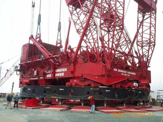
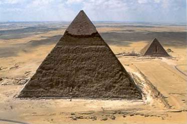
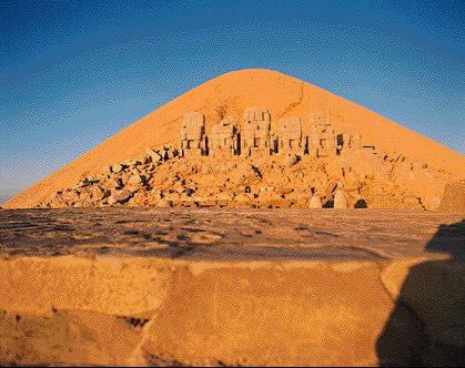
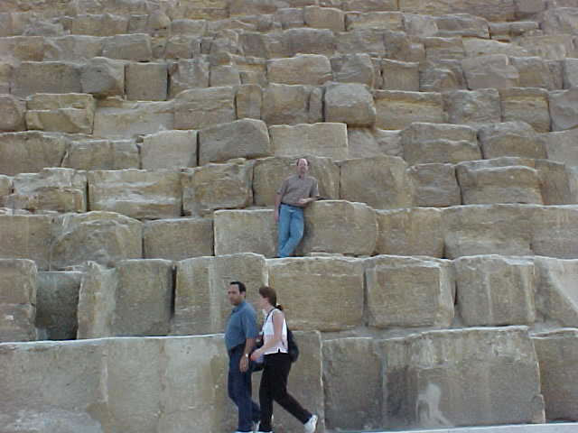
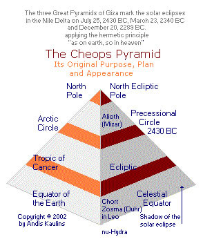
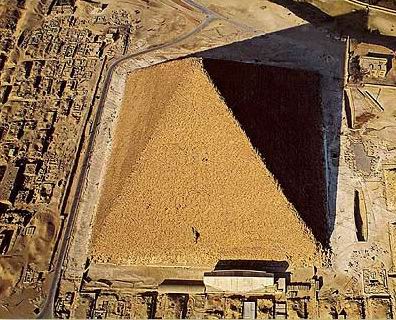
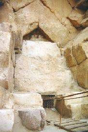
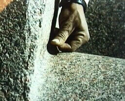
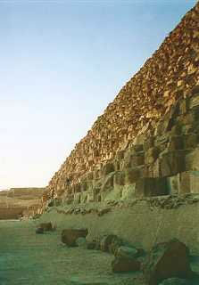
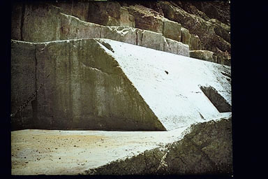
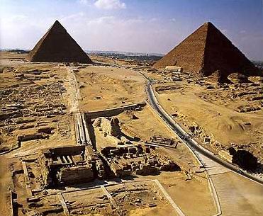
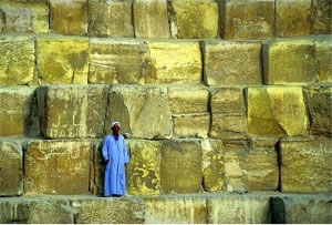
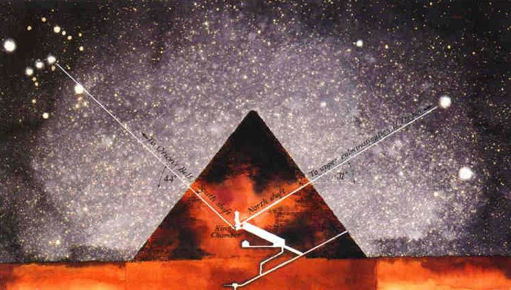
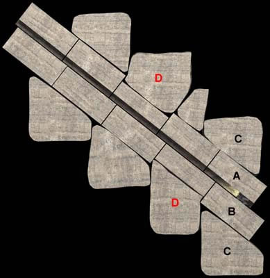
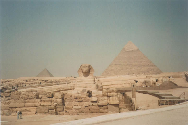
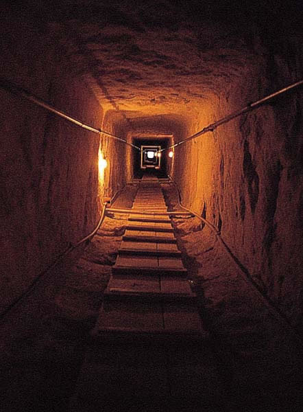
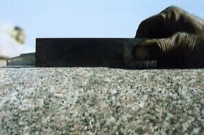
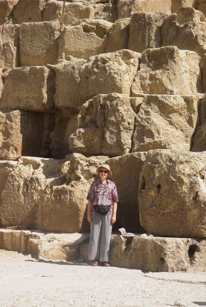
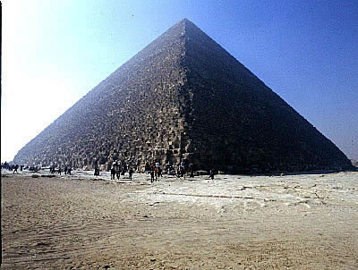
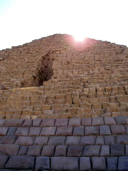
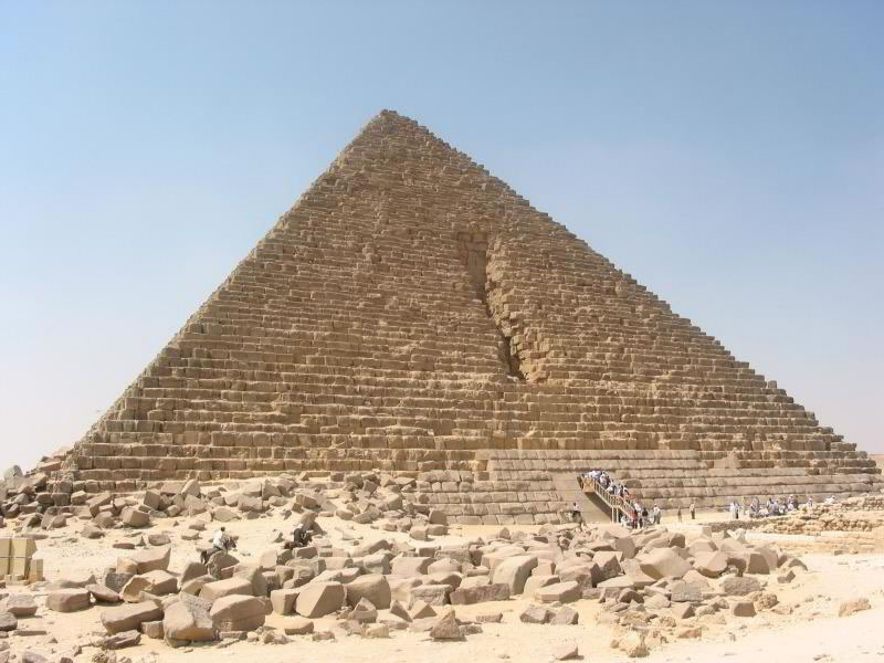
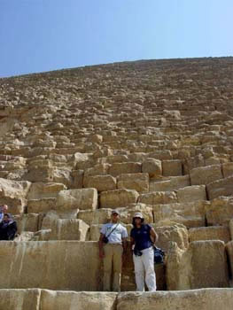
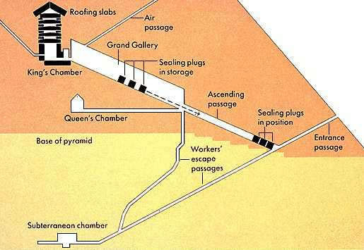
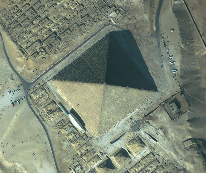
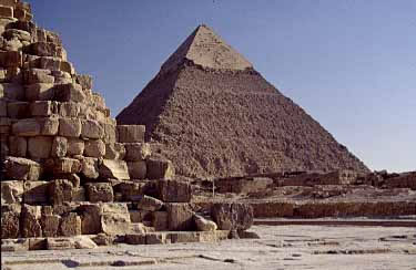
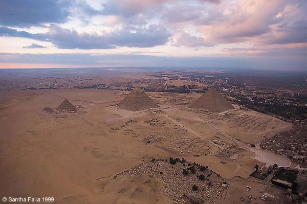
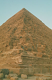
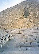
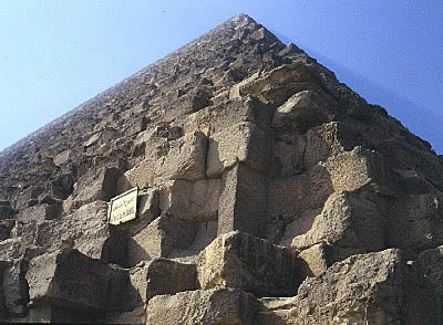
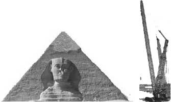
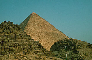
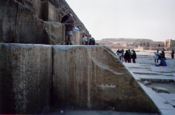
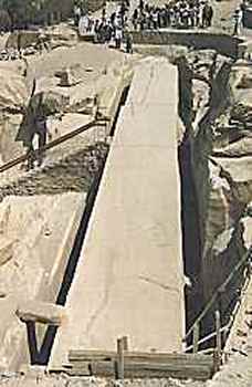
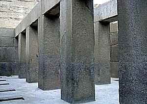
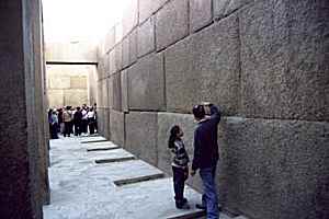
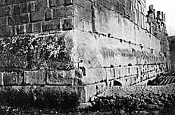

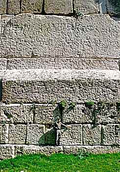
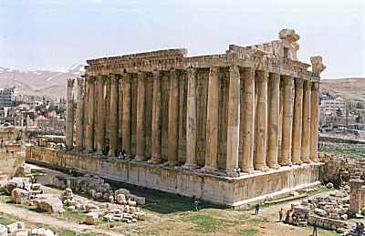
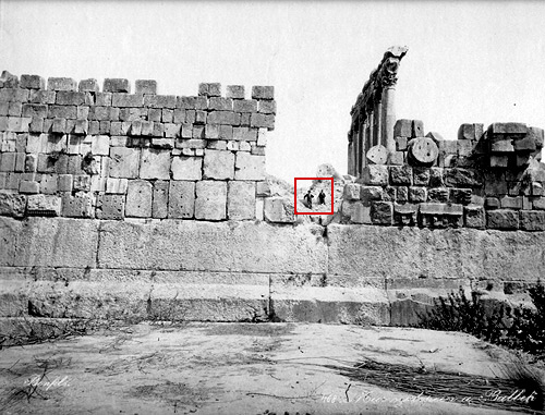
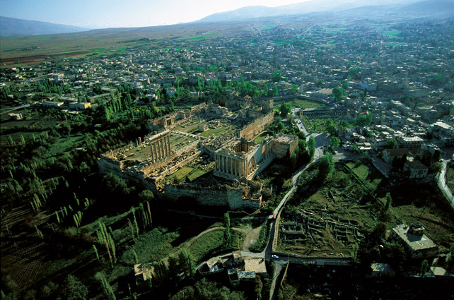
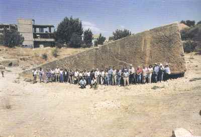
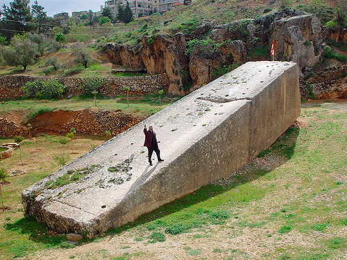
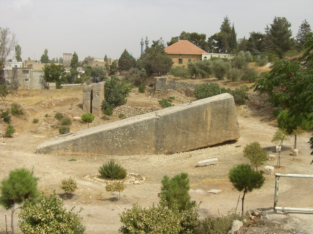
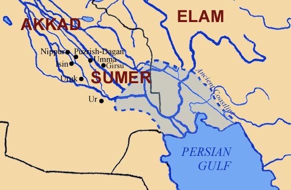
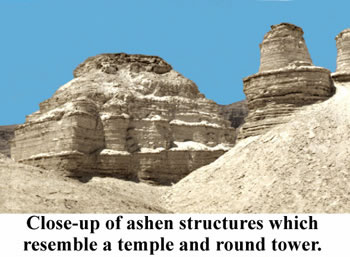
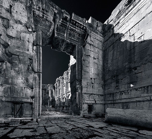
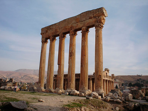
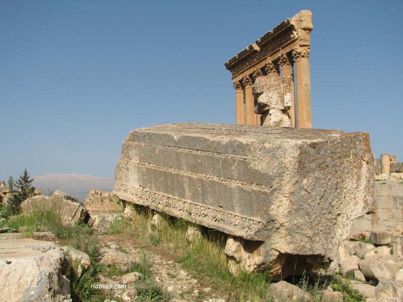
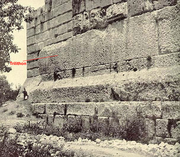
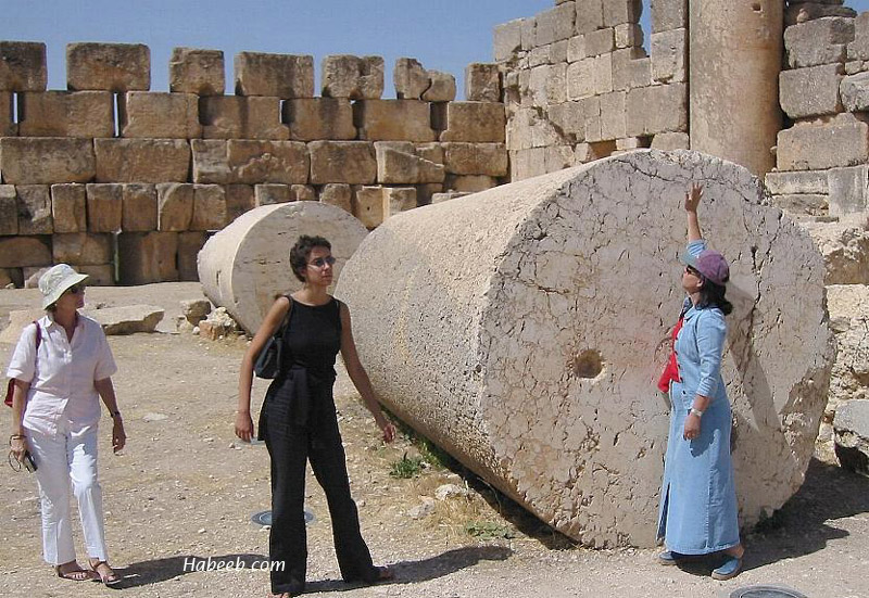
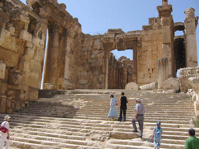
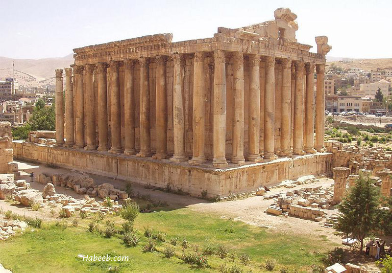

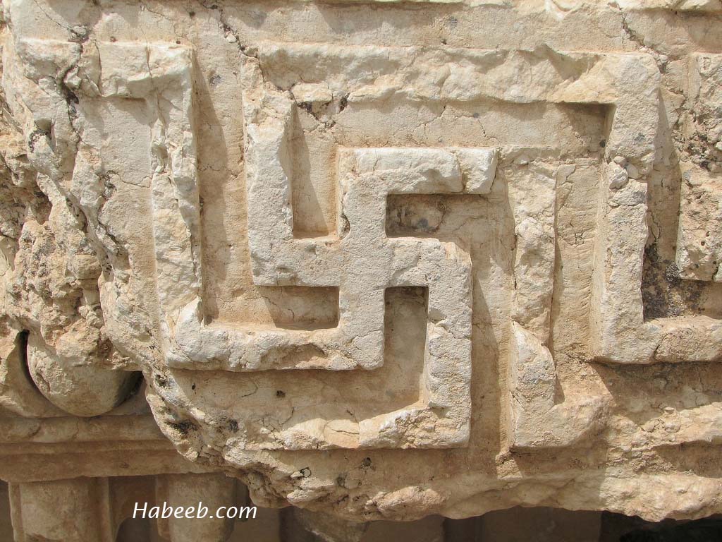
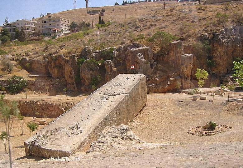
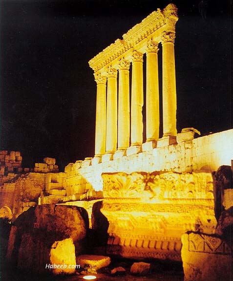
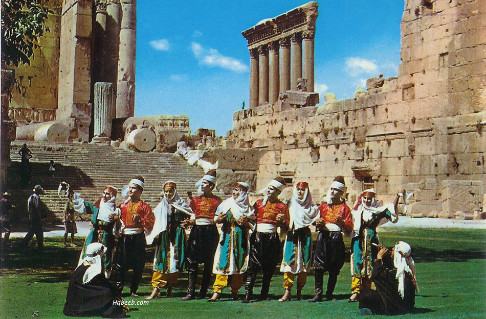
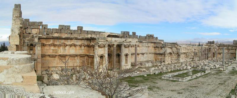
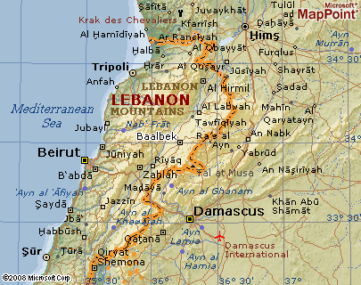
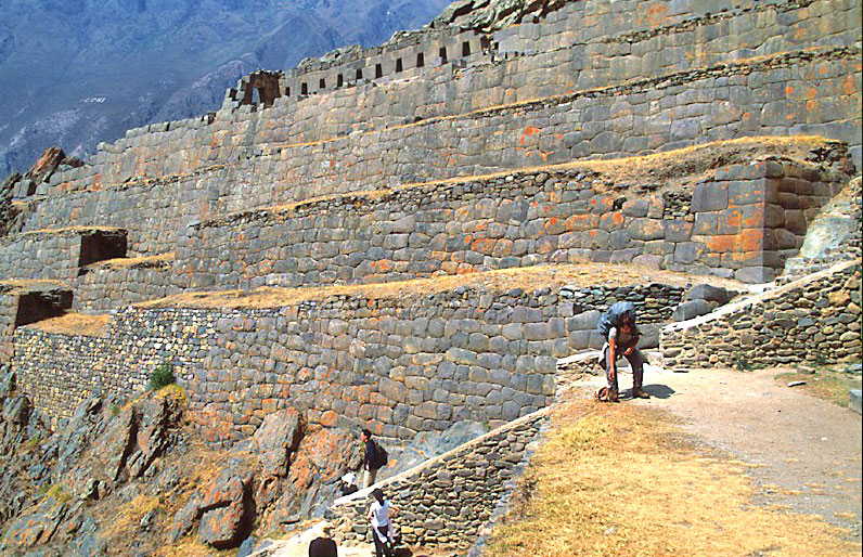
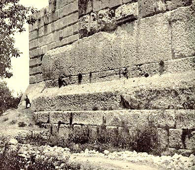
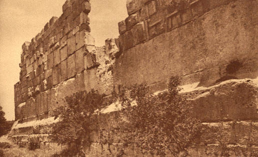
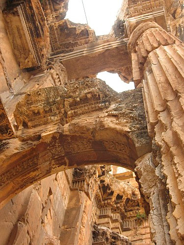
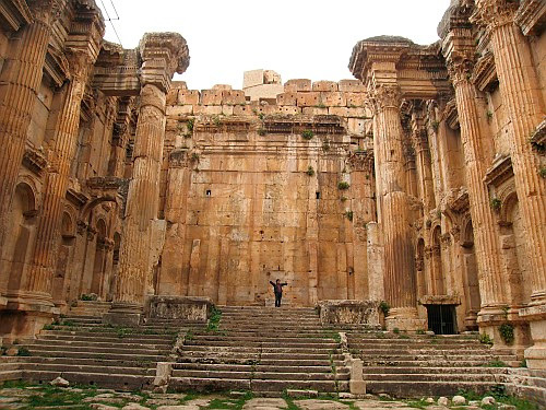
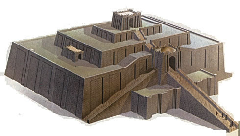
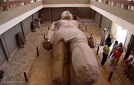
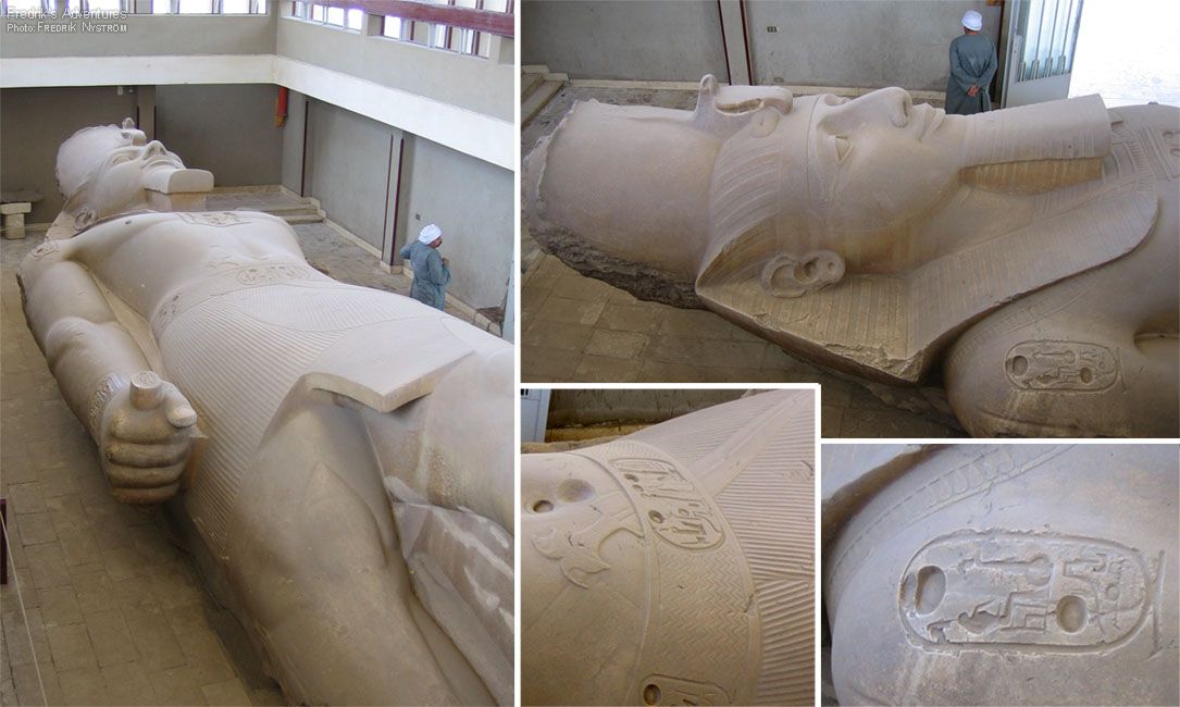
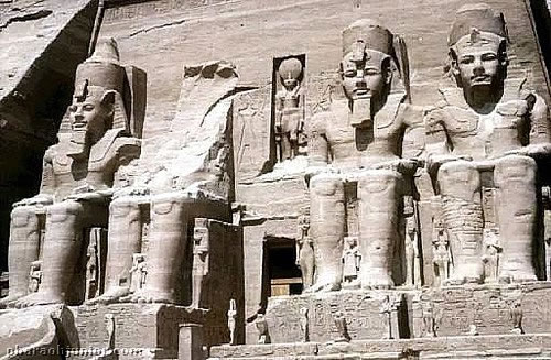
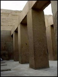
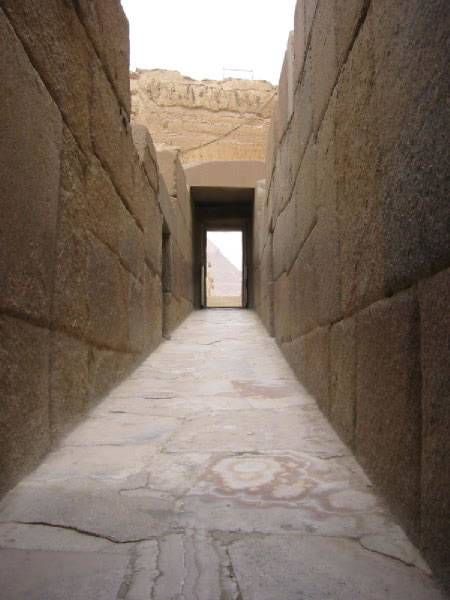

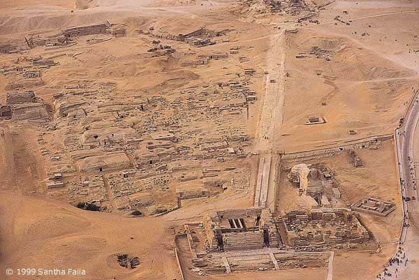
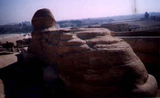
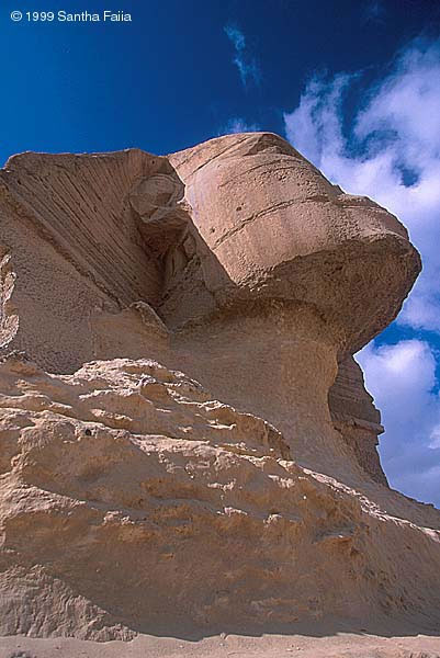
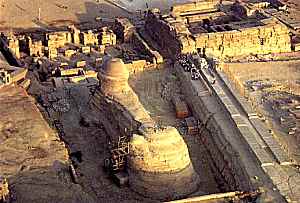

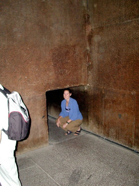
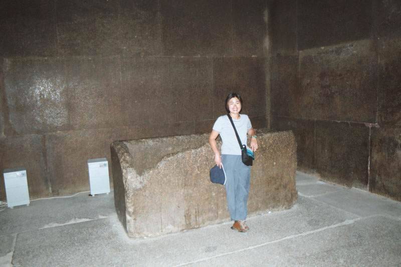
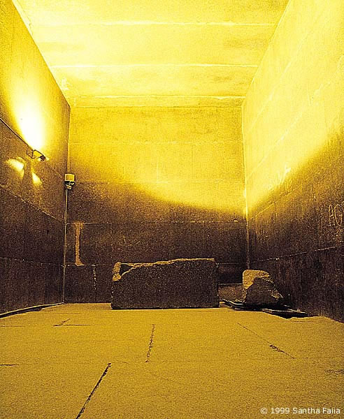
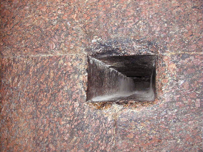
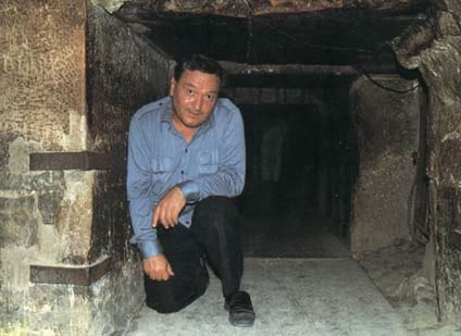
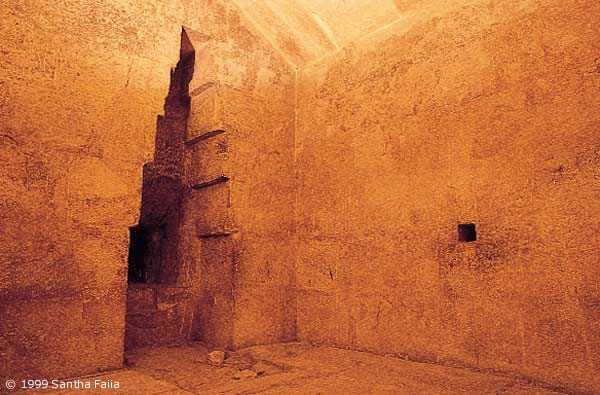
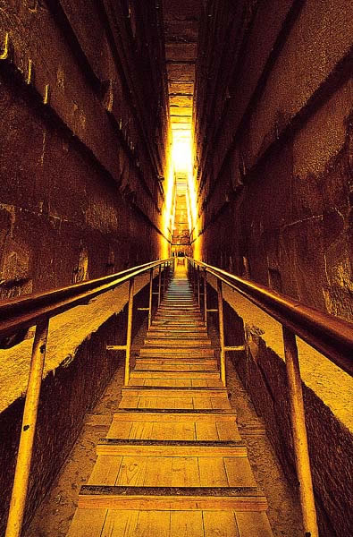
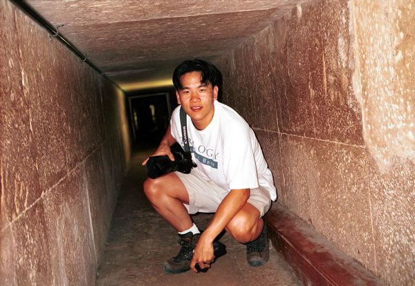
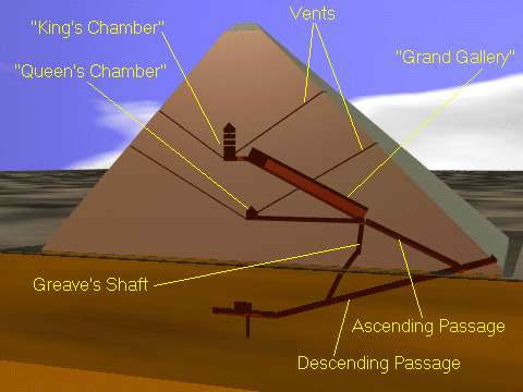
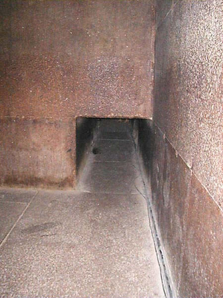
![[Close-up on pyramid image from Zelitsky’s submersible]](http://farm4.static.flickr.com/3528/3732809419_64b0b43153_o.jpg)

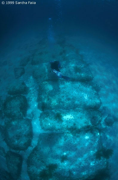
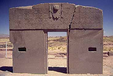
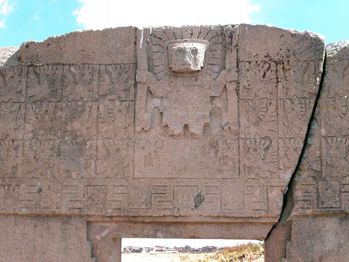
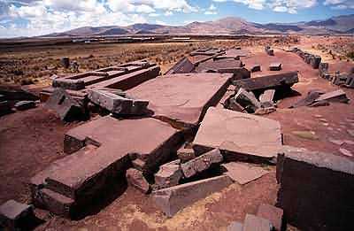
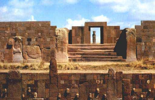
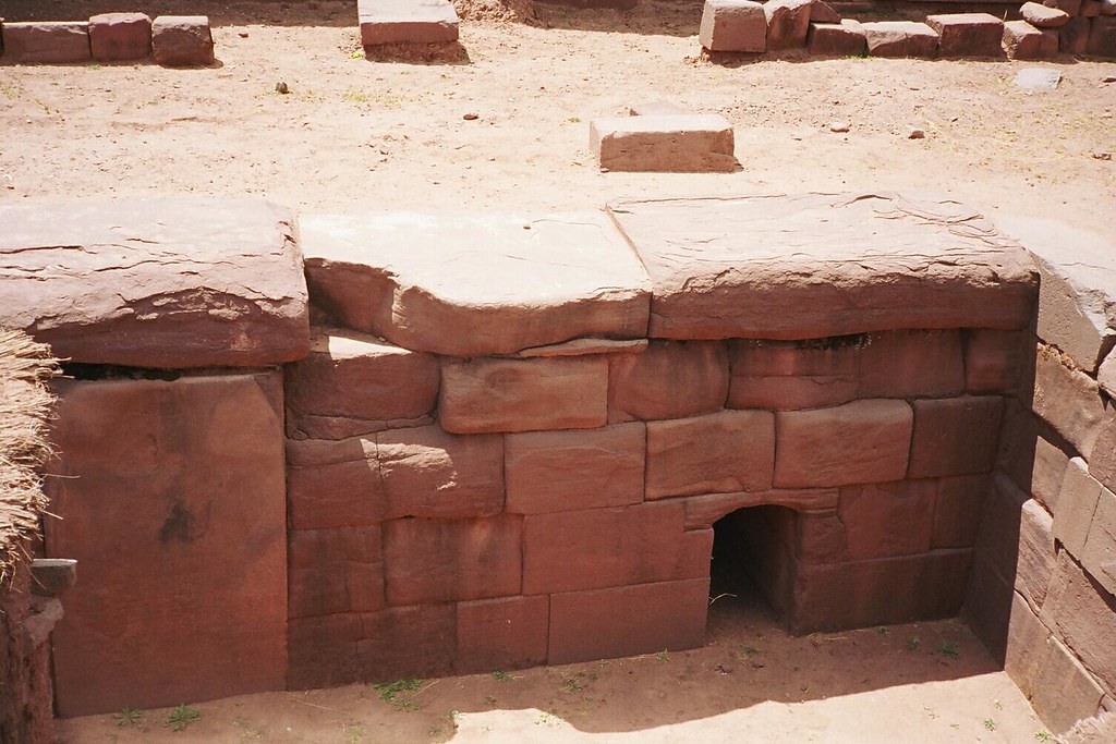
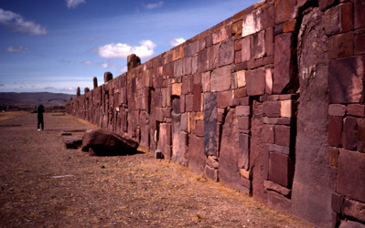
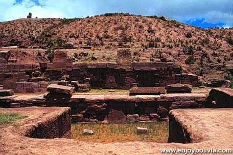
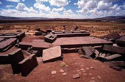
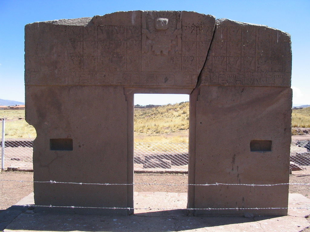
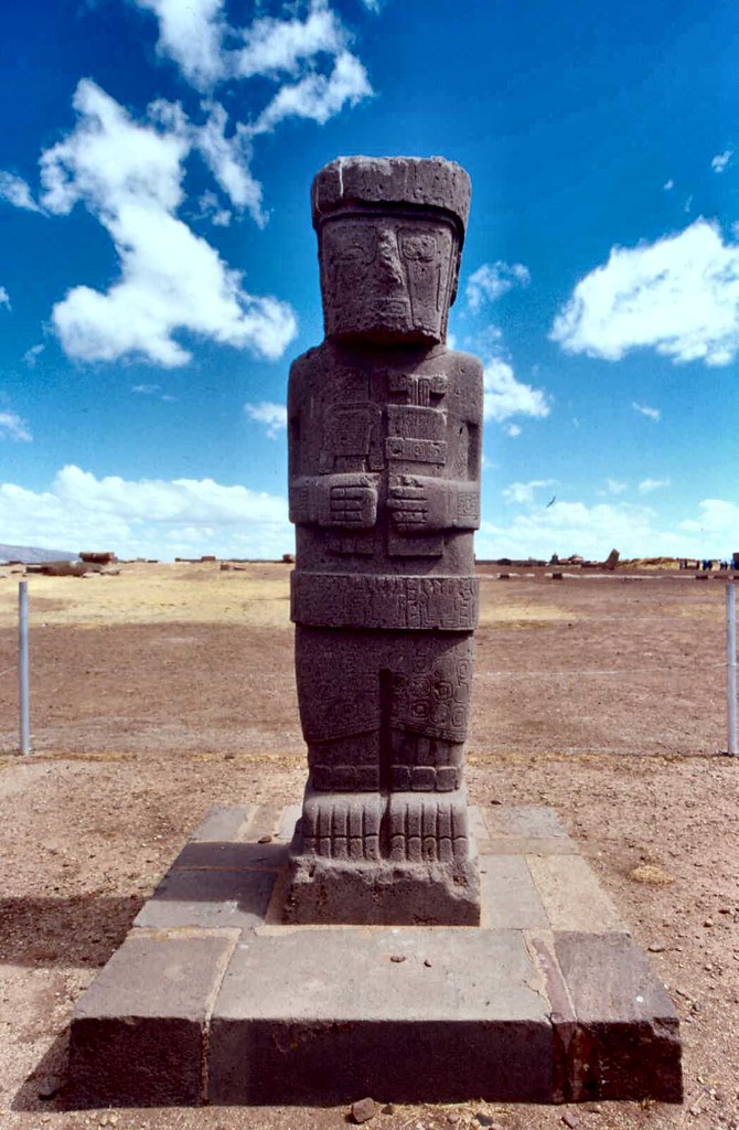
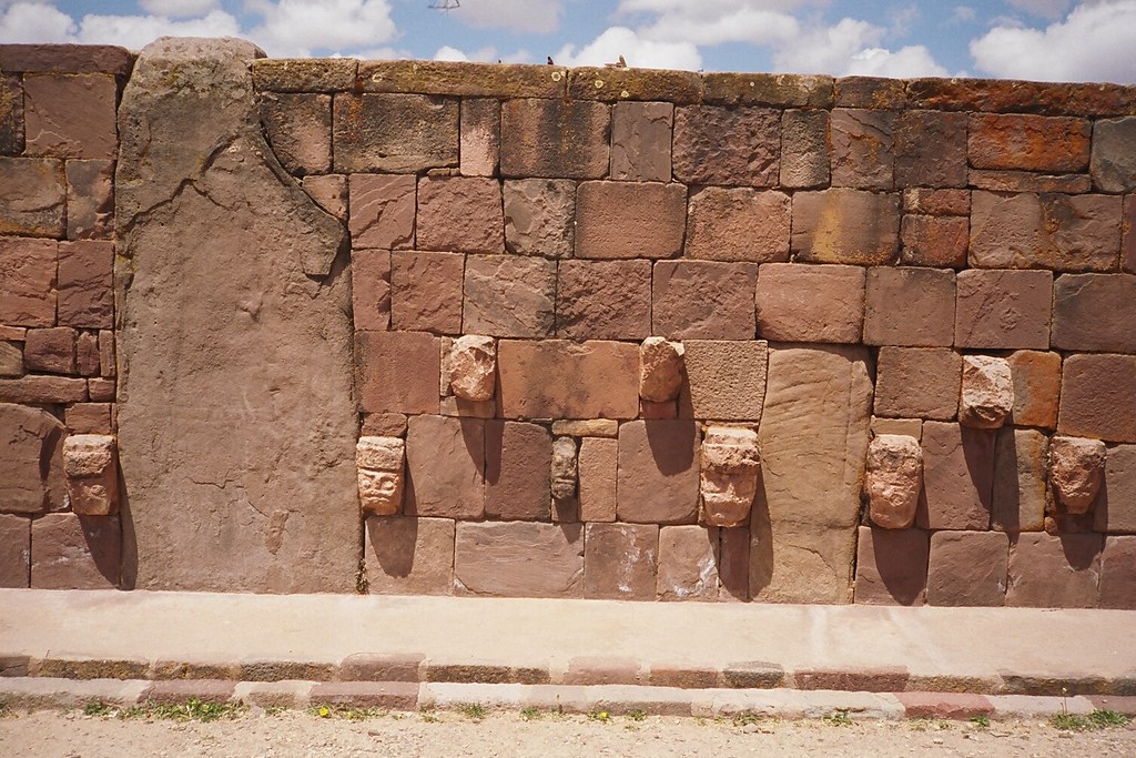
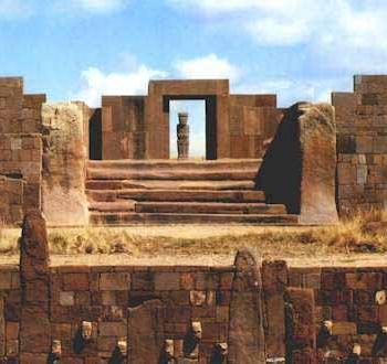

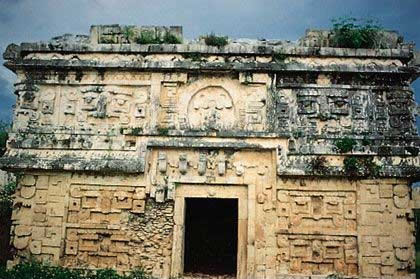
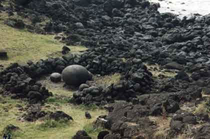
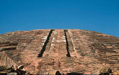
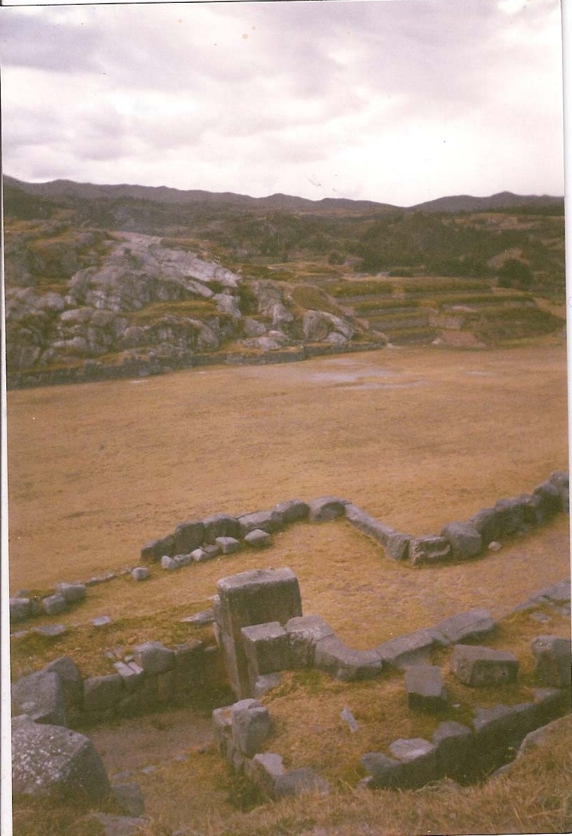
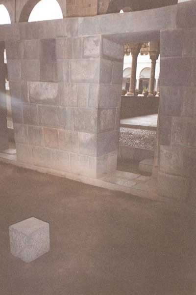

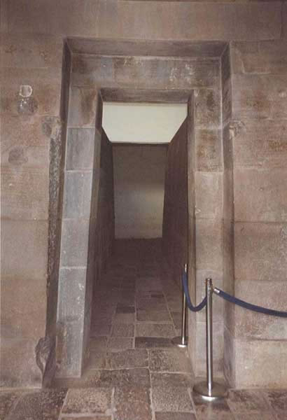
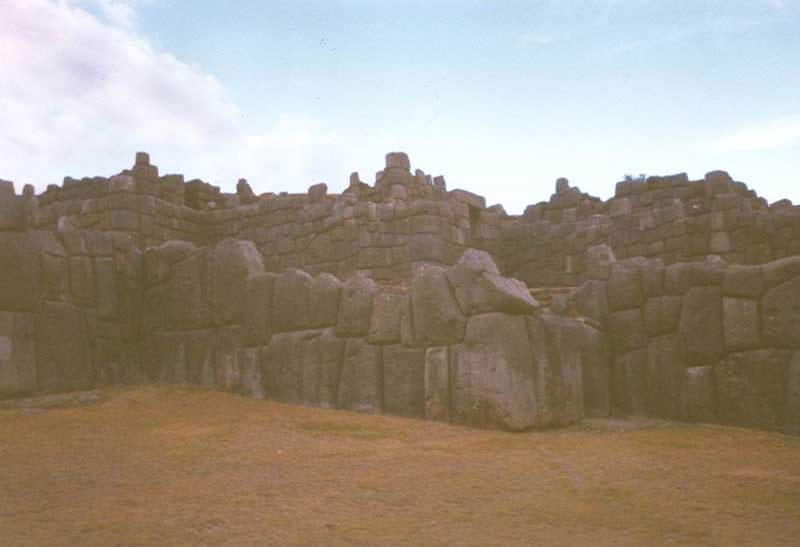
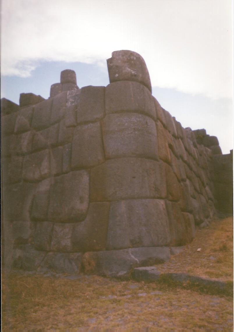
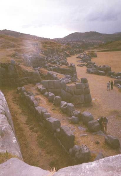
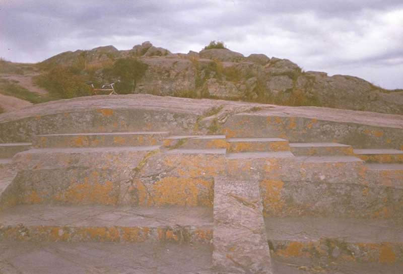
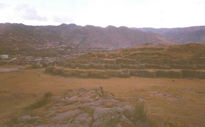
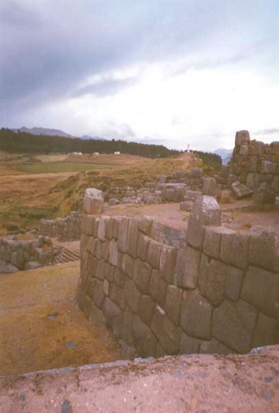
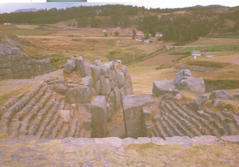
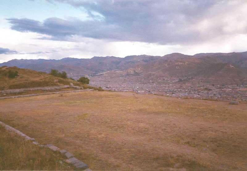
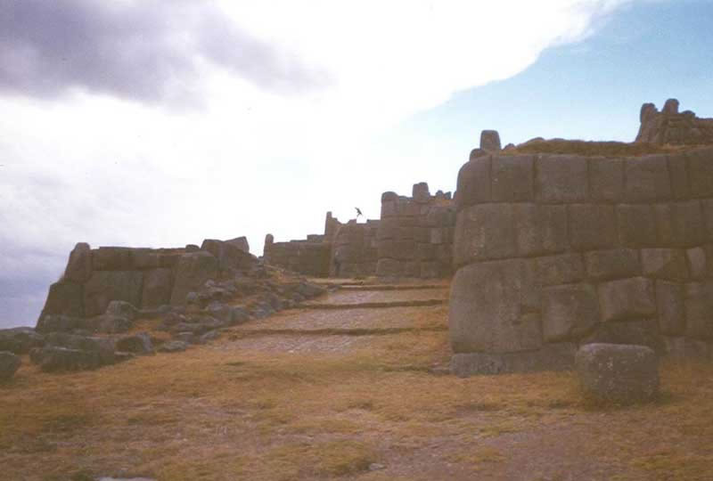
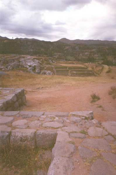
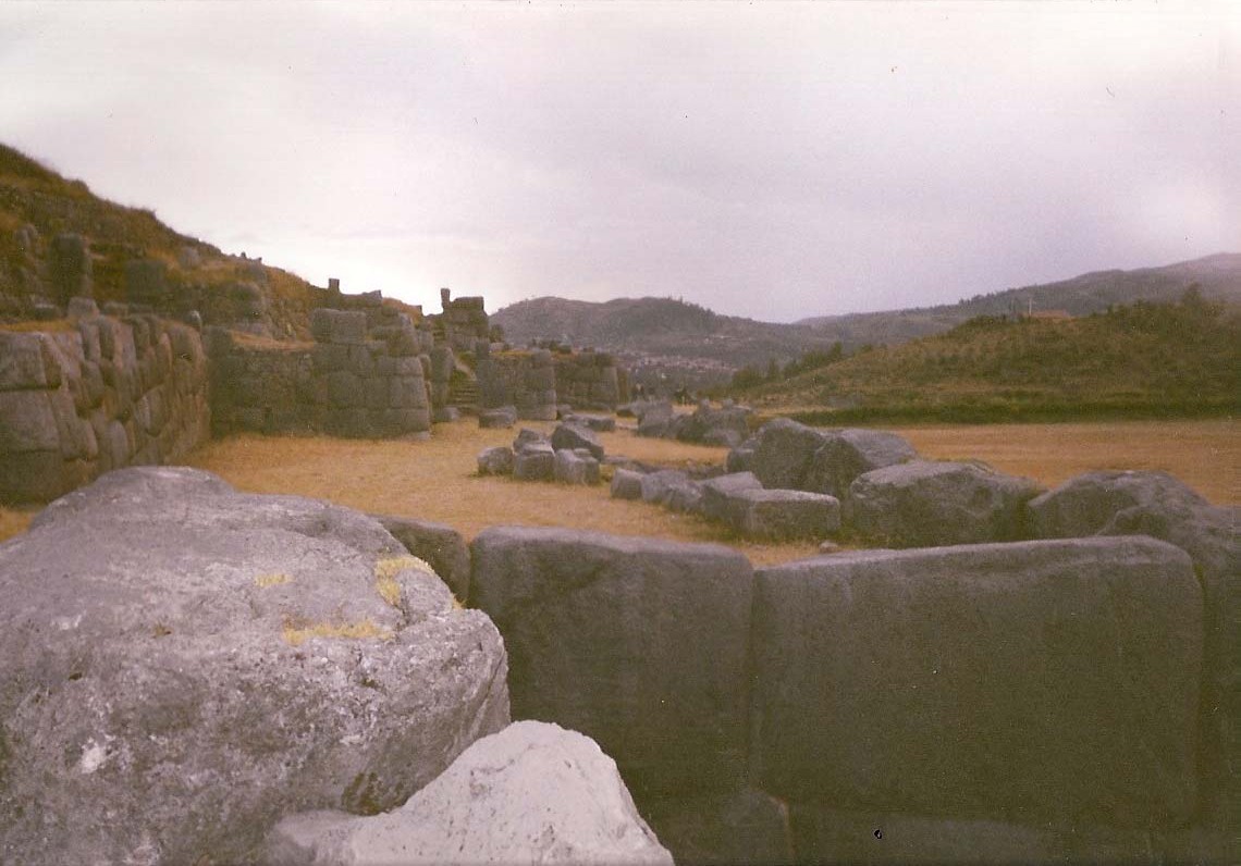
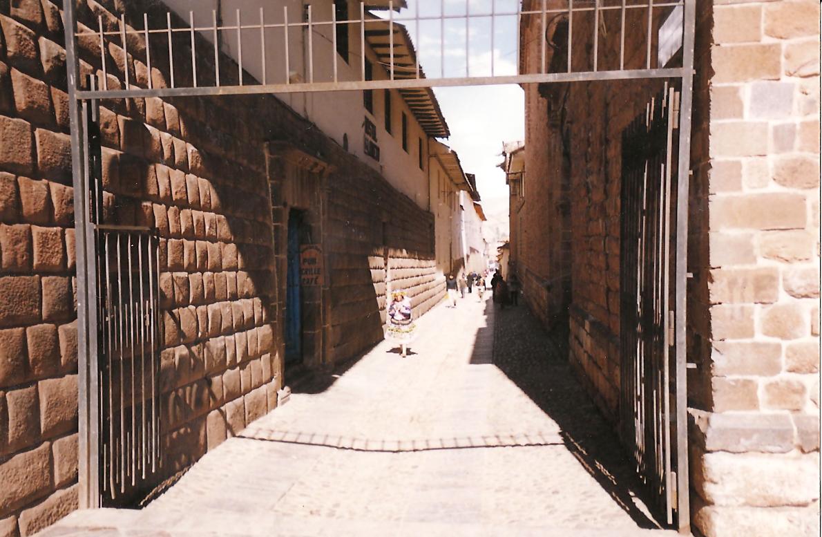
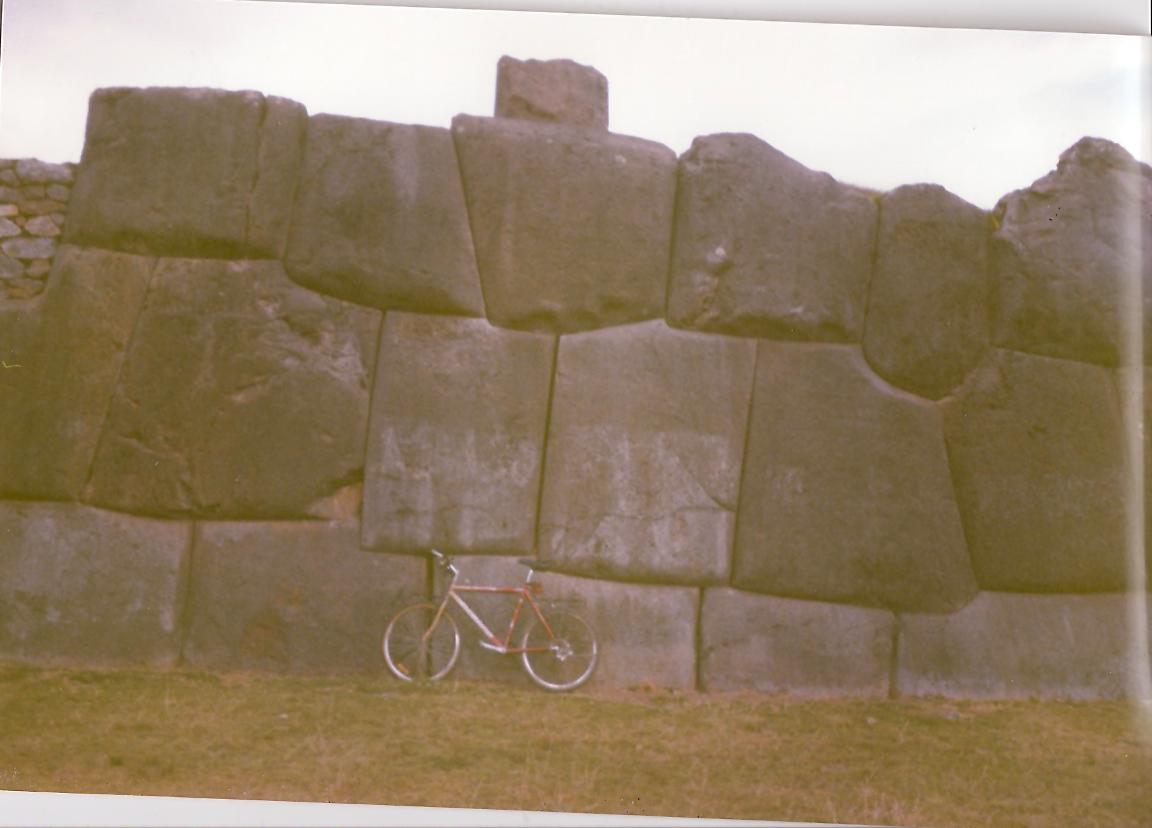
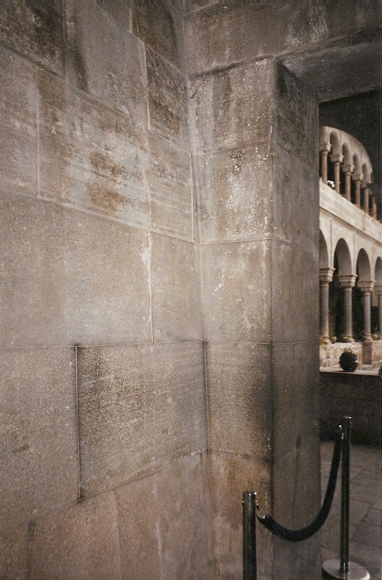
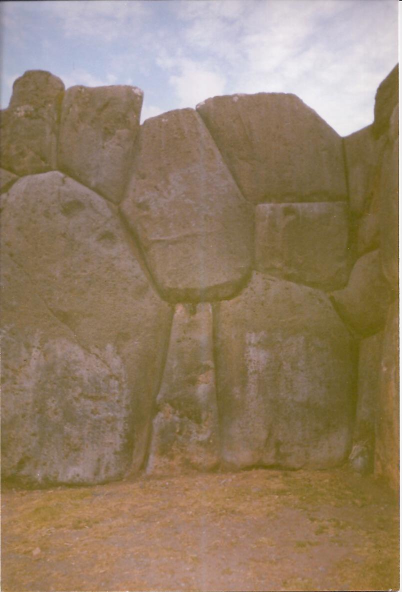
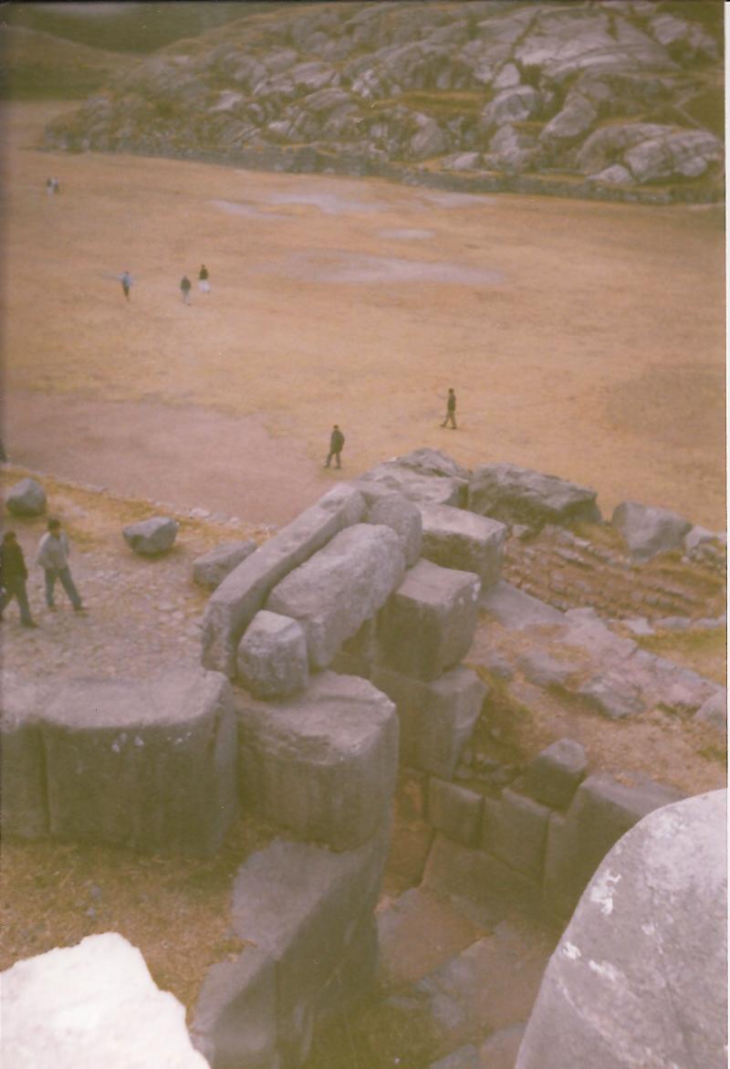
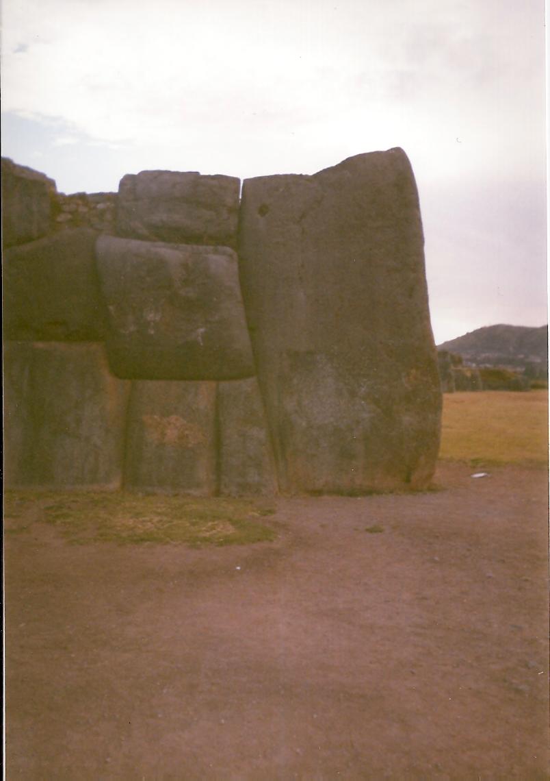
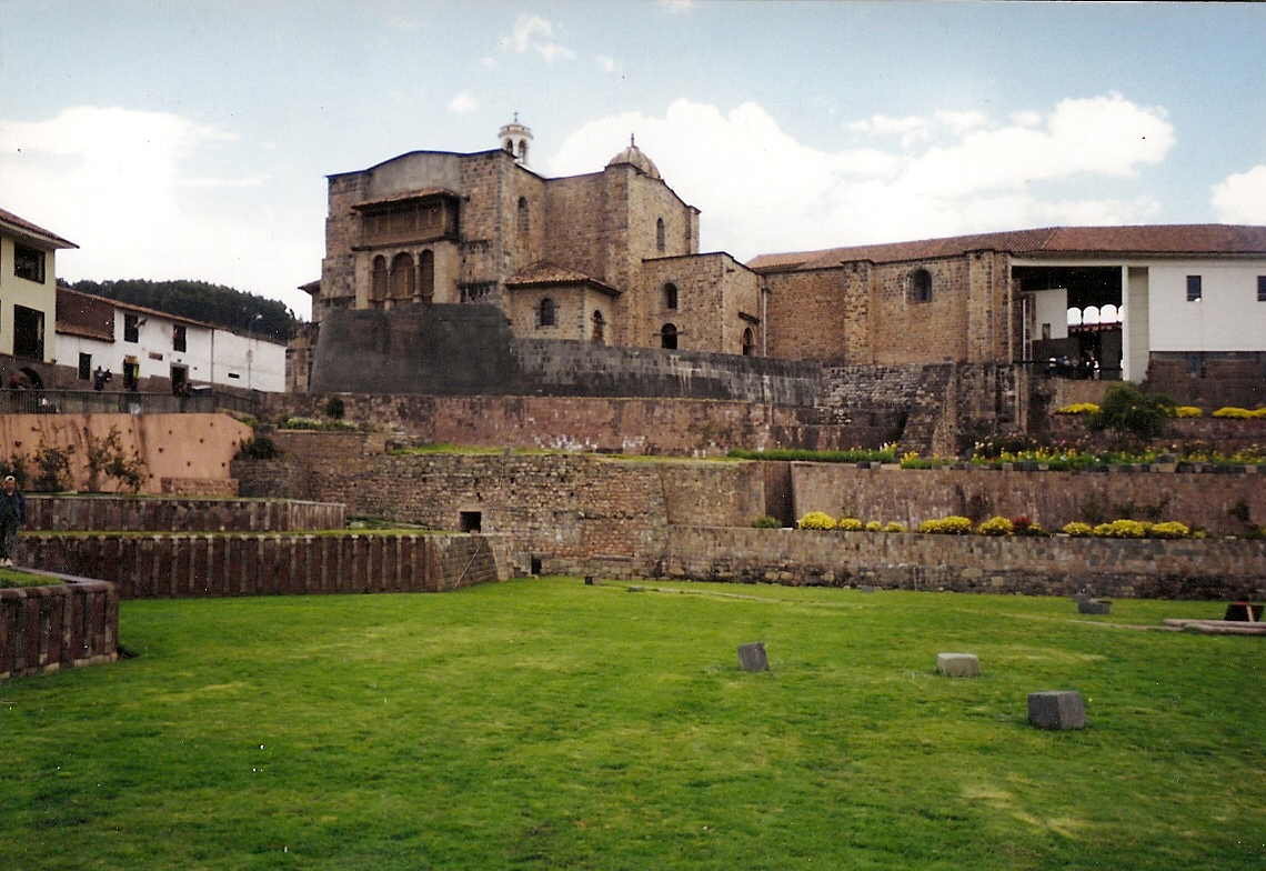
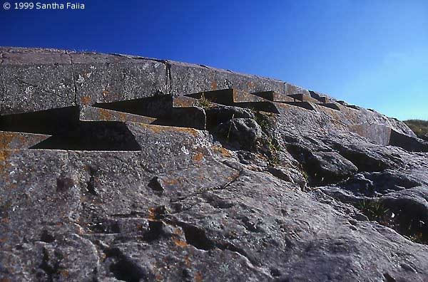
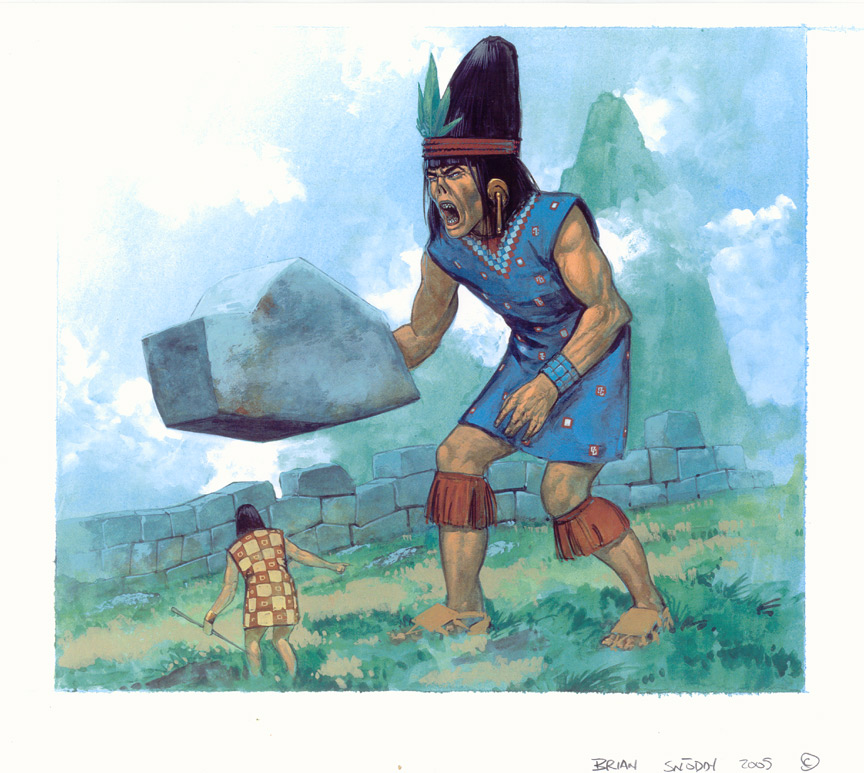
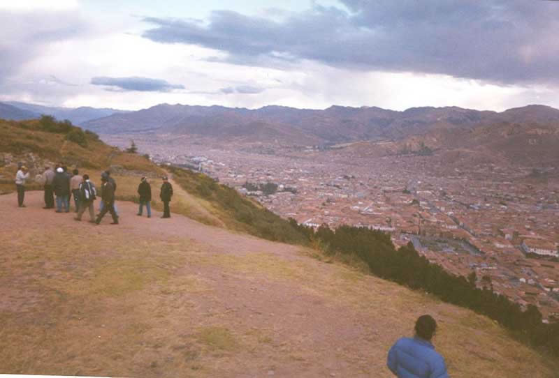
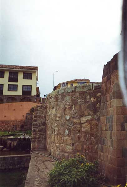
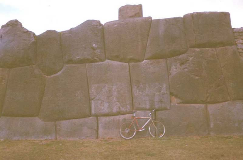

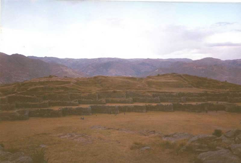
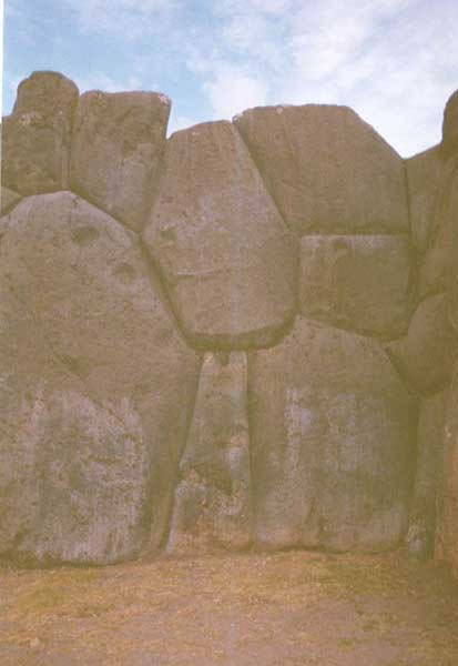
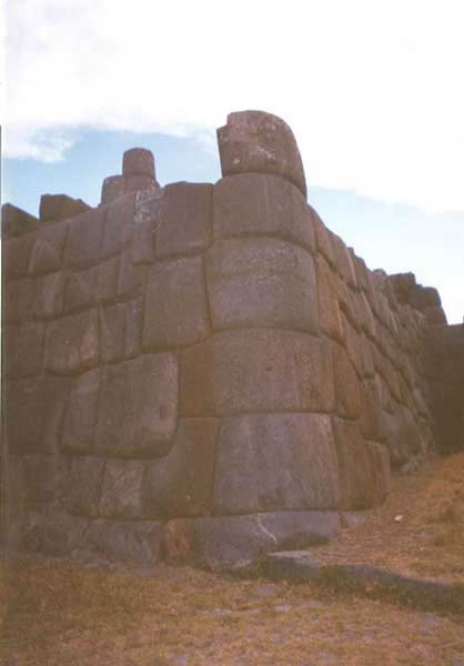
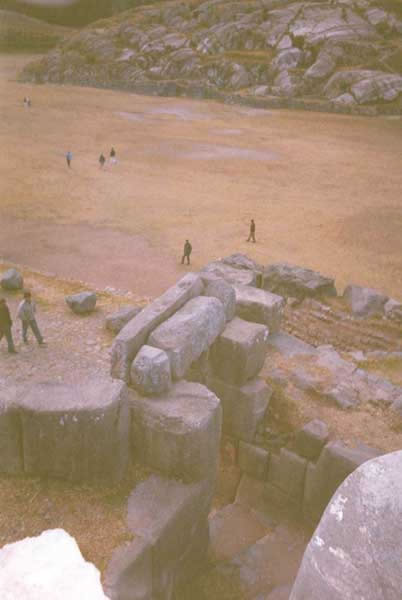
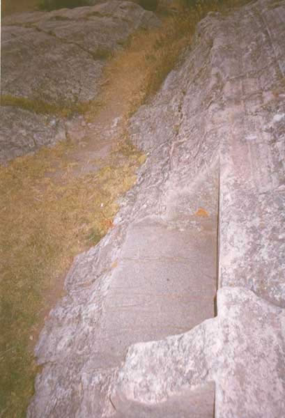
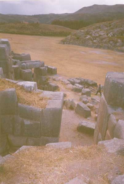
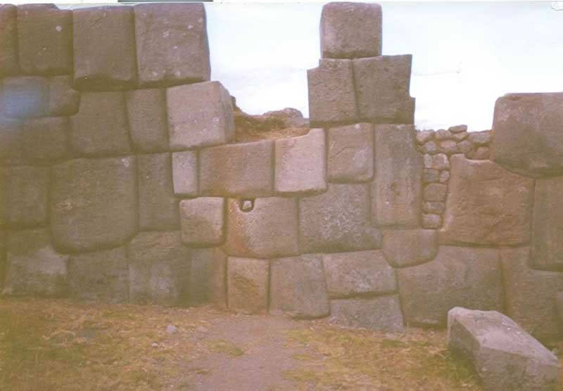
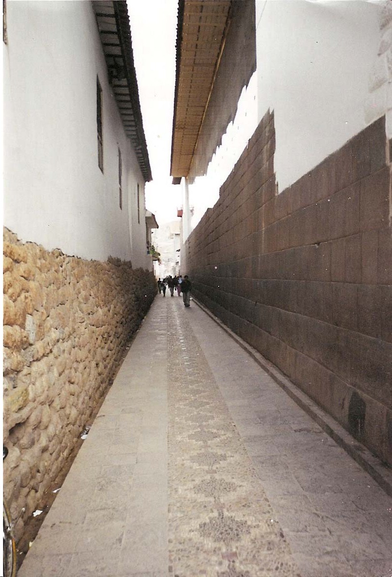
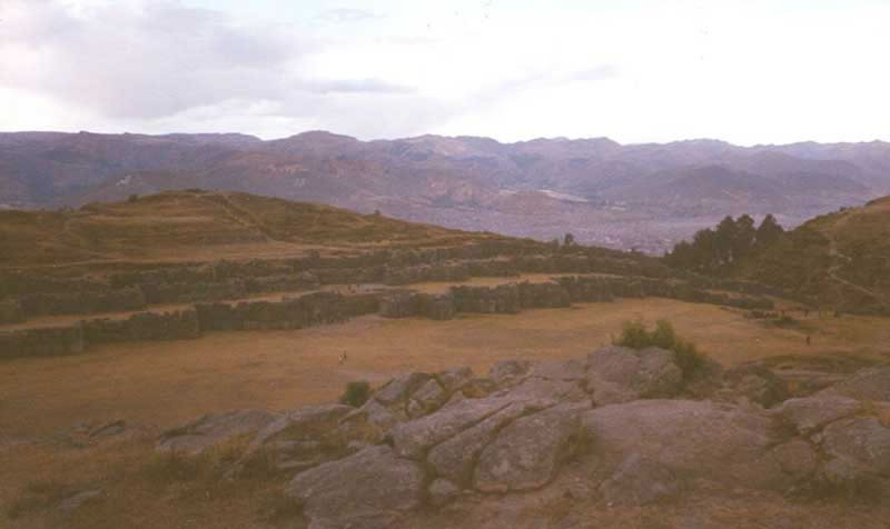
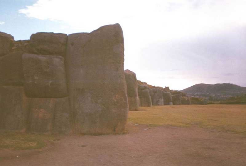
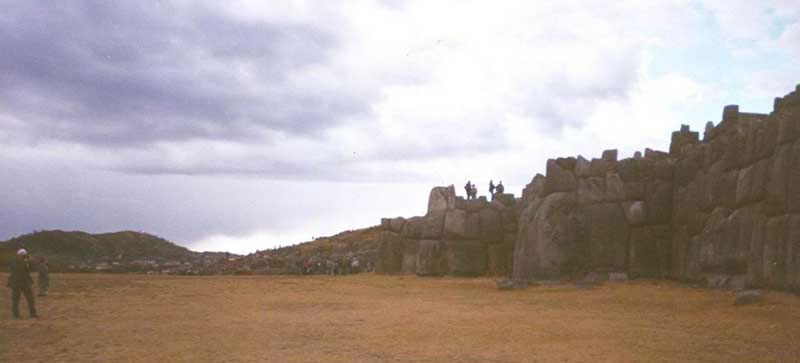
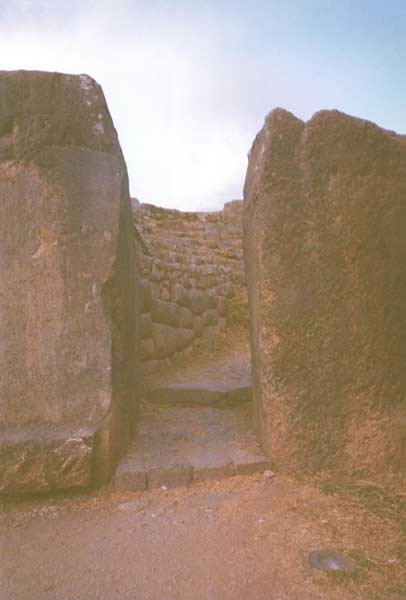
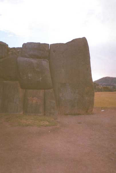
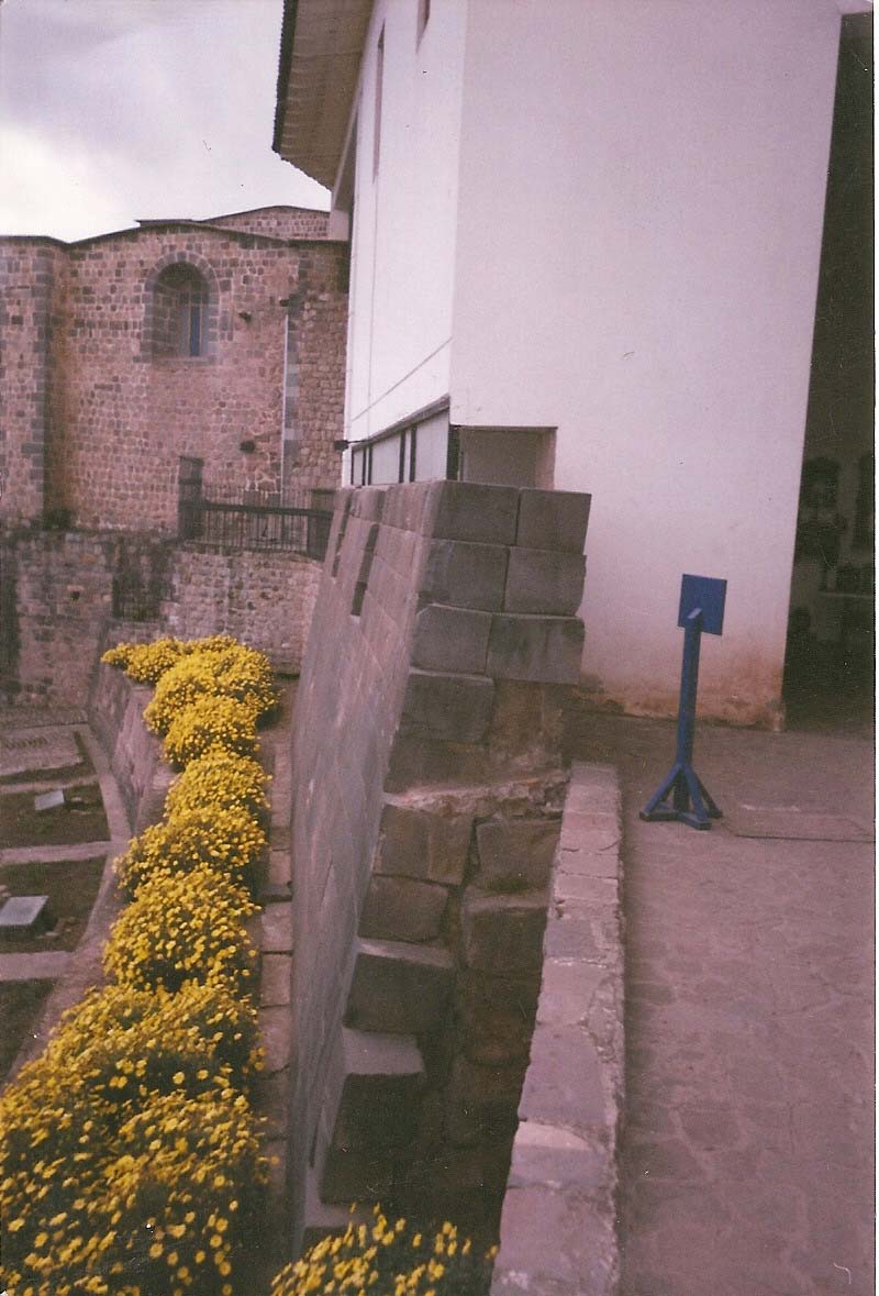
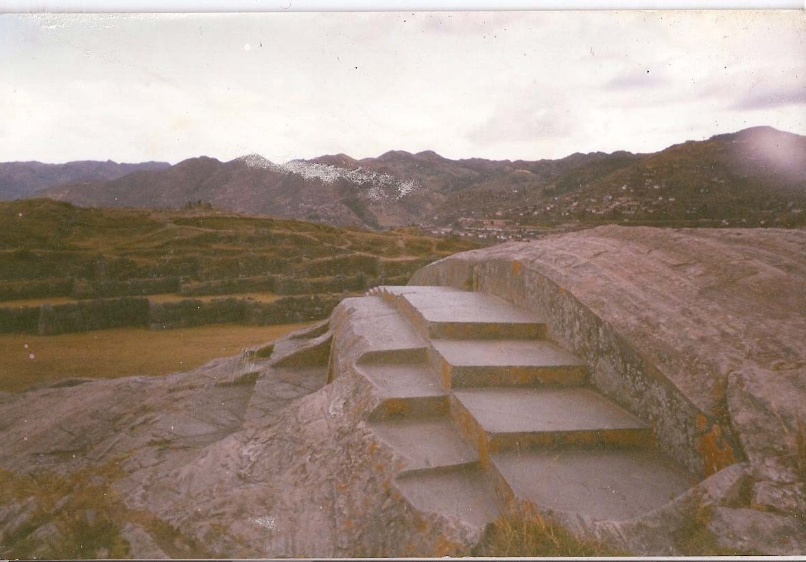
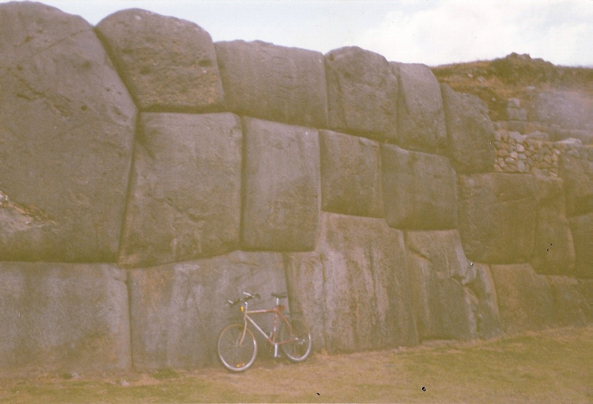
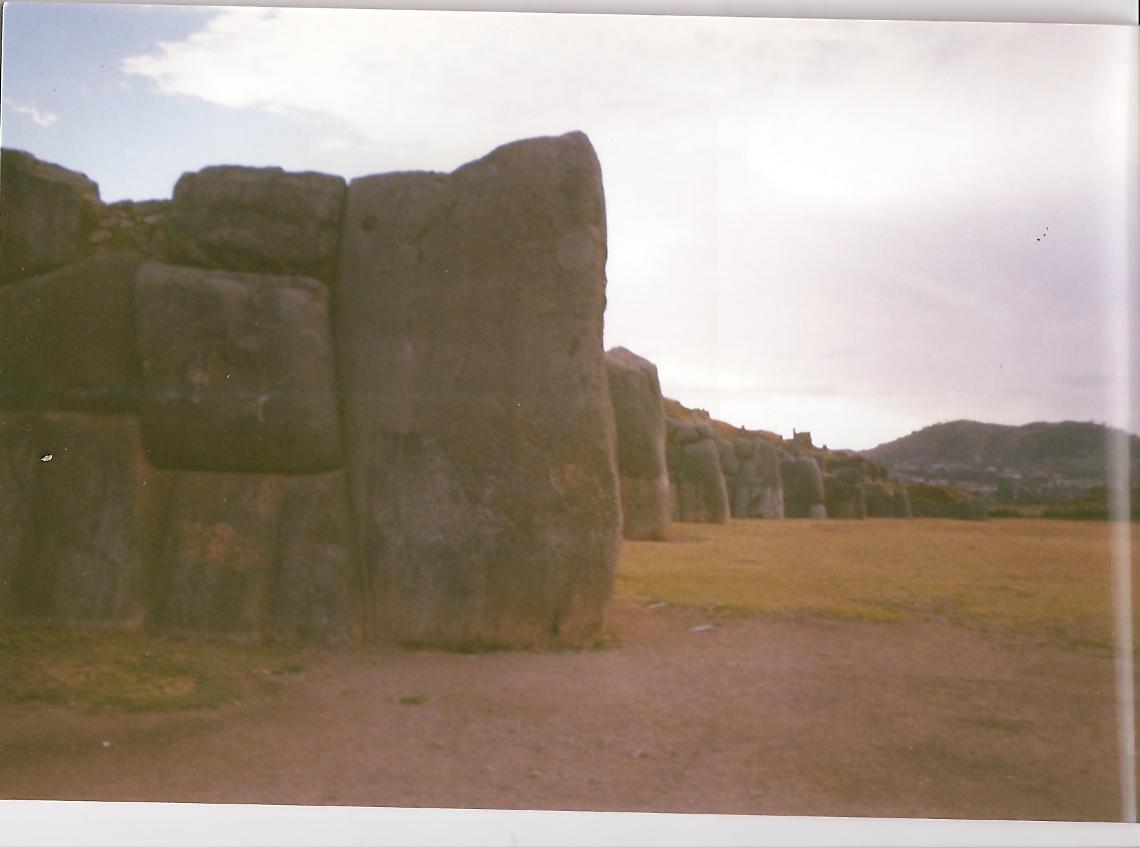
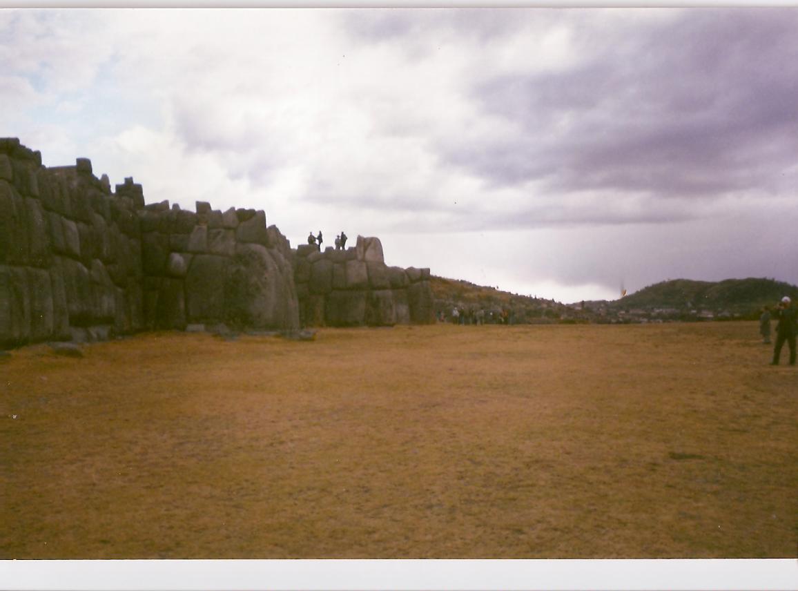
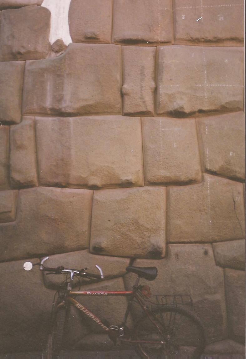
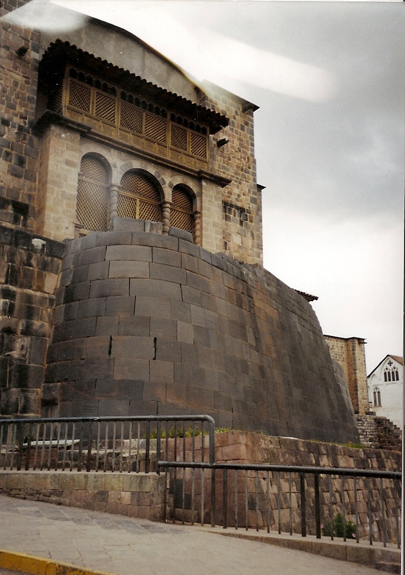
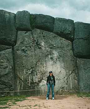
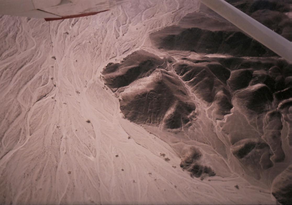
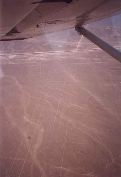
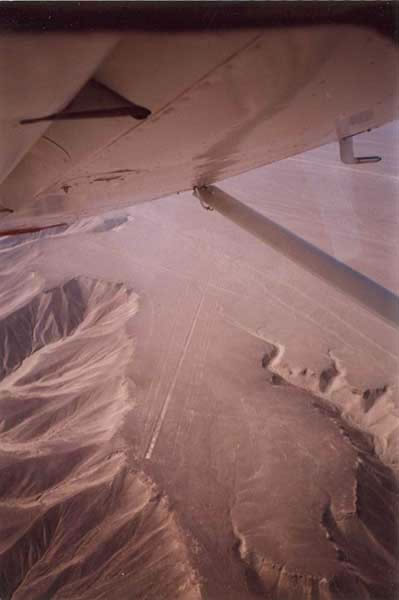
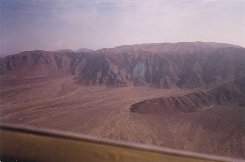
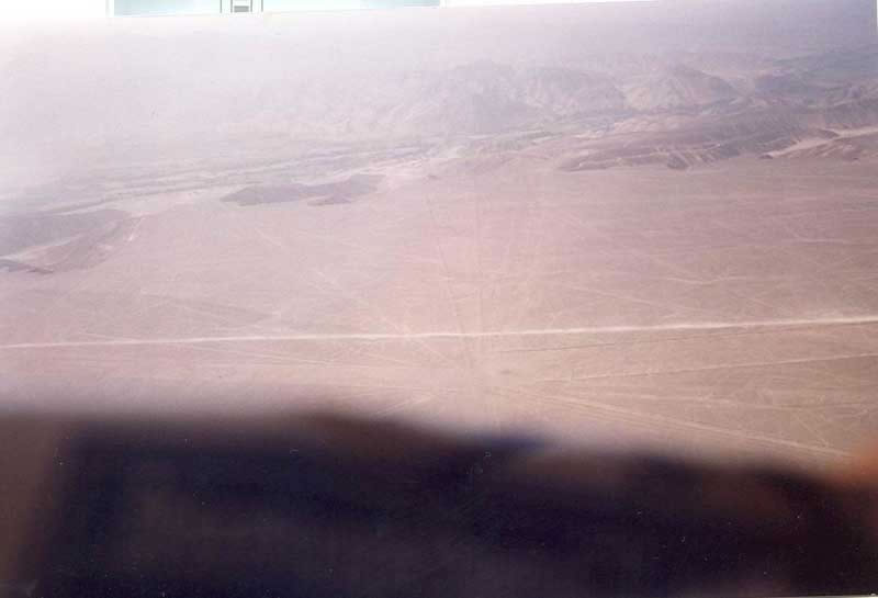
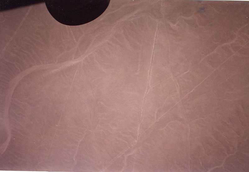
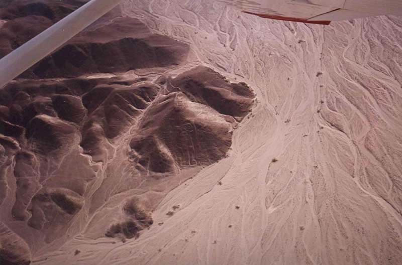
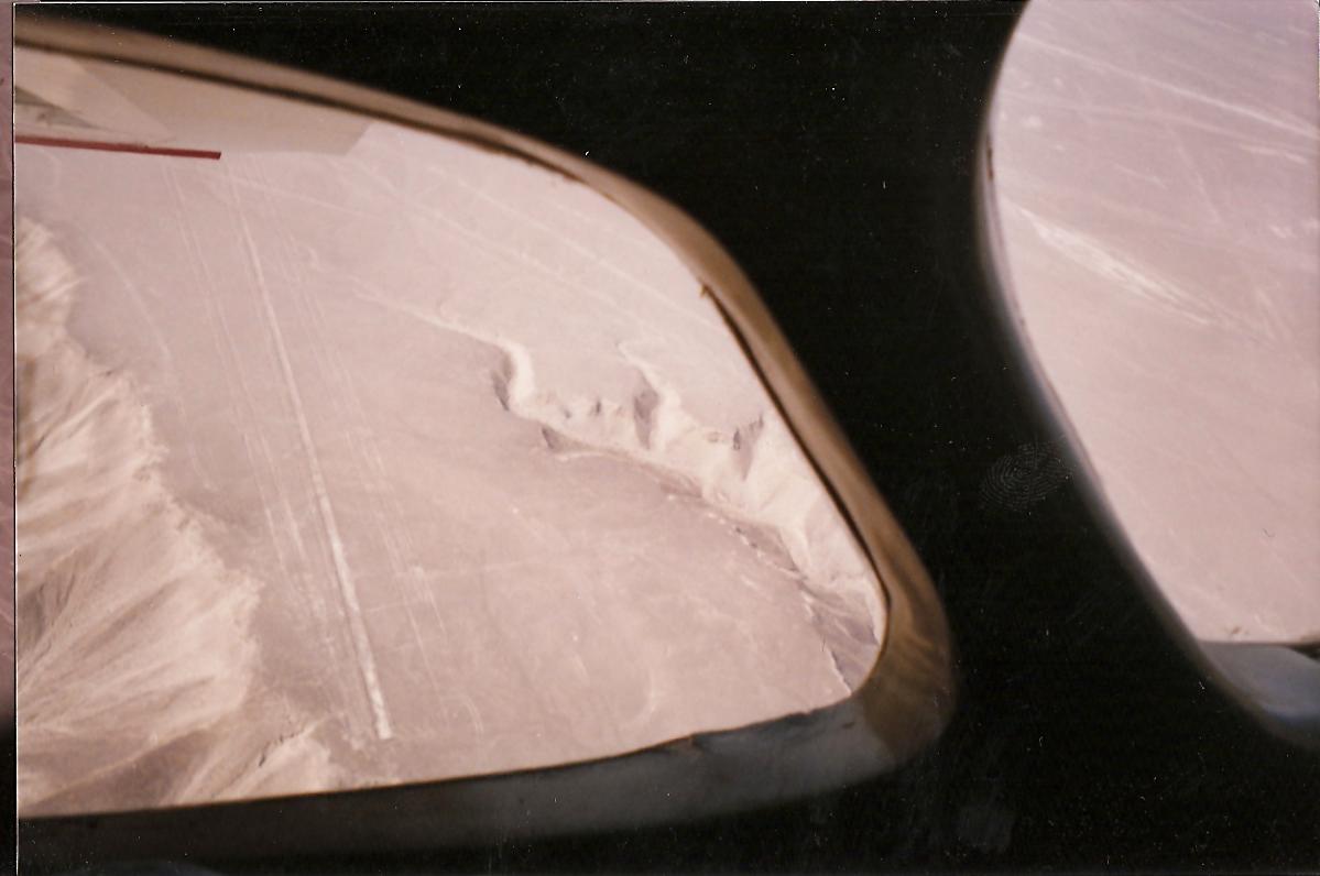
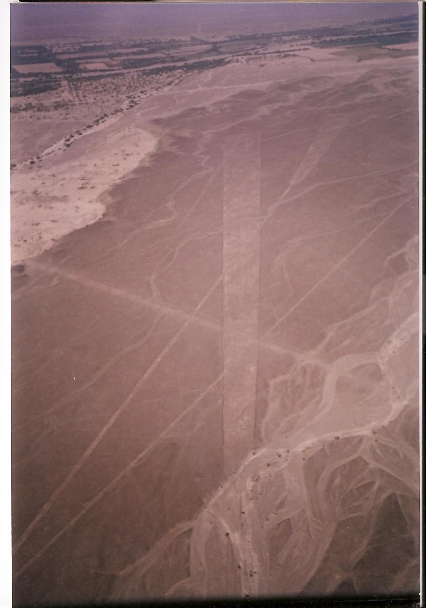
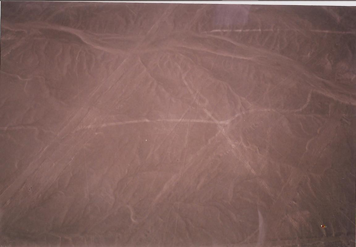
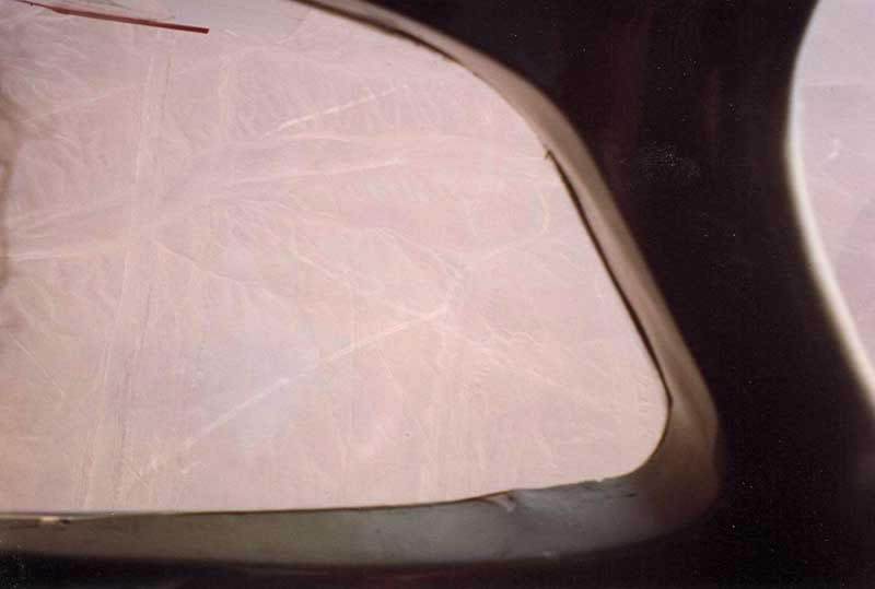
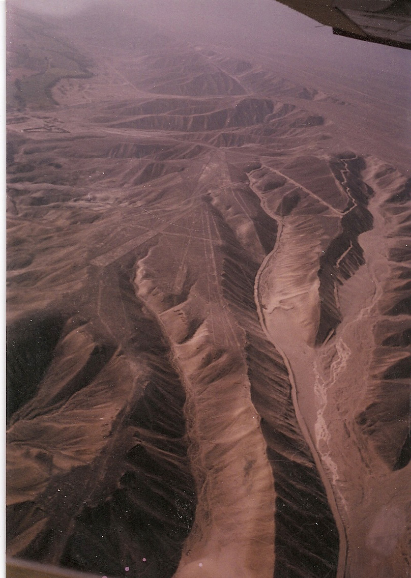
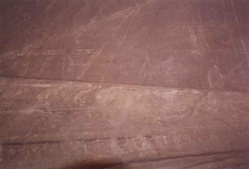
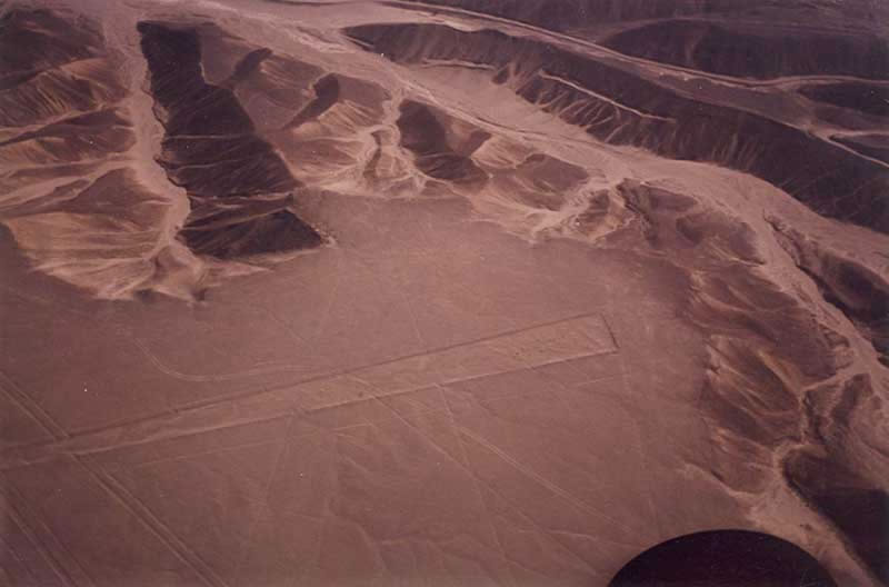
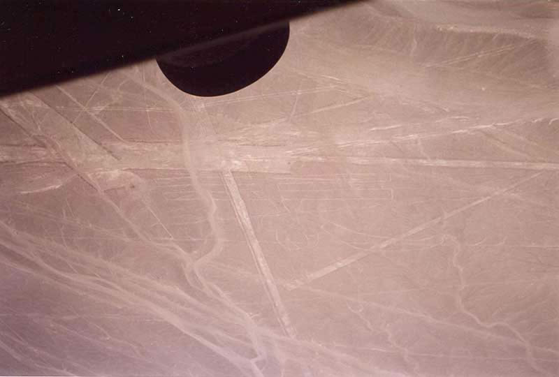
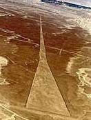
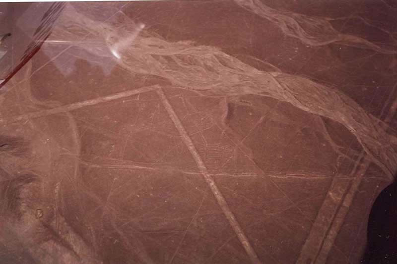
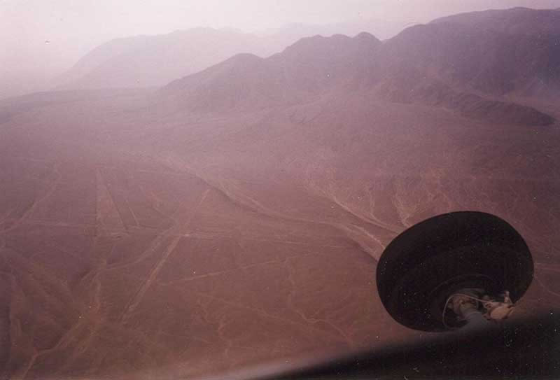
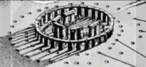
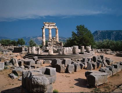
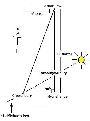


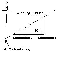

.jpg)

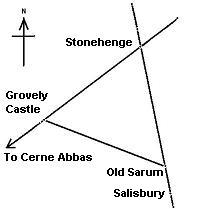


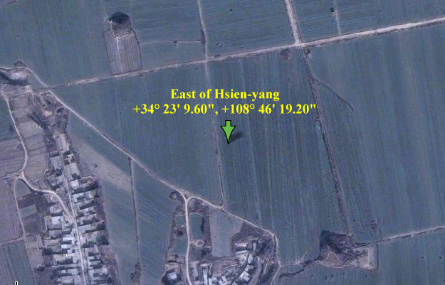
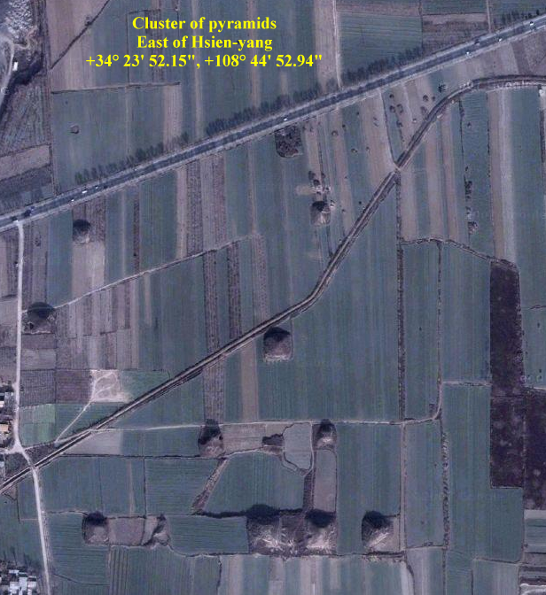
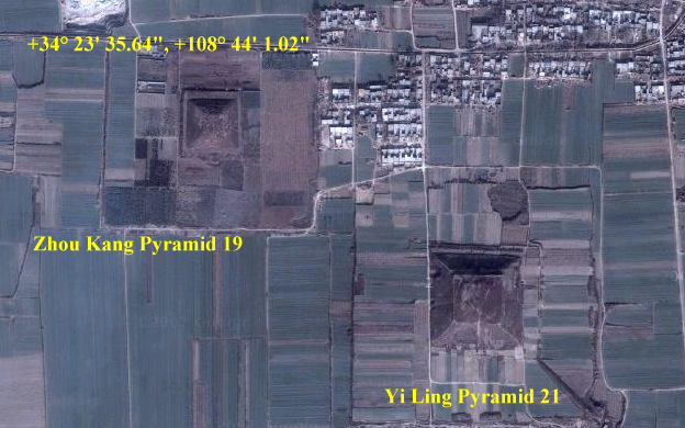
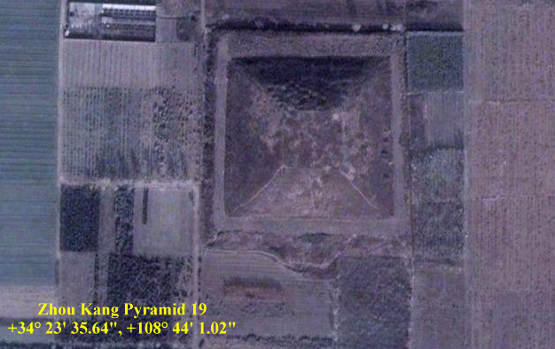
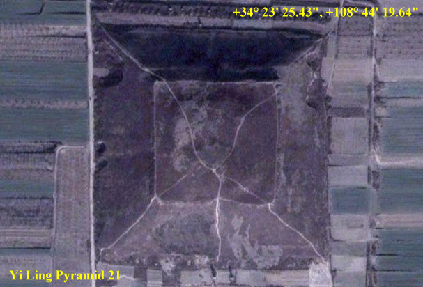
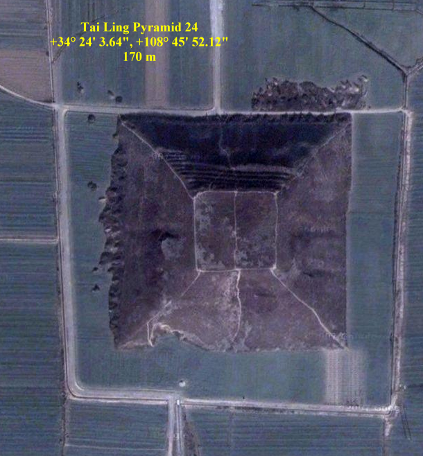
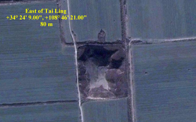
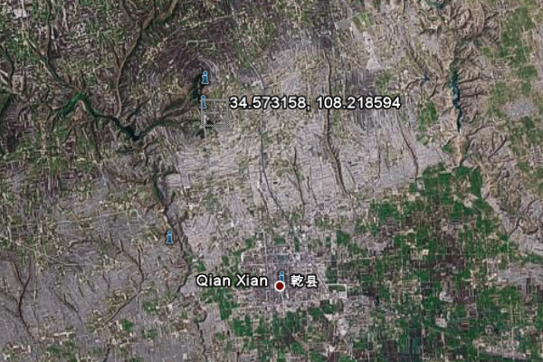
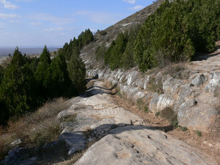
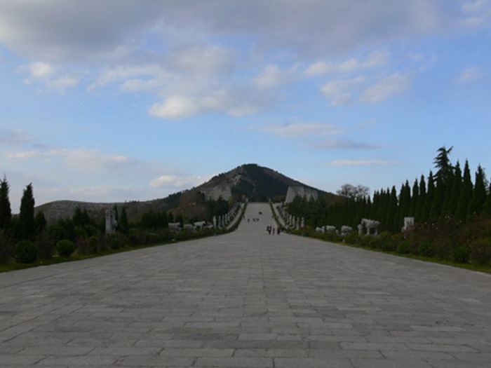
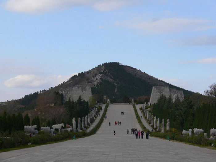
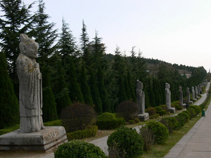
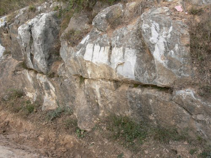
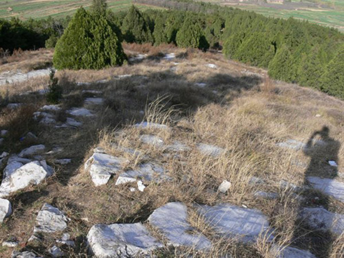
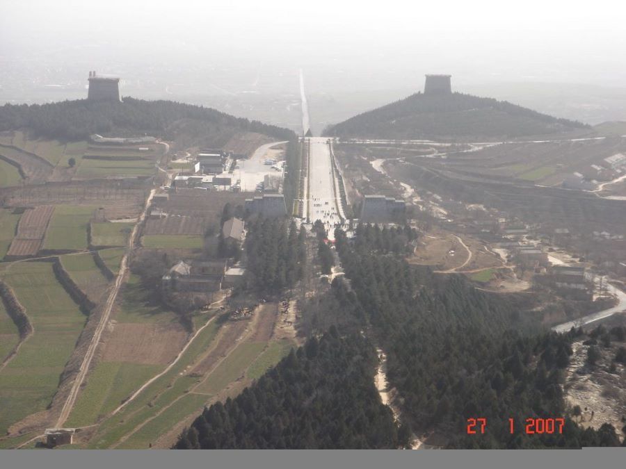
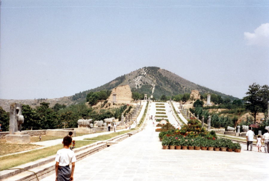
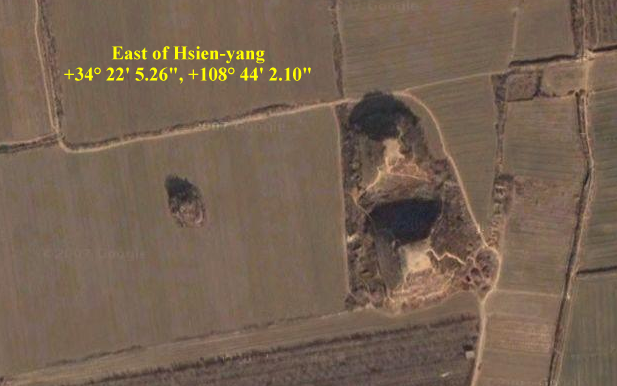
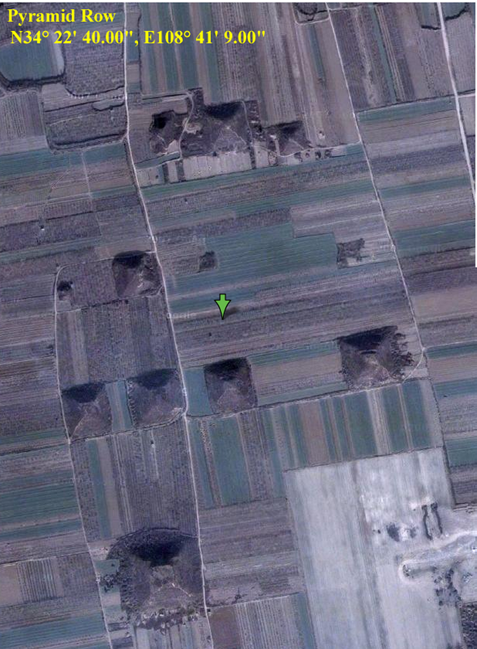
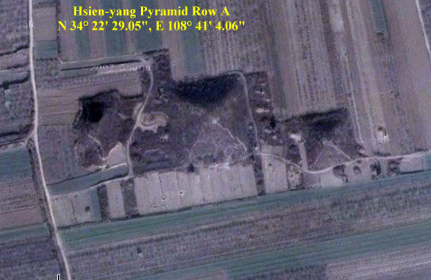
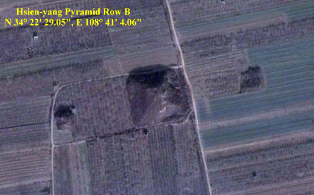
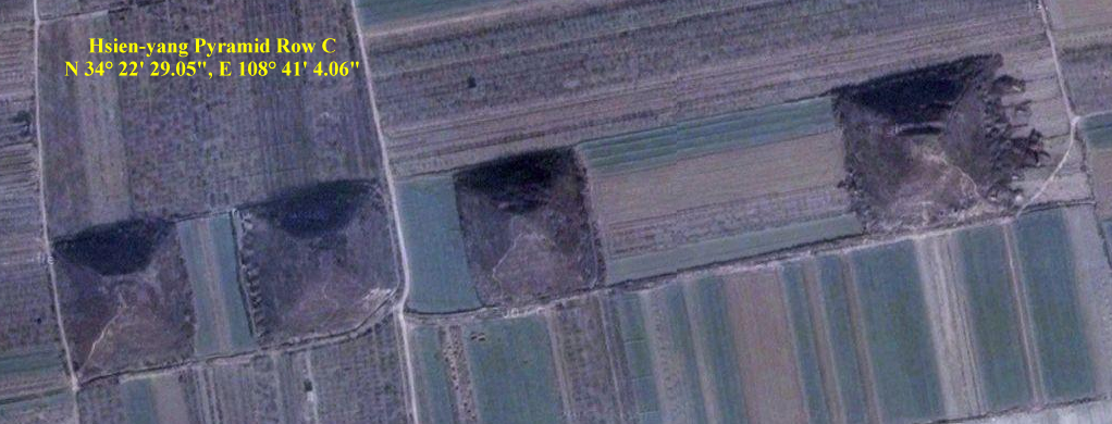
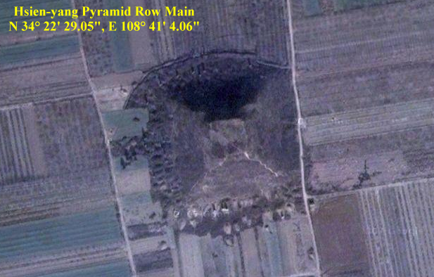
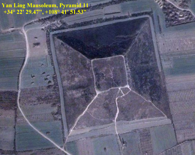
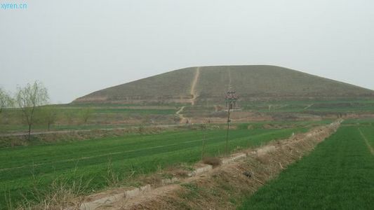
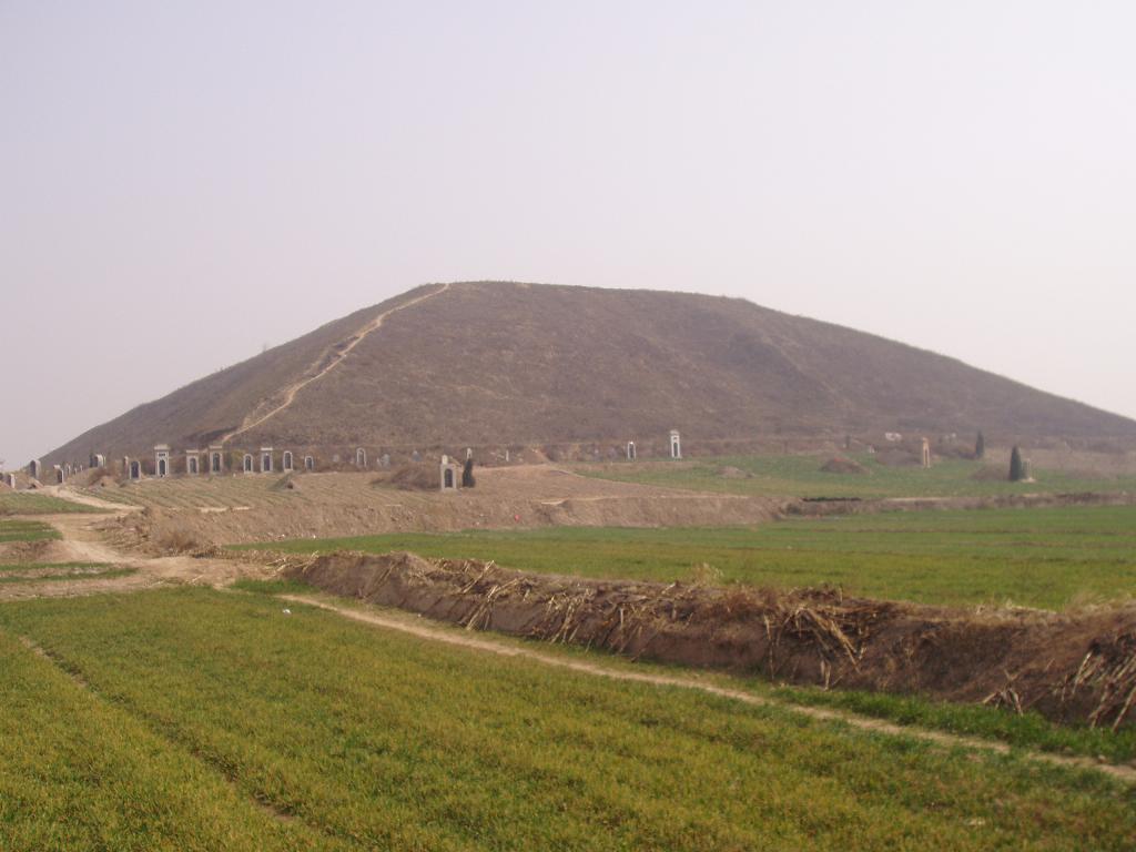
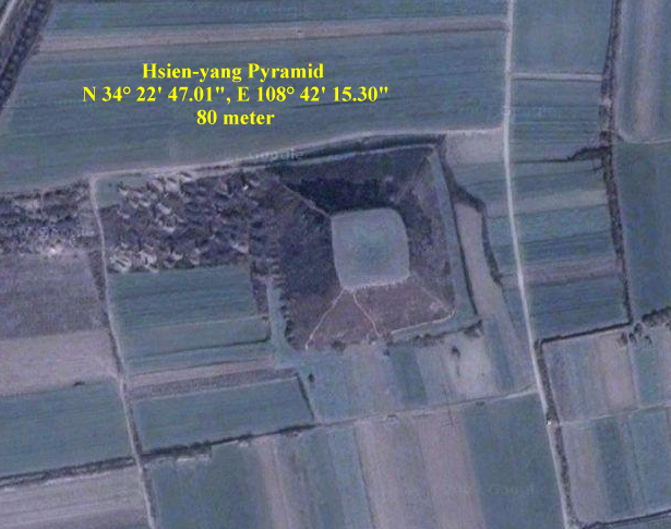
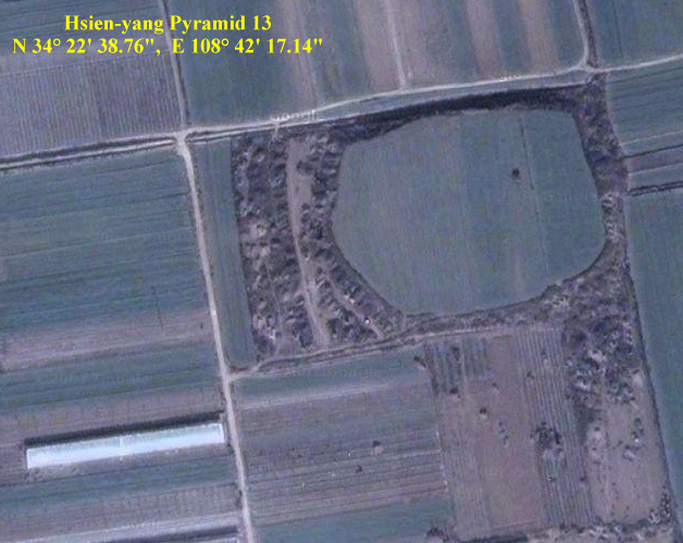
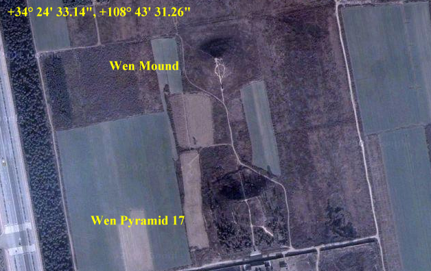
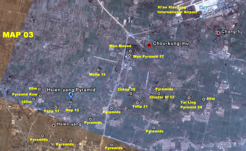
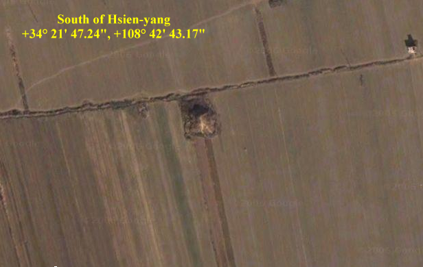
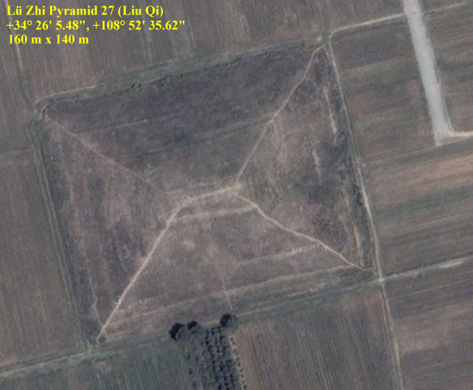
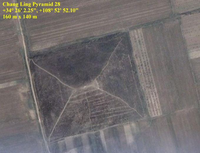
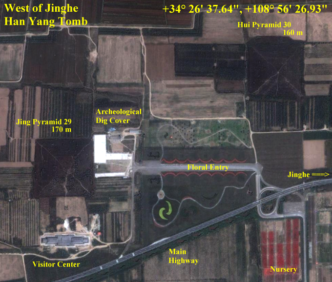
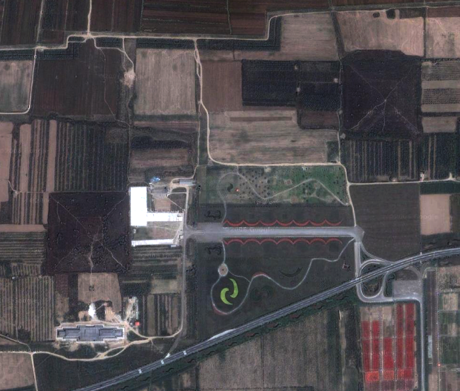
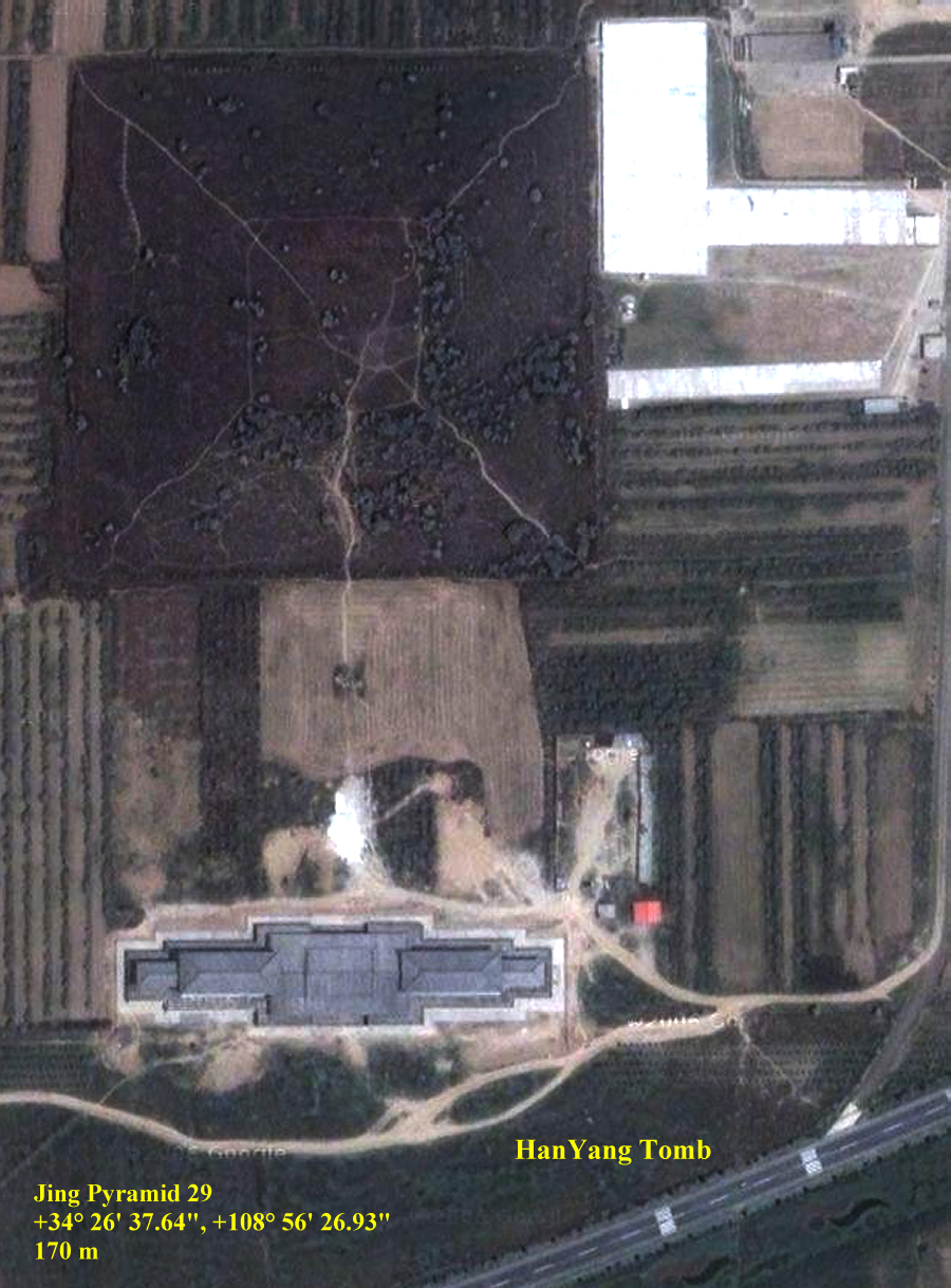
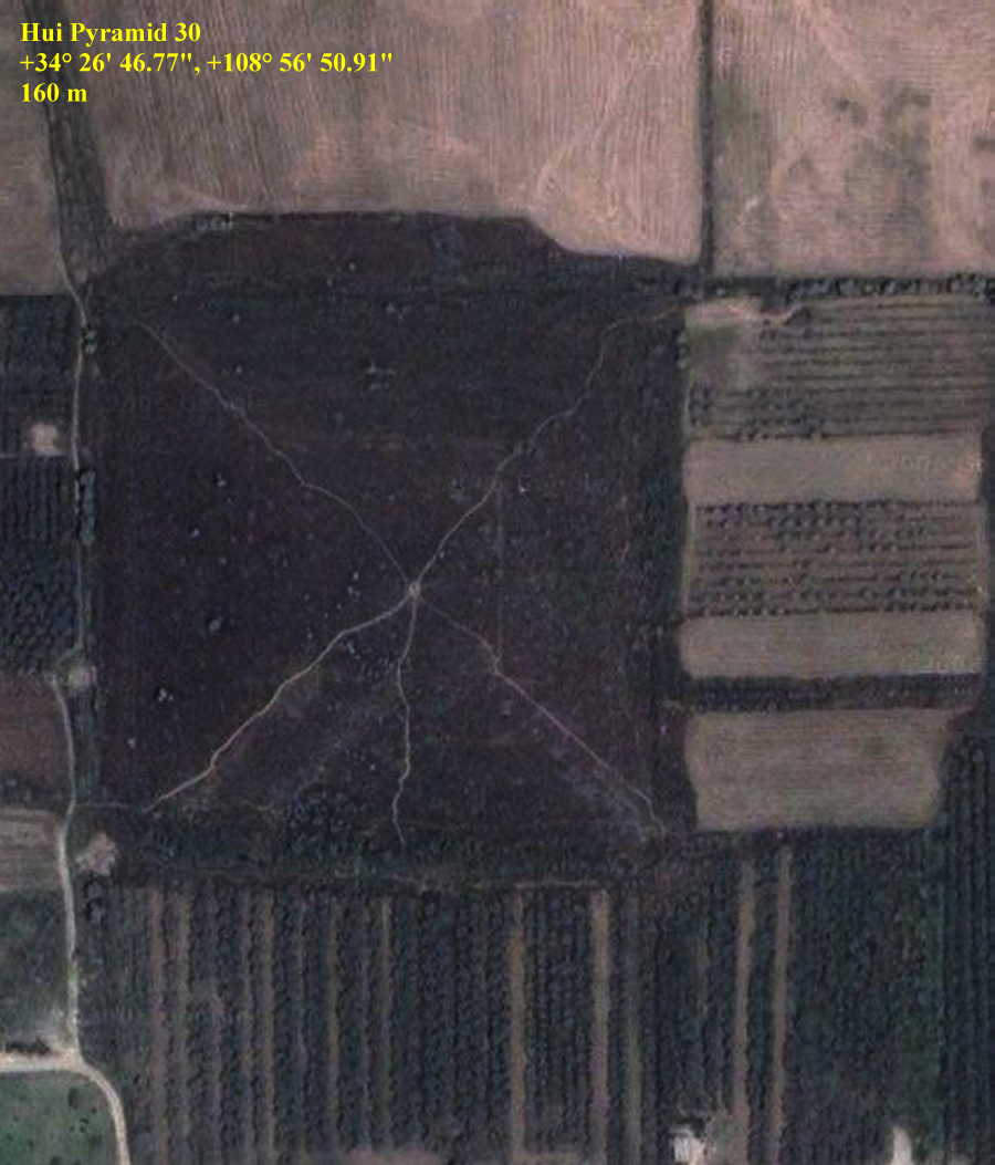
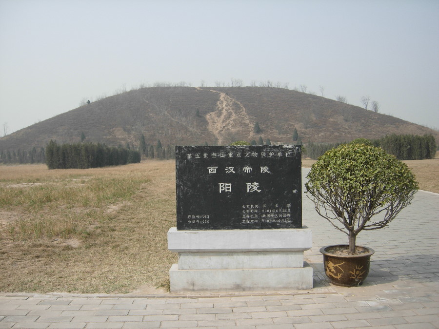
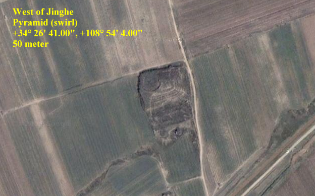

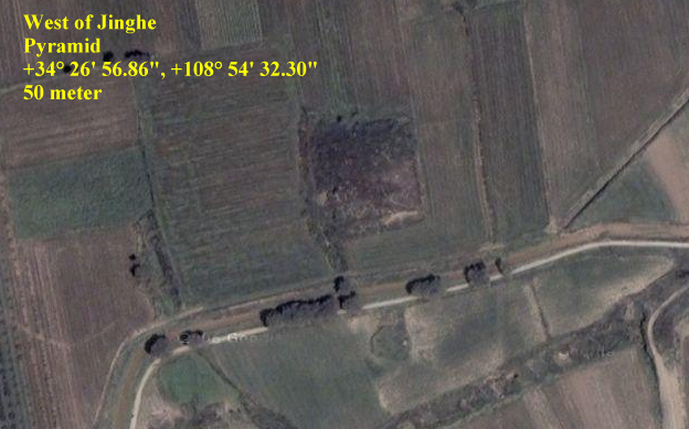
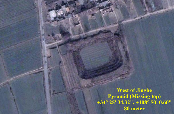
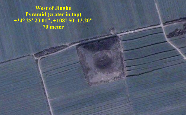
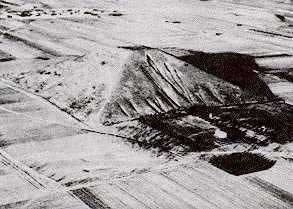

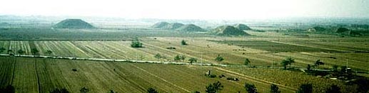
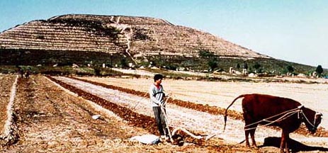

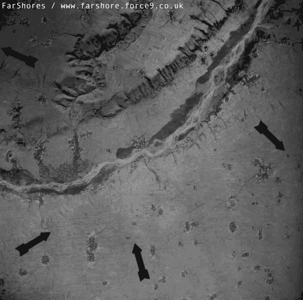

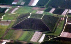
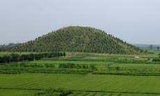
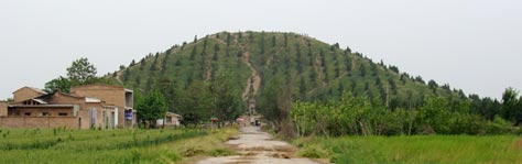
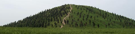
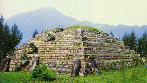
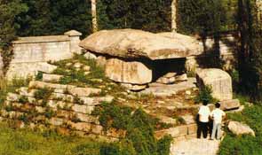
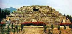
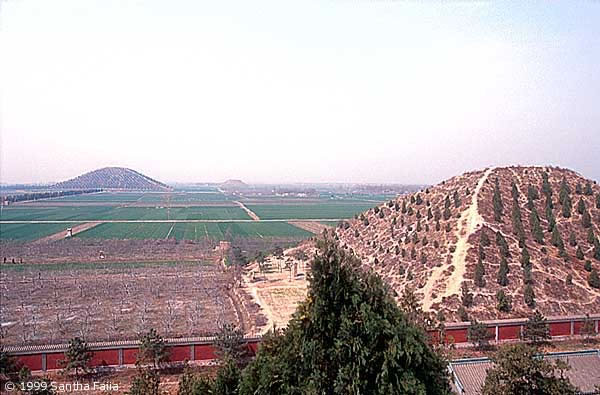
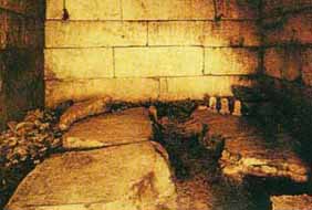
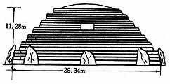
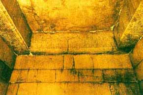
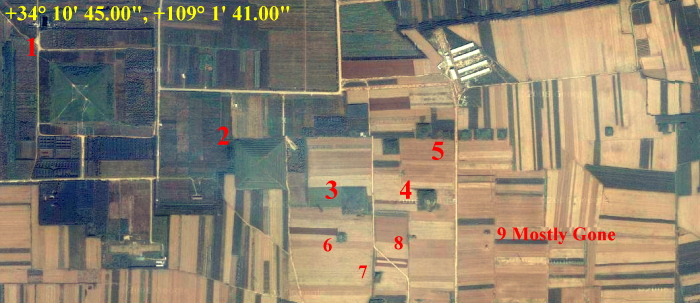
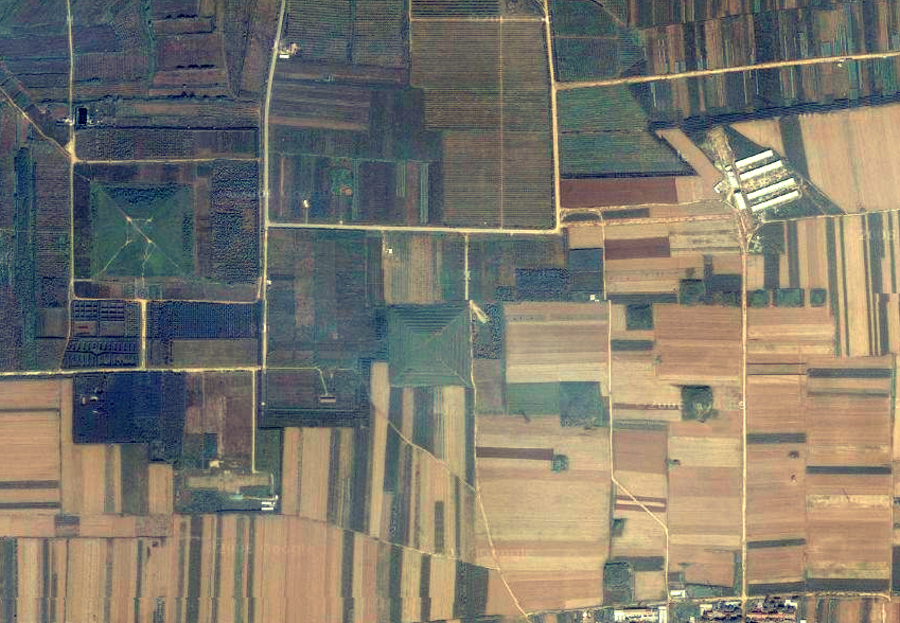
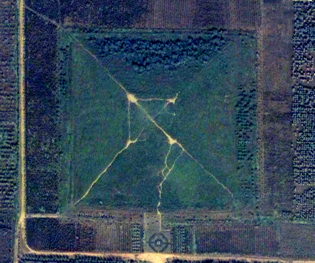
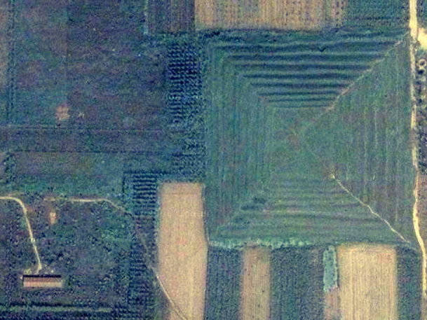

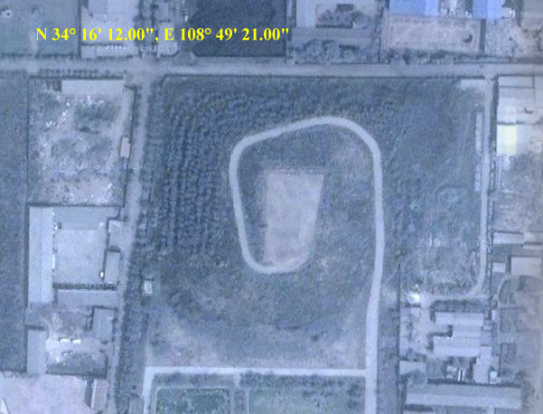
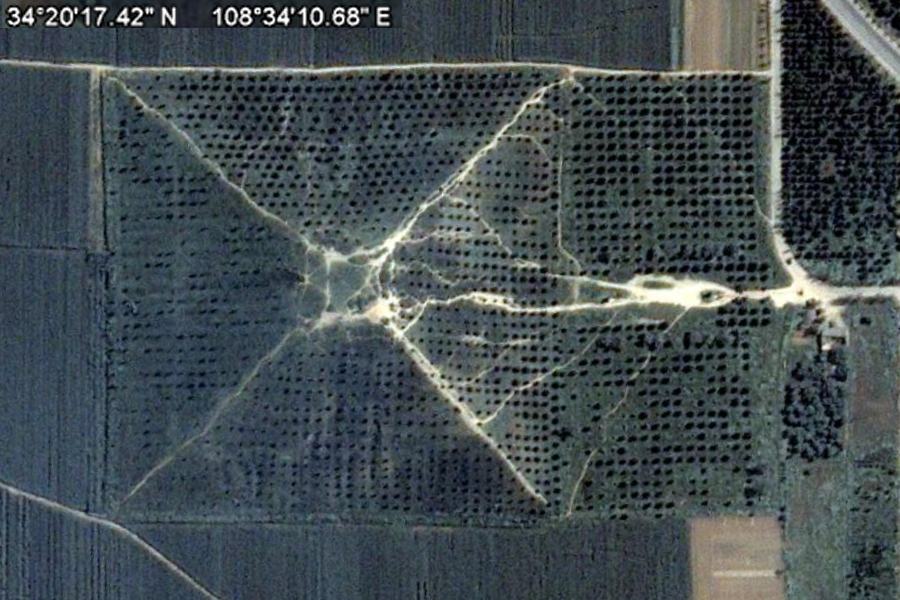
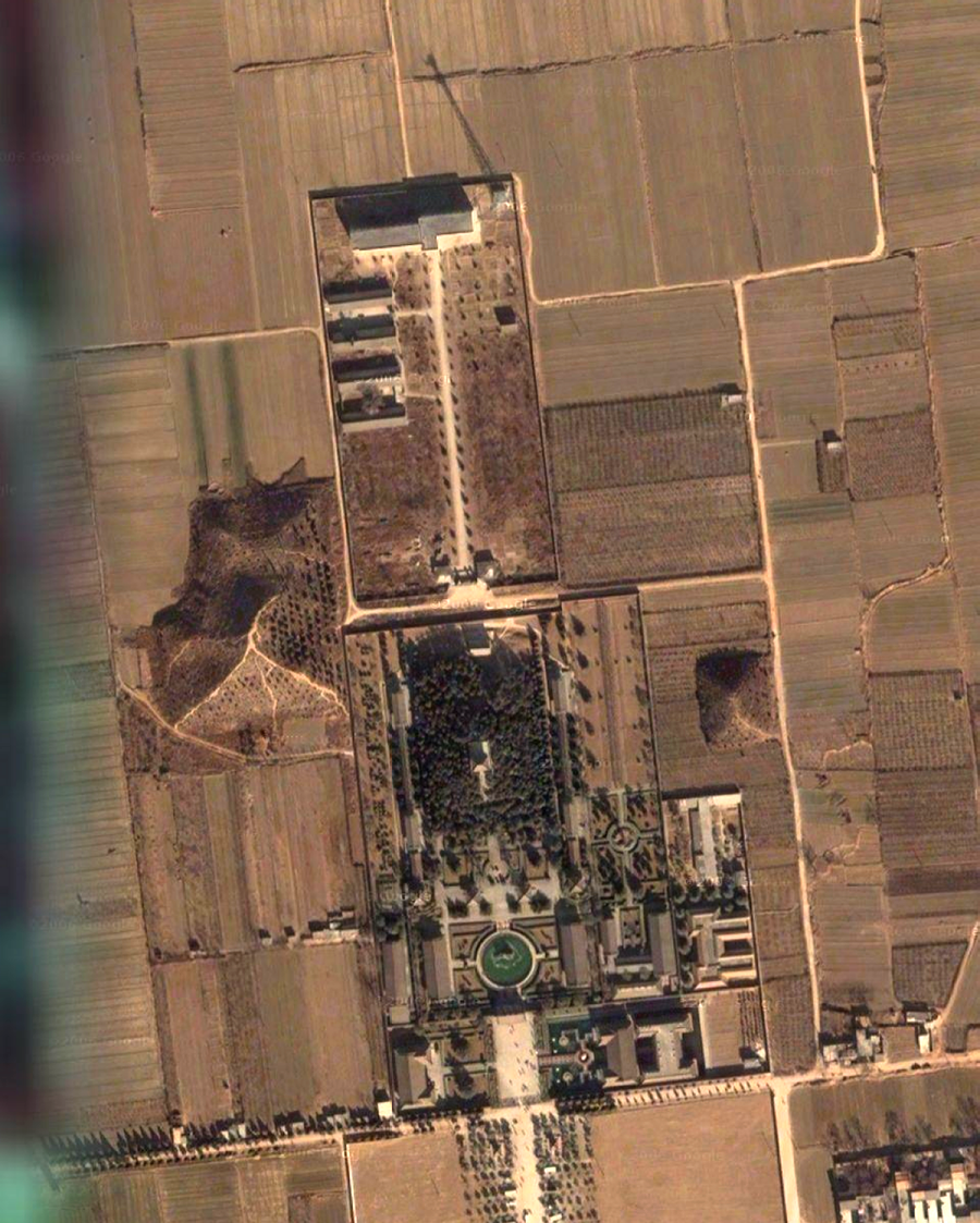
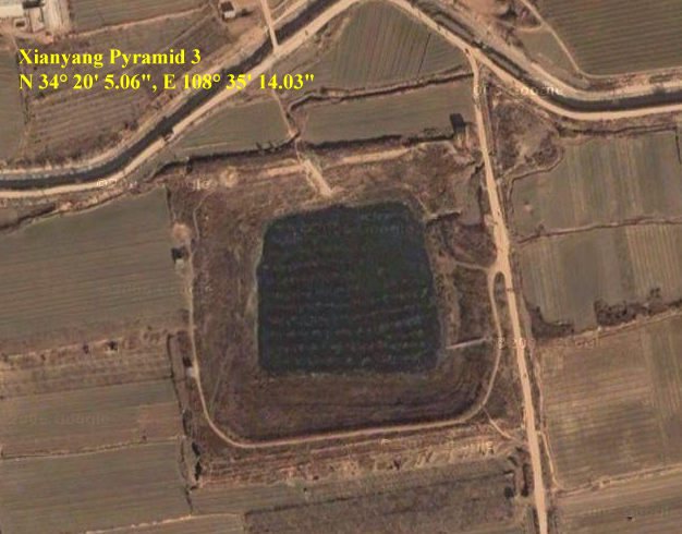
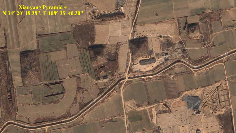
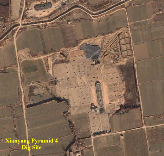
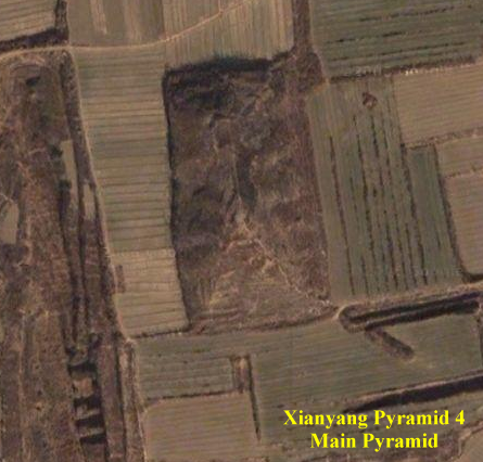
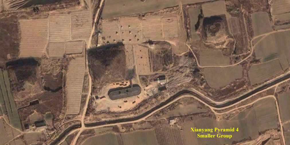
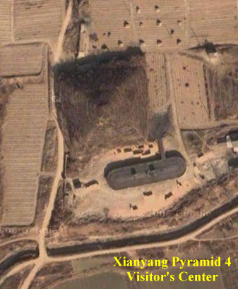
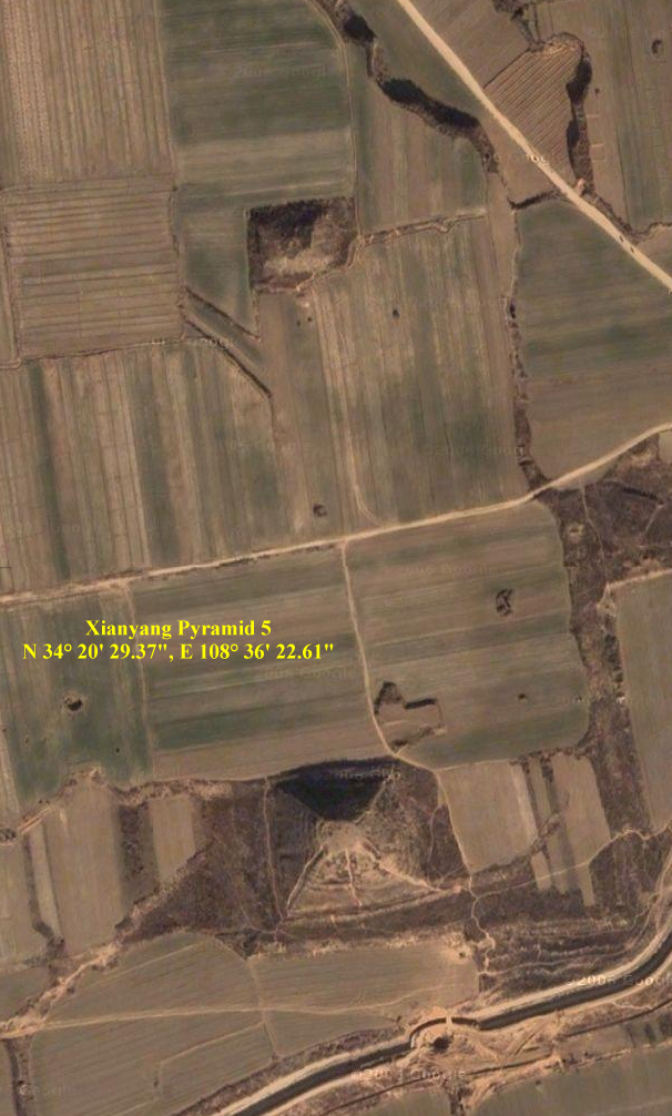
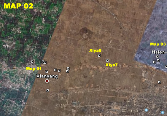
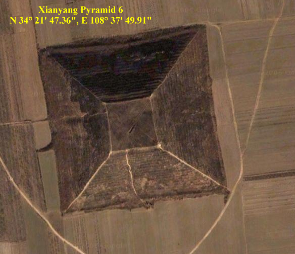
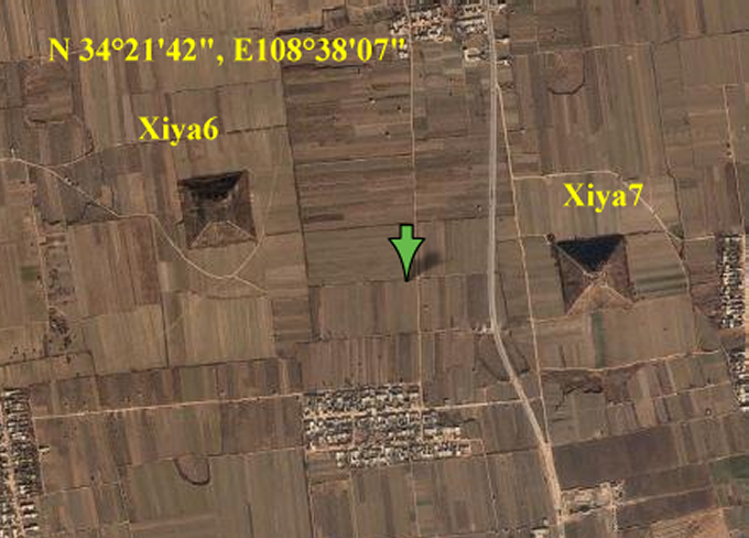
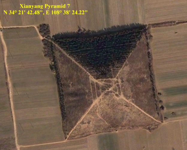
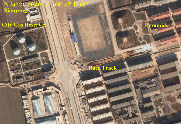
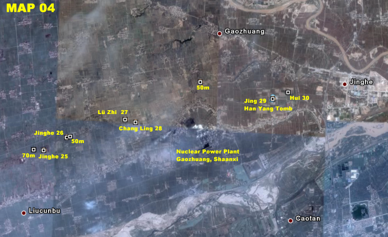
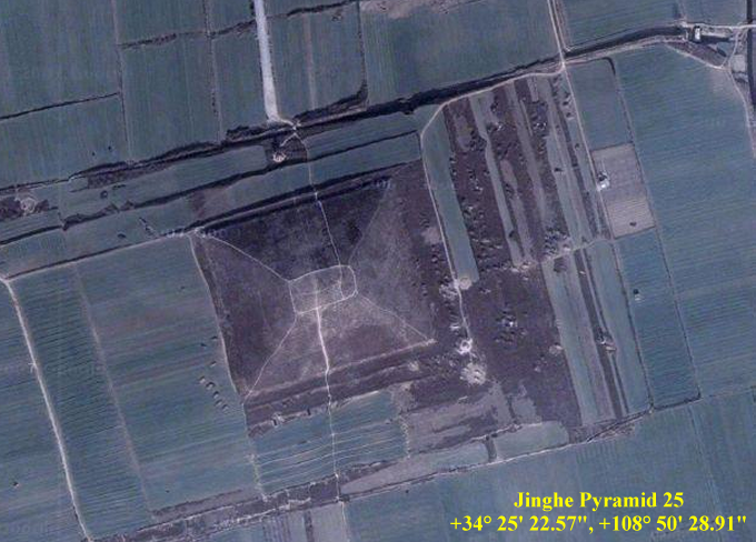
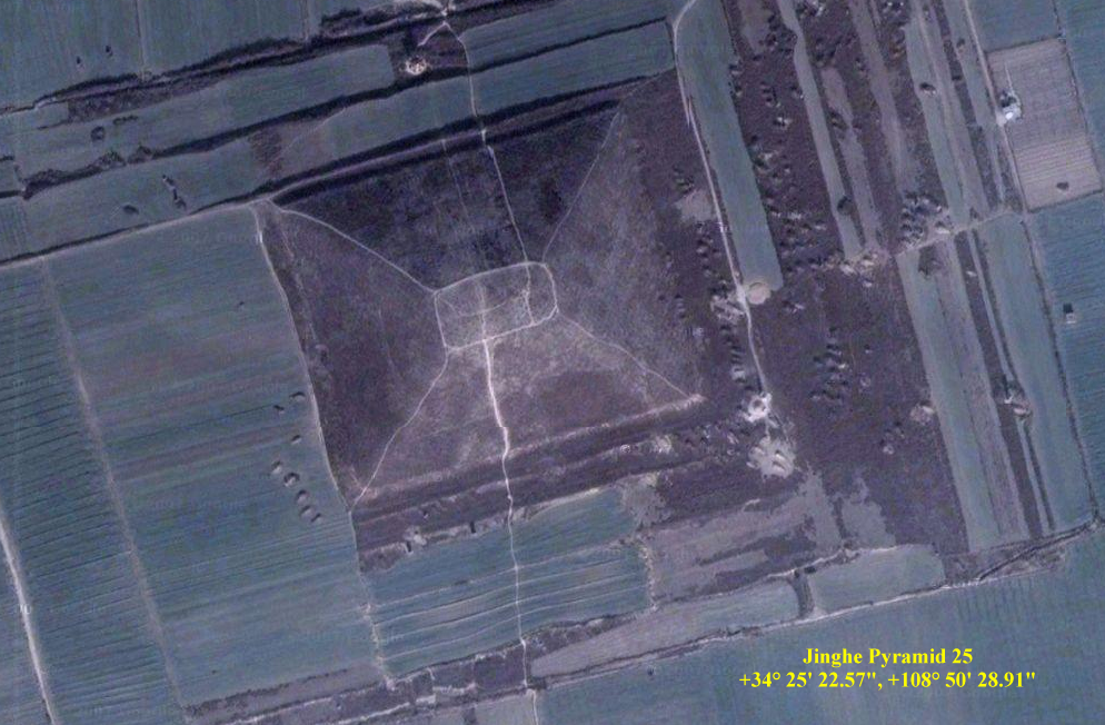
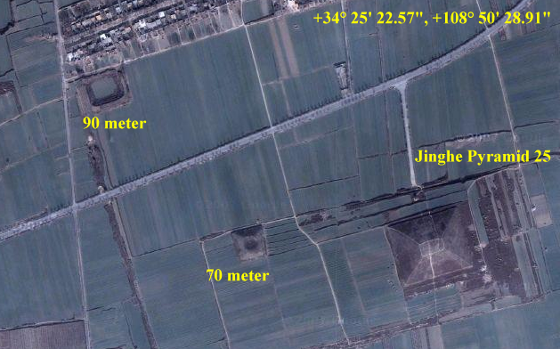
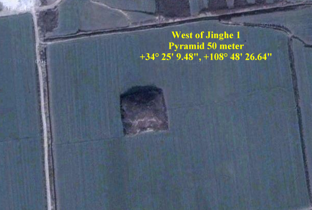
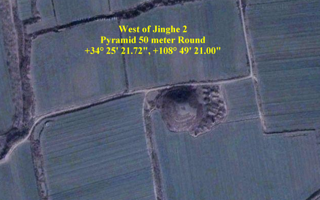

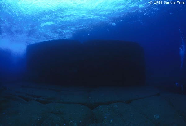
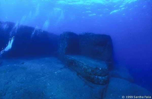
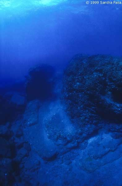
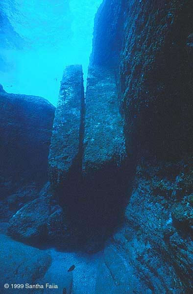
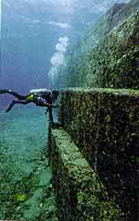
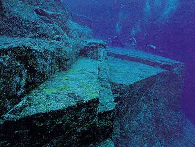
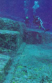
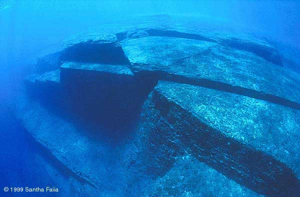
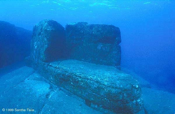
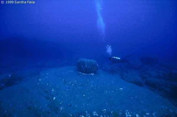
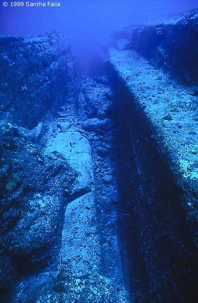
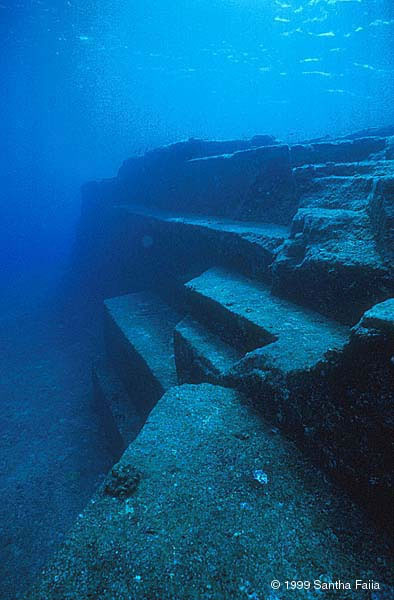
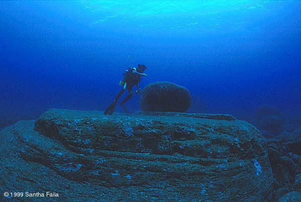
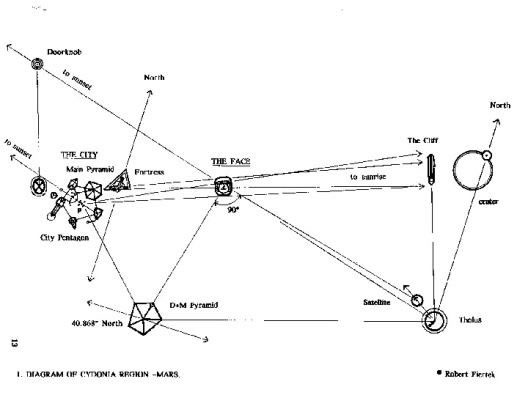
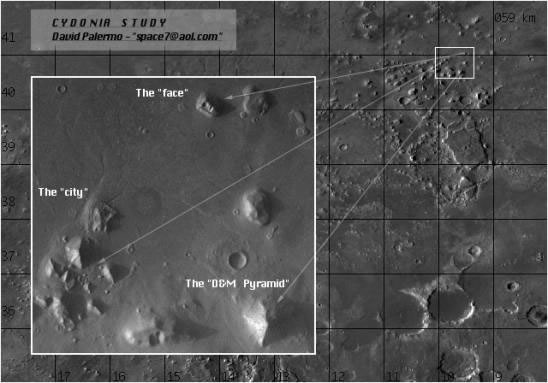
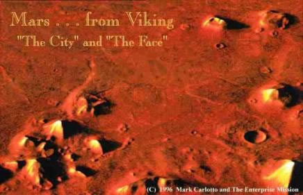
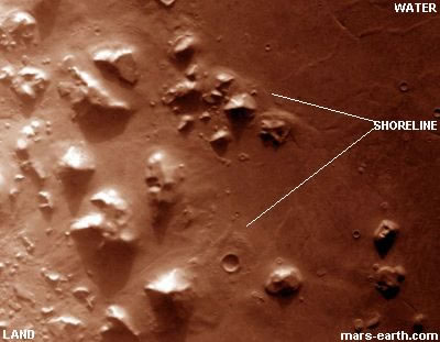
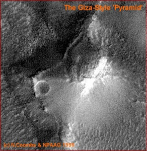
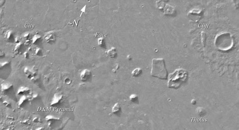
